
NJORD
Sailing
Current Trip
| Trip Time | 7 days |
|---|---|
| Trip Distance | 411.29 nm |
| AVG Speed | 6 Knop |
| MAX Speed | 9.1 Knop |
| Djupgående | --- |
| AVG Wind | 13 knots |
| MAX Wind | 20 knots |
| MIN Temp | 6.8°C / 44.24°F |
| MAX Temp | 11.6°C / 52.88°F |
| Position mottagen | 3 h, 18 m sen |
Current Position
| Longitud | -5.67197° |
|---|---|
| Latitude | 54.66558° |
| Status | Default |
| Fart | |
| Kurs | --- |
| Område | Inner Seas off the West Coast of Scotland |
| Station | T-AIS |
| Position mottagen | 3 h, 18 m sen |
Info
Information
The current position of NJORD is in Inner Seas off the West Coast of Scotland with coordinates 54.66558° / -5.67197° as reported on 2024-05-07 01:54 by AIS to our vessel tracker app. The vessel's current speed is 0 Knop and is currently inside the port of BANGOR.
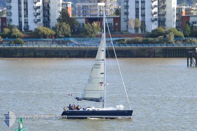
The vessel NJORD (MMSI: 227606160) is a Sailing It's sailing under the flag of [FR] France.
In this page you can find informations about the vessels current position, last detected port calls, and current voyage information. If the vessels is not in coverage by AIS you will find the latest position.
The current position of NJORD is detected by our AIS receivers and we are not responsible for the reliability of the data. The last position was recorded while the vessel was in Coverage by the Ais receivers of our vessel tracking app.
Weather
| Temperature | 6.9°C / 44.42°F |
|---|---|
| Wind Speed | 6 knots |
| Direction | 297° WNW |
| Pressure | 1019.1 hPa |
| Humidity | 90.2 % |
| Cloud Coverage | 11 % |
Featured Company
Last Trips
| Origin | Departure | Destination | Arrival | Distance | |
|---|---|---|---|---|---|
| 2024-04-29 11:07 | 2024-05-07 02:45 | 411.29 nm | |||
| 2024-04-28 15:58 | 2024-04-28 18:05 | 10.53 nm | |||
| 2024-04-27 17:46 | 2024-04-27 22:24 | 21.49 nm | |||
| 2024-04-17 14:31 | 2024-04-23 18:20 | 327.50 nm | |||
| 2024-04-17 14:31 | 2024-04-22 18:29 | 302.69 nm |
Events
| Tid | Event | Detaljer | Position / Dest | Information |
|---|---|---|---|---|
| 2024-05-07 01:54 | UTANFÖR täckningsområde |
54.66558 / -5.67197
Inner Seas off the West Coast of Scotland
[GB] BANGOR
|
Fart: Kurs: 511° |
|
| 2024-05-07 01:54 | STOPPAR förflyttning |
54.66558 / -5.67197
[GB] BANGOR
|
Fart: Kurs: 511° |
|
| 2024-05-07 01:45 | ANLÄNDER HAMN |
|
54.66673 / -5.67159
[GB] BANGOR
|
Fart: 4.5 kn Kurs: 225.1° |
| 2024-05-06 22:52 | Upptäckt i hav | United Kingdom part of the Inner Seas off the West Coast of Scotland |
54.66244 / -5.41740
Inner Seas off the West Coast of Scotland
|
Fart: 7.5 kn Kurs: 18.4° |
| 2024-05-06 22:52 | I täckningsområde |
54.66244 / -5.41740
Inner Seas off the West Coast of Scotland
|
Fart: 7.5 kn Kurs: 18.4° |
|
| 2024-05-03 13:22 | UTANFÖR täckningsområde |
51.98885 / -6.73617
Celtic Sea
|
Fart: 6.7 kn Kurs: 99° |
|
| 2024-05-03 09:35 | I täckningsområde |
52.01586 / -7.29197
Celtic Sea
|
Fart: 6.9 kn Kurs: 59.1° |
|
| 2024-05-03 05:57 | UTANFÖR täckningsområde |
51.79434 / -7.79859
Celtic Sea
|
Fart: 6.9 kn Kurs: 61.6° |
|
| 2024-05-02 16:19 | Upptäckt i hav | Irish part of the Celtic Sea |
51.40389 / -9.64882
Celtic Sea
|
Fart: 5.6 kn Kurs: 74.6° |
| 2024-05-02 16:19 | I täckningsområde |
51.40389 / -9.64882
Celtic Sea
|
Fart: 5.6 kn Kurs: 74.6° |