
NJORD
Sailing
Current Trip
Unknown
| Time Travelled | 2 days |
|---|---|
| Remaining Time | --- |
| Distance Travelled | 3.15 nm |
| Remaining Distance | --- |
| AVG Speed | 5.8 Noeuds |
| MAX Speed | 5.9 Noeuds |
| AVG Wind | 7 knots |
| MAX Wind | 7.1 knots |
| MIN Temp | 14.2°C / 57.56°F |
| MAX Temp | 15.1°C / 59.18°F |
| Tirant d eau | --- |
| Position reçue | 2 d depuis |
Current Position
| Longitude | -5.75528° |
|---|---|
| Latitude | 54.68067° |
| Etat | Default |
| Vitesse | 5.8 Noeuds |
| Parcours | 245.6° |
| Zone | Inner Seas off the West Coast of Scotland |
| Station | T-AIS |
| Position reçue | 2 d depuis |
Info
Information
The current position of NJORD is in Inner Seas off the West Coast of Scotland with coordinates 54.68067° / -5.75528° as reported on 2024-05-08 13:13 by AIS to our vessel tracker app. The vessel's current speed is 5.8 Noeuds
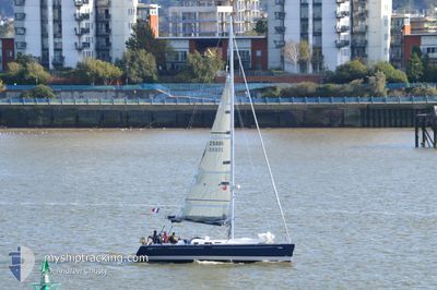
The vessel NJORD (MMSI: 227606160) is a Sailing It's sailing under the flag of [FR] France.
In this page you can find informations about the vessels current position, last detected port calls, and current voyage information. If the vessels is not in coverage by AIS you will find the latest position.
The current position of NJORD is detected by our AIS receivers and we are not responsible for the reliability of the data. The last position was recorded while the vessel was in Coverage by the Ais receivers of our vessel tracking app.
Weather
| Temperature | 15.1°C / 59.18°F |
|---|---|
| Wind Speed | 7 knots |
| Direction | 204° SSW |
| Pressure | 1025.6 hPa |
| Humidity | 70 % |
| Cloud Coverage | 100 % |
Featured Company
Last Port Calls
| Port | Arrival | Departure | Time In Port |
|---|---|---|---|
| 2024-05-08 11:02 | |||
| 2024-05-07 01:45 | 2024-05-07 13:59 | 12 h | |
| 2024-04-28 17:05 | 2024-04-29 10:07 | 17 h | |
| 2024-04-27 21:24 | 2024-04-28 14:58 | 17 h | |
| 2024-04-23 17:20 | 2024-04-27 16:46 | 3 d | |
| 2024-04-22 17:29 | |||
| 2024-04-16 17:42 | 2024-04-17 12:31 | 18 h |
Last Trips
| Origin | Departure | Destination | Arrival | Distance | |
|---|---|---|---|---|---|
| 2024-04-29 11:07 | 2024-05-07 02:45 | 411.29 nm | |||
| 2024-04-28 15:58 | 2024-04-28 18:05 | 10.53 nm | |||
| 2024-04-27 17:46 | 2024-04-27 22:24 | 21.49 nm | |||
| 2024-04-17 14:31 | 2024-04-23 18:20 | 327.50 nm | |||
| 2024-04-17 14:31 | 2024-04-22 18:29 | 302.69 nm |
Events
| Heure | Evenement | Détails | Position/ Destination | Info |
|---|---|---|---|---|
| 2024-05-08 13:13 | Hors de la zone couverte |
54.68067 / -5.75528
Inner Seas off the West Coast of Scotland
|
Vitesse: 5.8 kn Parcours: 245.6° |
|
| 2024-05-08 13:13 | Démarrage | 2.59 nm, South East of CARRICKFERGUS |
54.68067 / -5.75528
|
Vitesse: 5.8 kn Parcours: 245.6° |
| 2024-05-08 12:58 | Dans la zone couverte |
54.67589 / -5.73660
Inner Seas off the West Coast of Scotland
|
Vitesse: Parcours: 511° |
|
| 2024-05-08 11:41 | Hors de la zone couverte |
54.67583 / -5.73647
Inner Seas off the West Coast of Scotland
|
Vitesse: 2.3 kn Parcours: 190.1° |
|
| 2024-05-08 11:10 | Démarrage | 0.88 nm, South East of CARRICKFERGUS |
54.69842 / -5.79437
|
Vitesse: 6.5 kn Parcours: 111.3° |
| 2024-05-08 11:02 | PORT DE DEPART |
|
54.69842 / -5.79437
|
Vitesse: 2.2 kn Parcours: 511° |
| 2024-05-08 10:48 | Dans la zone couverte |
54.71022 / -5.81190
Inner Seas off the West Coast of Scotland
[GB] CARRICKFERGUS
|
Vitesse: Parcours: 511° |
|
| 2024-05-07 16:38 | Hors de la zone couverte |
54.70875 / -5.81117
Inner Seas off the West Coast of Scotland
|
Vitesse: 2.6 kn Parcours: 328.4° |
|
| 2024-05-07 14:05 | Dans la zone couverte |
54.67122 / -5.67525
Inner Seas off the West Coast of Scotland
|
Vitesse: 3.3 kn Parcours: 356.2° |
|
| 2024-05-07 13:59 | PORT DE DEPART |
|
54.67122 / -5.67525
|
Vitesse: Parcours: 511° |