
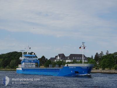
NEERBORG
General Cargo
Current Trip
| Time Travelled | 7 days |
|---|---|
| Remaining Time | 1 day |
| Distance Travelled | 1623.52 nm |
| Remaining Distance | 296.97 nm |
| AVG Speed | 10.8 Knop |
| MAX Speed | 13.4 Knop |
| AVG Wind | 13.9 knots |
| MAX Wind | 25 knots |
| MIN Temp | -0.5°C / 31.1°F |
| MAX Temp | 14.7°C / 58.46°F |
| Djupgående | 6.1 m |
| Position mottagen | 1 h, 4 m sen |
Current Position
| Longitud | 6.69533° |
|---|---|
| Latitude | 55.70063° |
| Status | Under way using engine |
| Fart | 10.7 Knop |
| Kurs | 212.5° |
| Område | North Sea |
| Station | T-AIS |
| Position mottagen | 1 h, 4 m sen |
Info
Information
The current position of NEERBORG is in North Sea with coordinates 55.70063° / 6.69533° as reported on 2024-05-04 06:38 by AIS to our vessel tracker app. The vessel's current speed is 10.7 Knop and is heading at the port of VLISSINGEN. The estimated time of arrival as calculated by MyShipTracking vessel tracking app is 2024-05-05 09:58 LT
The vessel NEERBORG (IMO: 9357509, MMSI: 244562000) is a General Cargo that was built in 2007 ( 17 År gammal ). It's sailing under the flag of [NL] Netherlands.
In this page you can find informations about the vessels current position, last detected port calls, and current voyage information. If the vessels is not in coverage by AIS you will find the latest position.
The current position of NEERBORG is detected by our AIS receivers and we are not responsible for the reliability of the data. The last position was recorded while the vessel was in Coverage by the Ais receivers of our vessel tracking app.
The current draught of NEERBORG as reported by AIS is 6.1 meters
Weather
| Temperature | 10.2°C / 50.36°F |
|---|---|
| Wind Speed | 11 knots |
| Direction | 195° SSW |
| Pressure | 1013.8 hPa |
| Humidity | 91.2 % |
| Cloud Coverage | 100 % |
Featured Company
Last Port Calls
| Port | Arrival | Departure | Time In Port |
|---|---|---|---|
| 2024-04-24 20:44 | 2024-04-26 13:08 | 1 d | |
| 2024-04-18 05:52 | 2024-04-18 21:18 | 15 h | |
| 2024-04-08 07:40 | 2024-04-10 11:04 | 2 d | |
| 2024-04-04 16:02 | 2024-04-05 14:15 | 22 h | |
| 2024-03-30 16:12 | 2024-04-03 16:15 | 4 d | |
| 2024-03-22 13:45 | 2024-03-25 20:17 | 3 d | |
| 2024-03-11 17:25 | 2024-03-12 22:20 | 1 d | |
| 2024-03-08 08:51 | 2024-03-08 08:54 | 3 m | |
| 2024-03-02 15:57 | 2024-03-06 18:18 | 4 d | |
| 2024-03-02 15:18 |
Last Trips
| Origin | Departure | Destination | Arrival | Distance | |
|---|---|---|---|---|---|
| 2024-04-18 23:18 | 2024-04-24 23:44 | 1384.83 nm | |||
| 2024-04-10 13:04 | 2024-04-18 07:52 | 1044.59 nm | |||
| 2024-04-05 16:15 | 2024-04-08 09:40 | 647.41 nm | |||
| 2024-04-03 18:15 | 2024-04-04 18:02 | 236.96 nm | |||
| 2024-03-25 21:17 | 2024-03-30 17:12 | 1114.70 nm | |||
| 2024-03-12 23:20 | 2024-03-22 14:45 | 247.75 nm | |||
| 2024-03-08 09:54 | 2024-03-11 18:25 | 904.87 nm | |||
| 2024-03-06 19:18 | 2024-03-08 09:51 | 378.59 nm | |||
| 2024-03-02 16:18 | 2024-03-02 16:57 | 4.88 nm |
Events
| Tid | Event | Detaljer | Position / Dest | Information |
|---|---|---|---|---|
| 2024-05-04 06:49 | Status ändrad | Default Under way using engine |
55.67426 / 6.66674
NLVLI VIA SKAW
|
Fart: 10.7 kn Kurs: 212.5° |
| 2024-05-04 06:38 | UTANFÖR täckningsområde |
55.70063 / 6.69533
North Sea
NLVLI VIA SKAW
|
Fart: 10.7 kn Kurs: 212.5° |
|
| 2024-05-03 20:05 | Byter havsområde | Danish part of the North Sea Danish part of the Skaggerak |
57.21936 / 8.42870
North Sea
NLVLI VIA SKAW
|
Fart: 10.6 kn Kurs: 235.9° |
| 2024-05-03 11:50 | Byter havsområde | Danish part of the Skaggerak Danish part of the Kattegat |
57.80099 / 10.94115
Skaggerak
NLVLI VIA SKAW
|
Fart: 11.2 kn Kurs: 315.6° |
| 2024-05-03 10:41 | Byter havsområde | Danish part of the Kattegat Swedish part of the Kattegat |
57.63845 / 11.21662
Kattegat
NLVLI VIA SKAW
|
Fart: 11.7 kn Kurs: 320.3° |
| 2024-05-03 00:22 | Byter havsområde | Swedish part of the Kattegat Danish part of the Kattegat |
55.82517 / 12.72243
Kattegat
NLVLI VIA SKAW
|
Fart: 11.3 kn Kurs: 6.8° |
| 2024-05-02 22:34 | Byter havsområde | Danish part of the Kattegat Swedish part of the Kattegat |
55.50362 / 12.71871
Kattegat
NLVLI VIA SKAW
|
Fart: 9.8 kn Kurs: 7.3° |
| 2024-05-02 21:37 | Byter havsområde | Swedish part of the Kattegat Swedish part of the Baltic Sea |
55.33422 / 12.67038
Kattegat
NLVLI VIA SKAW
|
Fart: 10.4 kn Kurs: 12.3° |
| 2024-05-02 18:59 | Djupgående ändrat | 6.1 6.2 |
55.23882 / 13.49660
NLVLI VIA SKAW
|
Fart: 11.5 kn Kurs: 272° |
| 2024-05-02 18:59 | ETA ändrat | 2024/05/05 10:00 2024/05/05 15:00 |
55.23882 / 13.49660
NLVLI VIA SKAW
|
Fart: 11.5 kn Kurs: 272° |