
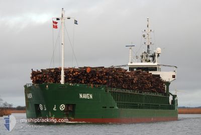
NAVEN
General Cargo
Current Trip
| Time Travelled | 3 days |
|---|---|
| Remaining Time | 11 h, 43 mins |
| Distance Travelled | 389.99 nm |
| Remaining Distance | 96.87 nm |
| AVG Speed | 7.8 Knop |
| MAX Speed | 11.7 Knop |
| AVG Wind | 10.8 knots |
| MAX Wind | 26 knots |
| MIN Temp | -1.6°C / 29.12°F |
| MAX Temp | 6.3°C / 43.34°F |
| Djupgående | 5.1 m |
| Position mottagen | Nu |
Current Position
| Longitud | --- |
|---|---|
| Latitude | --- |
| Status | Under way using engine |
| Fart | 9.8 Knop |
| Kurs | 44.3° |
| Område | Kattegat |
| Station | T-AIS |
| Position mottagen | Nu |
Info
Information
The current position of NAVEN is in Kattegat with coordinates 56.73105° / 10.58990° as reported on 2025-03-17 22:40 by AIS to our vessel tracker app. The vessel's current speed is 9.8 Knop and is heading at the port of STENUNGSUND. The estimated time of arrival as calculated by MyShipTracking vessel tracking app is 2025-03-18 11:24 LT
The vessel NAVEN (IMO: 9020285, MMSI: 231794000) is a General Cargo that was built in 1991 ( 34 År gammal ). It's sailing under the flag of [FO] Faroe Is.
In this page you can find informations about the vessels current position, last detected port calls, and current voyage information. If the vessels is not in coverage by AIS you will find the latest position.
The current position of NAVEN is detected by our AIS receivers and we are not responsible for the reliability of the data. The last position was recorded while the vessel was in Coverage by the Ais receivers of our vessel tracking app.
The current draught of NAVEN as reported by AIS is 5.1 meters
Weather
| Temperature | 2.6°C / 36.68°F |
|---|---|
| Wind Speed | 19 knots |
| Direction | 252° WSW |
| Pressure | 1028.6 hPa |
| Humidity | 74.3 % |
| Cloud Coverage | 3 % |
Featured Company
Last Port Calls
| Port | Arrival | Departure | Time In Port |
|---|---|---|---|
| 2025-03-13 20:08 | 2025-03-14 13:40 | 17 h | |
| 2025-03-12 13:46 | 2025-03-13 13:33 | 23 h | |
| 2025-03-11 01:09 | 2025-03-11 21:36 | 20 h | |
| 2025-03-07 05:18 | 2025-03-09 11:40 | 2 d | |
| 2025-02-28 12:21 | 2025-03-02 14:01 | 2 d | |
| 2025-02-24 20:34 | 2025-02-25 23:55 | 1 d | |
| 2025-02-20 21:09 | 2025-02-21 12:29 | 15 h | |
| 2025-02-10 07:04 | 2025-02-18 17:59 | 8 d | |
| 2025-02-05 01:57 | 2025-02-05 17:04 | 15 h | |
| 2025-02-04 04:41 | 2025-02-04 21:45 | 17 h |
Most Visited Ports (Last year)
| Port | Arrivals | |
|---|---|---|
| 29 | ||
| 17 | ||
| 9 | ||
| 9 | ||
| 6 | ||
| 5 |
Last Trips
| Origin | Departure | Destination | Arrival | Distance | |
|---|---|---|---|---|---|
| 2025-03-13 13:33 | 2025-03-13 20:08 | 62.36 nm | |||
| 2025-03-11 21:36 | 2025-03-12 13:46 | 165.05 nm | |||
| 2025-03-09 11:40 | 2025-03-11 01:09 | 364.84 nm | |||
| 2025-03-02 14:01 | 2025-03-07 05:18 | 1010.45 nm | |||
| 2025-02-25 23:55 | 2025-02-28 12:21 | 154.26 nm | |||
| 2025-02-21 12:29 | 2025-02-24 20:34 | 681.52 nm | |||
| 2025-02-18 17:59 | 2025-02-20 21:09 | 488.35 nm | |||
| 2025-02-05 17:04 | 2025-02-10 07:04 | 500.12 nm | |||
| 2025-02-04 21:45 | 2025-02-05 01:57 | 41.84 nm | |||
| 2025-02-01 14:08 | 2025-02-04 04:41 | 572.40 nm |
Events
| Tid | Event | Detaljer | Position / Dest | Information |
|---|---|---|---|---|
| 2025-03-17 22:35 | ETA ändrat | 2025/03/18 09:00 2025/03/18 08:30 |
56.72045 / 10.57107
SE STE
|
Fart: 9.4 kn Kurs: 43.2° |
| 2025-03-17 19:05 | STARTAR förflyttning | 13.45 nm, North of RANDERS |
56.68433 / 10.03675
SE STE
|
Fart: 3.6 kn Kurs: 18° |
| 2025-03-17 18:54 | Djupgående ändrat | 5.1 3.7 |
56.68276 / 10.03789
SE STE
|
Fart: Kurs: 45° |
| 2025-03-17 18:54 | Destination ändrad | SE STE DKMRG |
56.68276 / 10.03789
SE STE
|
Fart: Kurs: 45° |
| 2025-03-17 18:54 | ETA ändrat | 2025/03/18 08:30 2025/03/17 07:00 |
56.68276 / 10.03789
SE STE
|
Fart: Kurs: 45° |
| 2025-03-17 18:48 | Status ändrad | Under way using engine Moored |
56.68270 / 10.03795
DKMRG
|
Fart: Kurs: 37° |
| 2025-03-17 05:42 | STOPPAR förflyttning | 13.34 nm, North of RANDERS |
56.68256 / 10.03777
DKMRG
|
Fart: 0.2 kn Kurs: 37° |
| 2025-03-17 02:44 | STARTAR förflyttning | 18.98 nm, North East of RANDERS |
56.66550 / 10.48845
DKMRG
|
Fart: 3.1 kn Kurs: 359° |
| 2025-03-17 02:35 | Status ändrad | Moored At anchor |
56.66690 / 10.49214
DKMRG
|
Fart: 0.6 kn Kurs: 114° |
| 2025-03-15 20:51 | Status ändrad | At anchor Under way using engine |
56.67087 / 10.49869
DKMRG
|
Fart: Kurs: 281° |