
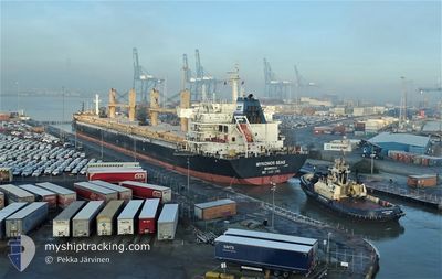
MYKONOS SEAS
Bulk Carrier
Current Trip
| Trip Time | 4 days |
|---|---|
| Trip Distance | 1444.30 nm |
| AVG Speed | 12.5 Knop |
| MAX Speed | 15.9 Knop |
| Djupgående | 8 m |
| AVG Wind | 15.1 knots |
| MAX Wind | 32.7 knots |
| MIN Temp | 0.9°C / 33.62°F |
| MAX Temp | 6.5°C / 43.7°F |
| Position mottagen | 1 h, 45 m sen |
Current Position
| Longitud | --- |
|---|---|
| Latitude | --- |
| Status | Under way using engine |
| Fart | 0.9 Knop |
| Kurs | 148° |
| Område | Gulf of Finland |
| Station | T-AIS |
| Position mottagen | 1 h, 45 m sen |
Information
The current position of MYKONOS SEAS is in Gulf of Finland with coordinates 59.88193° / 30.18499° as reported on 2025-03-07 05:36 by AIS to our vessel tracker app. The vessel's current speed is 0.9 Knop and is currently inside the port of ST PETERSBURG.
The vessel MYKONOS SEAS (IMO: 9491240, MMSI: 636015849) is a Bulk Carrier that was built in 2011 ( 14 År gammal ). It's sailing under the flag of [LR] Liberia.
In this page you can find informations about the vessels current position, last detected port calls, and current voyage information. If the vessels is not in coverage by AIS you will find the latest position.
The current position of MYKONOS SEAS is detected by our AIS receivers and we are not responsible for the reliability of the data. The last position was recorded while the vessel was in Coverage by the Ais receivers of our vessel tracking app.
The current draught of MYKONOS SEAS as reported by AIS is 8 meters
Weather
| Temperature | 2.7°C / 36.86°F |
|---|---|
| Wind Speed | 8 knots |
| Direction | 323° NW |
| Pressure | 1007.6 hPa |
| Humidity | 87.8 % |
| Cloud Coverage | 91 % |
Featured Company
Last Port Calls
| Port | Arrival | Departure | Time In Port |
|---|---|---|---|
| 2025-03-06 22:51 | |||
| 2025-03-06 22:51 | |||
| 2025-03-06 11:29 | |||
| 2025-02-27 12:47 | 2025-03-01 19:54 | 2 d | |
| 2025-02-17 12:58 | 2025-02-24 20:09 | 7 d | |
| 2025-02-17 03:41 | 2025-02-17 09:38 | 5 h | |
| 2025-02-12 16:04 | 2025-02-14 20:32 | 2 d | |
| 2025-02-05 21:56 | 2025-02-09 19:11 | 3 d | |
| 2025-02-01 15:39 | 2025-02-04 04:44 | 2 d |
Last Trips
| Origin | Departure | Destination | Arrival | Distance | |
|---|---|---|---|---|---|
| 2025-03-01 20:54 | 2025-03-07 01:51 | 1444.30 nm | |||
| 2025-03-01 20:54 | 2025-03-06 14:29 | 1416.96 nm | |||
| 2025-02-24 20:09 | 2025-02-27 13:47 | 744.39 nm | |||
| 2025-02-14 21:32 | 2025-02-17 12:58 | 660.60 nm | |||
| 2025-02-14 21:32 | 2025-02-17 03:41 | 636.02 nm | |||
| 2025-02-09 20:11 | 2025-02-12 17:04 | 215.71 nm | |||
| 2025-02-04 04:44 | 2025-02-05 22:56 | 433.95 nm | |||
| 2024-12-15 20:18 | 2025-02-01 15:39 | 7937.04 nm |
Events
| Tid | Event | Detaljer | Position / Dest | Information |
|---|---|---|---|---|
| 2025-03-07 05:37 | Status ändrad | Default Under way using engine |
59.88170 / 30.18533
[RU] ST PETERSBURG
|
Fart: 0.9 kn Kurs: 148° |
| 2025-03-07 05:36 | Status ändrad | Under way using engine Default |
59.88193 / 30.18499
[RU] ST PETERSBURG
|
Fart: 2 kn Kurs: 115° |
| 2025-03-07 05:36 | UTANFÖR täckningsområde |
59.88193 / 30.18499
Gulf of Finland
[RU] ST PETERSBURG
|
Fart: 0.9 kn Kurs: 142.6° |
|
| 2025-03-07 05:19 | I täckningsområde |
59.88193 / 30.18499
Gulf of Finland
[RU] ST PETERSBURG
|
Fart: 0.9 kn Kurs: 142.6° |
|
| 2025-03-06 22:51 | AVGÅTT HAMN |
|
59.88191 / 30.20004
RU LED
|
Fart: Kurs: 0° |
| 2025-03-06 22:51 | ANLÄNDER HAMN |
|
59.88191 / 30.20004
[RU] ST PETERSBURG
|
Fart: Kurs: 0° |
| 2025-03-06 21:26 | Djupgående ändrat | 8 7.1 |
59.98641 / 29.79803
[RU] KRONSHTADT
|
Fart: Kurs: 0° |
| 2025-03-06 11:29 | ANLÄNDER HAMN |
|
59.98641 / 29.79803
[RU] KRONSHTADT
|
Fart: 11.8 kn Kurs: 102.8° |
| 2025-03-06 07:58 | UTANFÖR täckningsområde |
60.05179 / 28.41880
Gulf of Finland
RU LED
|
Fart: 11.8 kn Kurs: 102.8° |
|
| 2025-03-06 02:37 | ETA ändrat | 2025/03/06 10:00 2025/03/06 12:00 |
59.95732 / 26.43416
RU LED
|
Fart: 12.2 kn Kurs: 74.8° |