
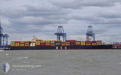
MSC TRACY V
Container Ship
Current Trip
| Time Travelled | 10 days |
|---|---|
| Remaining Time | --- |
| Distance Travelled | 3223.60 nm |
| Remaining Distance | 3.53 nm |
| AVG Speed | 11.2 Knop |
| MAX Speed | 19.5 Knop |
| AVG Wind | 13.7 knots |
| MAX Wind | 27 knots |
| MIN Temp | 2°C / 35.6°F |
| MAX Temp | 17.1°C / 62.78°F |
| Djupgående | 13.4 m |
| Position mottagen | 1 m sen |
Current Position
| Longitud | --- |
|---|---|
| Latitude | --- |
| Status | Under way using engine |
| Fart | 6.9 Knop |
| Kurs | 298.7° |
| Område | North Sea |
| Station | T-AIS |
| Position mottagen | 1 m sen |
Info
Information
The current position of MSC TRACY V is in North Sea with coordinates 51.92520° / 1.31917° as reported on 2025-02-27 13:42 by AIS to our vessel tracker app. The vessel's current speed is 6.9 Knop and is heading at the port of FELIXSTOWE. The estimated time of arrival as calculated by MyShipTracking vessel tracking app is 2025-02-27 11:00 LT
The vessel MSC TRACY V (IMO: 9295177, MMSI: 636022077) is a Container Ship that was built in 2005 ( 20 År gammal ). It's sailing under the flag of [LR] Liberia.
In this page you can find informations about the vessels current position, last detected port calls, and current voyage information. If the vessels is not in coverage by AIS you will find the latest position.
The current position of MSC TRACY V is detected by our AIS receivers and we are not responsible for the reliability of the data. The last position was recorded while the vessel was in Coverage by the Ais receivers of our vessel tracking app.
The current draught of MSC TRACY V as reported by AIS is 13.4 meters
Weather
| Temperature | 6.4°C / 43.52°F |
|---|---|
| Wind Speed | 16 knots |
| Direction | 314° NW |
| Pressure | 1018.4 hPa |
| Humidity | 81 % |
| Cloud Coverage | 100 % |
Featured Company
Last Port Calls
| Port | Arrival | Departure | Time In Port |
|---|---|---|---|
| 2025-02-16 05:41 | 2025-02-17 05:25 | 23 h | |
| 2025-02-15 05:59 | 2025-02-15 18:45 | 12 h | |
| 2025-02-13 20:14 | 2025-02-15 00:45 | 1 d | |
| 2025-02-04 18:49 | 2025-02-06 11:56 | 1 d | |
| 2025-02-02 17:54 | 2025-02-03 19:41 | 1 d | |
| 2025-01-19 18:59 | 2025-01-21 04:27 | 1 d | |
| 2025-01-17 15:00 | 2025-01-18 02:58 | 11 h | |
| 2025-01-16 18:26 | 2025-01-17 10:07 | 15 h | |
| 2025-01-06 19:02 | 2025-01-08 05:55 | 1 d | |
| 2025-01-02 08:01 | 2025-01-03 17:22 | 1 d |
Most Visited Ports (Last year)
| Port | Arrivals | |
|---|---|---|
| 14 | ||
| 14 | ||
| 13 | ||
| 13 | ||
| 10 | ||
| 6 |
Last Trips
| Origin | Departure | Destination | Arrival | Distance | |
|---|---|---|---|---|---|
| 2025-02-15 21:45 | 2025-02-16 08:41 | 90.05 nm | |||
| 2025-02-15 03:45 | 2025-02-15 08:59 | 65.41 nm | |||
| 2025-02-06 12:56 | 2025-02-13 23:14 | 3277.12 nm | |||
| 2025-02-03 19:41 | 2025-02-04 19:49 | 198.07 nm | |||
| 2025-01-21 07:27 | 2025-02-02 17:54 | 3567.98 nm | |||
| 2025-01-18 05:58 | 2025-01-19 21:59 | 102.45 nm | |||
| 2025-01-17 13:07 | 2025-01-17 18:00 | 65.83 nm | |||
| 2025-01-08 06:55 | 2025-01-16 21:26 | 3294.07 nm | |||
| 2025-01-03 17:22 | 2025-01-06 20:02 | 346.99 nm | |||
| 2024-12-23 16:38 | 2025-01-02 08:01 | 3274.16 nm |
Events
| Tid | Event | Detaljer | Position / Dest | Information |
|---|---|---|---|---|
| 2025-02-27 05:37 | Byter havsområde | United Kingdom part of the North Sea French part of the North Sea |
51.07243 / 1.64361
North Sea
GBFXT
|
Fart: 11.3 kn Kurs: 33.7° |
| 2025-02-27 05:19 | Byter havsområde | French part of the North Sea French part of the English Channel |
51.02380 / 1.59298
North Sea
GBFXT
|
Fart: 11.8 kn Kurs: 32.9° |
| 2025-02-27 02:48 | Status ändrad | Under way using engine Default |
50.57936 / 1.12966
GBFXT
|
Fart: 13.3 kn Kurs: 46° |
| 2025-02-27 02:45 | Status ändrad | Default Under way using engine |
50.57366 / 1.12045
GBFXT
|
Fart: 13.2 kn Kurs: 50.8° |
| 2025-02-27 02:32 | Status ändrad | Under way using engine Default |
50.54527 / 1.05610
GBFXT
|
Fart: 13.5 kn Kurs: 62° |
| 2025-02-27 02:29 | Status ändrad | Default Under way using engine |
50.54086 / 1.04304
GBFXT
|
Fart: 13.6 kn Kurs: 61.7° |
| 2025-02-27 02:13 | Byter havsområde | French part of the English Channel United Kingdom part of the English Channel |
50.51140 / .95486
English Channel
GBFXT
|
Fart: 13.6 kn Kurs: 65.9° |
| 2025-02-27 01:59 | Status ändrad | Under way using engine Default |
50.49213 / .87919
GBFXT
|
Fart: 13.6 kn Kurs: 76° |
| 2025-02-27 01:57 | Status ändrad | Default Under way using engine |
50.49091 / .87144
GBFXT
|
Fart: 13.6 kn Kurs: 76.1° |
| 2025-02-27 01:35 | Status ändrad | Under way using engine Default |
50.46965 / .73975
GBFXT
|
Fart: 13.6 kn Kurs: 76° |