
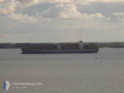
MSC TAMPA
Container Ship
Current Trip
| Time Travelled | 7 days |
|---|---|
| Remaining Time | 2 days |
| Distance Travelled | 2293.41 nm |
| Remaining Distance | 801.15 nm |
| AVG Speed | 13.3 Knop |
| MAX Speed | 17.1 Knop |
| AVG Wind | 11.7 knots |
| MAX Wind | 21.1 knots |
| MIN Temp | 5.5°C / 41.9°F |
| MAX Temp | 15.8°C / 60.44°F |
| Djupgående | 11 m |
| Position mottagen | 4 d sen |
Current Position
| Longitud | -23.16915° |
|---|---|
| Latitude | 50.17894° |
| Status | Under way using engine |
| Fart | 13.8 Knop |
| Kurs | 255.7° |
| Område | North Atlantic Ocean |
| Station | T-AIS |
| Position mottagen | 4 d sen |
Info
Information
The current position of MSC TAMPA is in North Atlantic Ocean with coordinates 50.17894° / -23.16915° as reported on 2024-05-18 04:26 by AIS to our vessel tracker app. The vessel's current speed is 13.8 Knop and is heading at the port of MONTREAL. The estimated time of arrival as calculated by MyShipTracking vessel tracking app is 2024-05-25 04:04 LT
The vessel MSC TAMPA (IMO: 9317925, MMSI: 636021760) is a Container Ship that was built in 2006 ( 18 År gammal ). It's sailing under the flag of [LR] Liberia.
In this page you can find informations about the vessels current position, last detected port calls, and current voyage information. If the vessels is not in coverage by AIS you will find the latest position.
The current position of MSC TAMPA is detected by our AIS receivers and we are not responsible for the reliability of the data. The last position was recorded while the vessel was in Coverage by the Ais receivers of our vessel tracking app.
The current draught of MSC TAMPA as reported by AIS is 11 meters
Weather
| Temperature | 6°C / 42.8°F |
|---|---|
| Wind Speed | 8 knots |
| Direction | 218° SW |
| Pressure | 1009.8 hPa |
| Humidity | 98.4 % |
| Cloud Coverage | 100 % |
Featured Company
Last Port Calls
| Port | Arrival | Departure | Time In Port |
|---|---|---|---|
| 2024-05-14 15:52 | 2024-05-15 15:49 | 23 h | |
| 2024-05-12 01:55 | 2024-05-12 20:58 | 19 h | |
| 2024-05-11 10:10 | 2024-05-12 01:11 | 15 h | |
| 2024-05-09 08:17 | 2024-05-09 23:04 | 14 h | |
| 2024-05-02 14:24 | 2024-05-08 05:28 | 5 d | |
| 2024-04-21 08:24 | 2024-04-23 15:14 | 2 d | |
| 2024-04-10 00:09 | 2024-04-11 13:23 | 1 d | |
| 2024-04-06 11:06 | 2024-04-07 00:40 | 13 h | |
| 2024-04-04 02:29 | 2024-04-04 11:58 | 9 h | |
| 2024-03-31 03:42 | 2024-04-02 21:36 | 2 d |
Most Visited Ports (Last year)
| Port | Arrivals | |
|---|---|---|
| 14 | ||
| 11 | ||
| 11 | ||
| 10 | ||
| 9 |
Last Trips
| Origin | Departure | Destination | Arrival | Distance | |
|---|---|---|---|---|---|
| 2024-05-12 22:58 | 2024-05-14 16:52 | 549.87 nm | |||
| 2024-05-12 03:11 | 2024-05-12 03:55 | 7.80 nm | |||
| 2024-05-10 01:04 | 2024-05-11 12:10 | 507.16 nm | |||
| 2024-05-08 07:28 | 2024-05-09 10:17 | 371.07 nm | |||
| 2024-04-23 11:14 | 2024-05-02 16:24 | 3327.90 nm | |||
| 2024-04-11 14:23 | 2024-04-21 04:24 | 3078.39 nm | |||
| 2024-04-07 02:40 | 2024-04-10 01:09 | 567.53 nm | |||
| 2024-04-04 13:58 | 2024-04-06 13:06 | 510.09 nm | |||
| 2024-04-02 23:36 | 2024-04-04 04:29 | 371.80 nm | |||
| 2024-03-19 07:01 | 2024-03-31 05:42 | 3554.64 nm |
Events
| Tid | Event | Detaljer | Position / Dest | Information |
|---|---|---|---|---|
| 2024-05-18 04:37 | Status ändrad | Default Under way using engine |
50.16833 / -23.23333
CAMTR
|
Fart: 13.8 kn Kurs: 255.7° |
| 2024-05-18 04:26 | UTANFÖR täckningsområde |
50.17894 / -23.16915
North Atlantic Ocean
CAMTR
|
Fart: 13.8 kn Kurs: 255.7° |
|
| 2024-05-18 04:17 | Djupgående ändrat | 11 11.7 |
50.18710 / -23.11704
CAMTR
|
Fart: 13.7 kn Kurs: 256.1° |
| 2024-05-18 04:11 | Byter havsområde | High seas of the North Atlantic Ocean Irish part of the Celtic Sea |
50.19223 / -23.08448
North Atlantic Ocean
CAMTR
|
Fart: 13.8 kn Kurs: 256.4° |
| 2024-05-18 04:11 | Status ändrad | Under way using engine Default |
50.19251 / -23.08245
CAMTR
|
Fart: 13 kn Kurs: 257° |
| 2024-05-18 04:11 | I täckningsområde |
50.19223 / -23.08448
North Atlantic Ocean
CAMTR
|
Fart: 13.8 kn Kurs: 256.4° |
|
| 2024-05-16 16:09 | Status ändrad | Default Under way using engine |
51.30126 / -10.32960
CAMTR
|
Fart: 13.3 kn Kurs: 268.2° |
| 2024-05-16 16:05 | Status ändrad | Under way using engine Default |
51.30177 / -10.30495
CAMTR
|
Fart: 13 kn Kurs: 267° |
| 2024-05-16 16:05 | UTANFÖR täckningsområde |
51.30177 / -10.30495
Celtic Sea
CAMTR
|
Fart: 13.3 kn Kurs: 268.2° |
|
| 2024-05-16 15:52 | Status ändrad | Default Under way using engine |
51.30333 / -10.22833
CAMTR
|
Fart: 13.3 kn Kurs: 267° |