
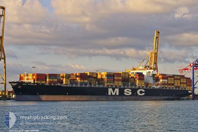
MSC STELLA
Container Ship
Current Trip
| Time Travelled | 12 h, 38 mins |
|---|---|
| Remaining Time | 6 h, 40 mins |
| Distance Travelled | 186.88 nm |
| Remaining Distance | 104.76 nm |
| AVG Speed | 15 Knop |
| MAX Speed | 17.6 Knop |
| AVG Wind | 13.6 knots |
| MAX Wind | 17.9 knots |
| MIN Temp | 6.7°C / 44.06°F |
| MAX Temp | 10.5°C / 50.9°F |
| Djupgående | 11.5 m |
| Position mottagen | 30 m sen |
Current Position
| Longitud | 4.48686° |
|---|---|
| Latitude | 53.32186° |
| Status | Under way using engine |
| Fart | 14.6 Knop |
| Kurs | 195.9° |
| Område | North Sea |
| Station | T-AIS |
| Position mottagen | 30 m sen |
Info
Information
The current position of MSC STELLA is in North Sea with coordinates 53.32186° / 4.48686° as reported on 2024-04-29 12:11 by AIS to our vessel tracker app. The vessel's current speed is 14.6 Knop and is heading at the port of ROTTERDAM. The estimated time of arrival as calculated by MyShipTracking vessel tracking app is 2024-04-29 19:21 LT
The vessel MSC STELLA (IMO: 9279989, MMSI: 352983000) is a Container Ship that was built in 2004 ( 20 År gammal ). It's sailing under the flag of [PA] Panama.
In this page you can find informations about the vessels current position, last detected port calls, and current voyage information. If the vessels is not in coverage by AIS you will find the latest position.
The current position of MSC STELLA is detected by our AIS receivers and we are not responsible for the reliability of the data. The last position was recorded while the vessel was in Coverage by the Ais receivers of our vessel tracking app.
The current draught of MSC STELLA as reported by AIS is 11.5 meters
Weather
| Temperature | 10.5°C / 50.9°F |
|---|---|
| Wind Speed | 12 knots |
| Direction | 193° SSW |
| Pressure | 1019 hPa |
| Humidity | 78.5 % |
| Cloud Coverage | 1 % |
Featured Company
Last Port Calls
| Port | Arrival | Departure | Time In Port |
|---|---|---|---|
| 2024-04-27 20:28 | 2024-04-29 00:03 | 1 d | |
| 2024-04-26 02:32 | 2024-04-26 20:53 | 18 h | |
| 2024-04-14 12:31 | 2024-04-15 23:02 | 1 d | |
| 2024-04-11 07:01 | 2024-04-13 09:32 | 2 d | |
| 2024-04-03 21:55 | 2024-04-04 17:55 | 20 h | |
| 2024-04-01 05:11 | 2024-04-02 14:51 | 1 d | |
| 2024-03-29 05:12 | 2024-03-29 20:54 | 15 h | |
| 2024-03-21 07:54 | 2024-03-22 05:07 | 21 h | |
| 2024-03-18 09:02 | 2024-03-19 13:15 | 1 d | |
| 2024-03-06 17:56 | 2024-03-08 07:12 | 1 d |
Most Visited Ports (Last year)
| Port | Arrivals | |
|---|---|---|
| 15 | ||
| 9 | ||
| 8 | ||
| 8 | ||
| 7 | ||
| 7 |
Last Trips
| Origin | Departure | Destination | Arrival | Distance | |
|---|---|---|---|---|---|
| 2024-04-26 22:53 | 2024-04-27 22:28 | 371.02 nm | |||
| 2024-04-15 19:02 | 2024-04-26 04:32 | 3885.56 nm | |||
| 2024-04-13 05:32 | 2024-04-14 08:31 | 406.10 nm | |||
| 2024-04-04 12:55 | 2024-04-11 03:01 | 1084.85 nm | |||
| 2024-04-02 09:51 | 2024-04-03 16:55 | 298.54 nm | |||
| 2024-03-29 14:54 | 2024-04-01 00:11 | 720.96 nm | |||
| 2024-03-22 01:07 | 2024-03-28 23:12 | 1834.22 nm | |||
| 2024-03-19 09:15 | 2024-03-21 03:54 | 662.41 nm | |||
| 2024-03-08 08:12 | 2024-03-18 05:02 | 3614.77 nm | |||
| 2024-03-05 23:32 | 2024-03-06 18:56 | 252.90 nm |
Events
| Tid | Event | Detaljer | Position / Dest | Information |
|---|---|---|---|---|
| 2024-04-29 12:19 | Status ändrad | Default Under way using engine |
53.29233 / 4.47205
ROTTERDAM
|
Fart: 14.6 kn Kurs: 195.9° |
| 2024-04-29 12:04 | Status ändrad | Under way using engine Default |
53.34854 / 4.49849
ROTTERDAM
|
Fart: 14.4 kn Kurs: 196° |
| 2024-04-29 11:47 | Status ändrad | Default Under way using engine |
53.41396 / 4.52945
ROTTERDAM
|
Fart: 14.1 kn Kurs: 197.9° |
| 2024-04-29 10:59 | ETA ändrat | 2024/04/29 19:00 2024/04/29 17:30 |
53.58768 / 4.64498
ROTTERDAM
|
Fart: 13.2 kn Kurs: 207° |
| 2024-04-29 10:45 | Byter havsområde | Dutch part of the North Sea German part of the North Sea |
53.63029 / 4.67648
North Sea
ROTTERDAM
|
Fart: 13.3 kn Kurs: 201.9° |
| 2024-04-29 10:45 | Status ändrad | Under way using engine Default |
53.63029 / 4.67648
ROTTERDAM
|
Fart: 16.7 kn Kurs: 200° |
| 2024-04-29 10:45 | I täckningsområde |
53.63029 / 4.67648
North Sea
ROTTERDAM
|
Fart: 13.3 kn Kurs: 201.9° |
|
| 2024-04-29 02:46 | Status ändrad | Default Under way using engine |
53.96333 / 7.69104
ROTTERDAM
|
Fart: 17.5 kn Kurs: 306.9° |
| 2024-04-29 02:29 | UTANFÖR täckningsområde |
53.88971 / 7.75983
North Sea
ROTTERDAM
|
Fart: 17.5 kn Kurs: 306.9° |
|
| 2024-04-29 00:24 | ETA ändrat | 2024/04/29 17:30 2024/04/29 17:00 |
53.64970 / 8.40805
ROTTERDAM
|
Fart: 12.4 kn Kurs: 310° |