
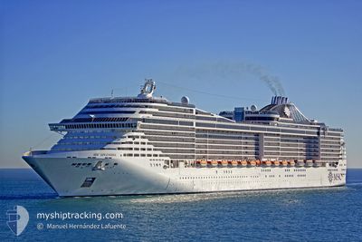
MSC SPLENDIDA
Passengers Ship
Current Trip
| Trip Time | 2 days |
|---|---|
| Trip Distance | 1000.22 nm |
| AVG Speed | 16.9 Knop |
| MAX Speed | 19.6 Knop |
| Djupgående | 8.8 m |
| AVG Wind | 10.8 knots |
| MAX Wind | 23.9 knots |
| MIN Temp | 21.2°C / 70.16°F |
| MAX Temp | 27.2°C / 80.96°F |
| Position mottagen | 20 h, 12 m sen |
Current Position
| Longitud | --- |
|---|---|
| Latitude | --- |
| Status | Under way using engine |
| Fart | 13.1 Knop |
| Kurs | 277° |
| Område | Rio de La Plata |
| Station | T-AIS |
| Position mottagen | 20 h, 12 m sen |
Info
Information
The current position of MSC SPLENDIDA is in Rio de La Plata with coordinates -35.16825° / -56.35028° as reported on 2025-02-17 00:53 by AIS to our vessel tracker app. The vessel's current speed is 13.1 Knop and is currently inside the port of BUENOS AIRES.
The vessel MSC SPLENDIDA (IMO: 9359806, MMSI: 357698000) is a Passengers Ship that was built in 2009 ( 16 År gammal ). It's sailing under the flag of [PA] Panama.
In this page you can find informations about the vessels current position, last detected port calls, and current voyage information. If the vessels is not in coverage by AIS you will find the latest position.
The current position of MSC SPLENDIDA is detected by our AIS receivers and we are not responsible for the reliability of the data. The last position was recorded while the vessel was in Coverage by the Ais receivers of our vessel tracking app.
The current draught of MSC SPLENDIDA as reported by AIS is 8.8 meters
Weather
| Temperature | 25.7°C / 78.26°F |
|---|---|
| Wind Speed | 7 knots |
| Direction | 99° E |
| Pressure | 1009.1 hPa |
| Humidity | 59.9 % |
| Cloud Coverage | --- |
Featured Company
Last Port Calls
| Port | Arrival | Departure | Time In Port |
|---|---|---|---|
| 2025-02-17 06:22 | |||
| 2025-02-14 06:32 | 2025-02-14 19:38 | 13 h | |
| 2025-02-13 09:29 | 2025-02-13 18:45 | 9 h | |
| 2025-02-10 07:21 | 2025-02-10 19:34 | 12 h | |
| 2025-02-07 06:37 | 2025-02-07 19:34 | 12 h | |
| 2025-02-06 09:36 | 2025-02-06 18:37 | 9 h | |
| 2025-02-03 06:54 | 2025-02-03 19:38 | 12 h | |
| 2025-01-31 06:44 | 2025-01-31 19:40 | 12 h | |
| 2025-01-30 09:34 | 2025-01-30 18:33 | 8 h | |
| 2025-01-27 06:39 | 2025-01-27 20:35 | 13 h |
Last Trips
| Origin | Departure | Destination | Arrival | Distance | |
|---|---|---|---|---|---|
| 2025-02-14 19:38 | 2025-02-17 06:22 | 1000.22 nm | |||
| 2025-02-13 18:45 | 2025-02-14 06:32 | 216.85 nm | |||
| 2025-02-10 19:34 | 2025-02-13 09:29 | 816.05 nm | |||
| 2025-02-07 19:34 | 2025-02-10 07:21 | 999.71 nm | |||
| 2025-02-06 18:37 | 2025-02-07 06:37 | 217.39 nm | |||
| 2025-02-03 19:38 | 2025-02-06 09:36 | 817.34 nm | |||
| 2025-01-31 19:40 | 2025-02-03 06:54 | 999.78 nm | |||
| 2025-01-30 18:33 | 2025-01-31 06:44 | 217.96 nm | |||
| 2025-01-27 20:35 | 2025-01-30 09:34 | 817.94 nm | |||
| 2025-01-24 19:39 | 2025-01-27 06:39 | 999.58 nm |
Events
| Tid | Event | Detaljer | Position / Dest | Information |
|---|---|---|---|---|
| 2025-02-17 09:53 | STOPPAR förflyttning |
-34.57948 / -58.36530
[AR] BUENOS AIRES
|
Fart: 0.2 kn Kurs: 125° |
|
| 2025-02-17 09:22 | ANLÄNDER HAMN |
|
-34.59327 / -58.35416
[AR] BUENOS AIRES
|
Fart: 7.6 kn Kurs: 282° |
| 2025-02-17 00:58 | Status ändrad | Default Under way using engine |
-35.16629 / -56.37233
ARBUE
|
Fart: 13.1 kn Kurs: 277° |
| 2025-02-17 00:53 | UTANFÖR täckningsområde |
-35.16825 / -56.35028
Rio de La Plata
ARBUE
|
Fart: 13.1 kn Kurs: 277° |
|
| 2025-02-17 00:43 | Status ändrad | Under way using engine Default |
-35.17117 / -56.30444
ARBUE
|
Fart: 13.3 kn Kurs: 268° |
| 2025-02-17 00:34 | Status ändrad | Default Under way using engine |
-35.17026 / -56.26579
ARBUE
|
Fart: 13.1 kn Kurs: 268.8° |
| 2025-02-16 23:38 | Status ändrad | Under way using engine Default |
-35.09228 / -56.02795
ARBUE
|
Fart: 13.4 kn Kurs: 241° |
| 2025-02-16 23:34 | Status ändrad | Default Under way using engine |
-35.08719 / -56.01415
ARBUE
|
Fart: 13 kn Kurs: 243° |
| 2025-02-16 22:41 | Status ändrad | Under way using engine Default |
-35.07552 / -55.85207
ARBUE
|
Fart: 9.1 kn Kurs: 271° |
| 2025-02-16 22:38 | Status ändrad | Default Under way using engine |
-35.07573 / -55.84553
ARBUE
|
Fart: 12.1 kn Kurs: 270.7° |