
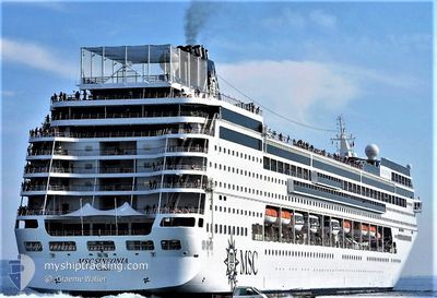
MSC SINFONIA
Passengers Ship
Current Trip
| Trip Time | 22 h, 24 mins |
|---|---|
| Trip Distance | 398.81 nm |
| AVG Speed | 16.2 Knop |
| MAX Speed | 19.3 Knop |
| Djupgående | 6.6 m |
| AVG Wind | 10.2 knots |
| MAX Wind | 15.5 knots |
| MIN Temp | 16.4°C / 61.52°F |
| MAX Temp | 20.8°C / 69.44°F |
| Position mottagen | 3 h, 4 m sen |
Current Position
| Longitud | 18.04113° |
|---|---|
| Latitude | 40.66503° |
| Status | Under way using engine |
| Fart | 15 Knop |
| Kurs | 262.3° |
| Område | Adriatic Sea |
| Station | T-AIS |
| Position mottagen | 3 h, 4 m sen |
Info
Information
The current position of MSC SINFONIA is in Adriatic Sea with coordinates 40.66503° / 18.04113° as reported on 2024-05-06 12:37 by AIS to our vessel tracker app. The vessel's current speed is 15 Knop and is currently inside the port of BRINDISI.
The vessel MSC SINFONIA (IMO: 9210153, MMSI: 356716000) is a Passengers Ship that was built in 2002 ( 22 År gammal ). It's sailing under the flag of [PA] Panama.
In this page you can find informations about the vessels current position, last detected port calls, and current voyage information. If the vessels is not in coverage by AIS you will find the latest position.
The current position of MSC SINFONIA is detected by our AIS receivers and we are not responsible for the reliability of the data. The last position was recorded while the vessel was in Coverage by the Ais receivers of our vessel tracking app.
The current draught of MSC SINFONIA as reported by AIS is 6.6 meters
Weather
| Temperature | 20°C / 68°F |
|---|---|
| Wind Speed | 10 knots |
| Direction | 151° SSE |
| Pressure | 1014.9 hPa |
| Humidity | 65.1 % |
| Cloud Coverage | 100 % |
Featured Company
Last Port Calls
| Port | Arrival | Departure | Time In Port |
|---|---|---|---|
| 2024-05-06 12:52 | |||
| 2024-05-05 04:00 | 2024-05-05 14:28 | 10 h | |
| 2024-05-02 01:35 | 2024-05-02 14:11 | 12 h | |
| 2024-05-01 17:04 | 2024-05-01 17:13 | 8 m | |
| 2024-05-01 05:11 | 2024-05-01 16:32 | 11 h | |
| 2024-04-29 12:52 | 2024-04-29 19:57 | 7 h | |
| 2024-04-28 04:05 | 2024-04-28 14:16 | 10 h | |
| 2024-04-25 01:33 | 2024-04-25 14:15 | 12 h | |
| 2024-04-24 04:42 | 2024-04-24 16:34 | 11 h | |
| 2024-04-22 13:08 | 2024-04-22 20:01 | 6 h |
Last Trips
| Origin | Departure | Destination | Arrival | Distance | |
|---|---|---|---|---|---|
| 2024-05-05 16:28 | 2024-05-06 14:52 | 398.81 nm | |||
| 2024-05-02 17:11 | 2024-05-05 06:00 | 915.10 nm | |||
| 2024-05-01 20:13 | 2024-05-02 04:35 | 108.28 nm | |||
| 2024-05-01 19:32 | 2024-05-01 20:04 | 0.19 nm | |||
| 2024-04-29 21:57 | 2024-05-01 08:11 | 524.03 nm | |||
| 2024-04-28 16:16 | 2024-04-29 14:52 | 396.63 nm | |||
| 2024-04-25 17:15 | 2024-04-28 06:05 | 915.48 nm | |||
| 2024-04-24 19:34 | 2024-04-25 04:33 | 107.49 nm | |||
| 2024-04-22 22:01 | 2024-04-24 07:42 | 521.24 nm | |||
| 2024-04-21 16:23 | 2024-04-22 15:08 | 395.03 nm |
Events
| Tid | Event | Detaljer | Position / Dest | Information |
|---|---|---|---|---|
| 2024-05-06 13:35 | STOPPAR förflyttning |
40.63917 / 17.94950
[IT] BRINDISI
|
Fart: Kurs: 331° |
|
| 2024-05-06 12:52 | ANLÄNDER HAMN |
|
40.65667 / 17.97833
[IT] BRINDISI
|
Fart: 12.8 kn Kurs: 262° |
| 2024-05-06 12:44 | Status ändrad | Default Under way using engine |
40.66185 / 18.00920
ITBDS
|
Fart: 15 kn Kurs: 262.3° |
| 2024-05-06 12:37 | UTANFÖR täckningsområde |
40.66503 / 18.04113
Adriatic Sea
[IT] BRINDISI
|
Fart: 15 kn Kurs: 262.3° |
|
| 2024-05-06 12:19 | Status ändrad | Under way using engine Default |
40.69320 / 18.13622
ITBDS
|
Fart: 17.8 kn Kurs: 148° |
| 2024-05-06 12:13 | Status ändrad | Default Under way using engine |
40.71993 / 18.12257
ITBDS
|
Fart: 18.6 kn Kurs: 131.2° |
| 2024-05-06 11:21 | Status ändrad | Under way using engine Default |
40.90488 / 17.86312
ITBDS
|
Fart: 18 kn Kurs: 134° |
| 2024-05-06 11:19 | Status ändrad | Default Under way using engine |
40.91333 / 17.85167
ITBDS
|
Fart: 18 kn Kurs: 135° |
| 2024-05-06 11:08 | Status ändrad | Under way using engine Default |
40.95126 / 17.80135
ITBDS
|
Fart: 18.2 kn Kurs: 133° |
| 2024-05-06 10:06 | UTANFÖR täckningsområde |
41.15840 / 17.48330
Adriatic Sea
ITBDS
|
Fart: 18.7 kn Kurs: 137.9° |