
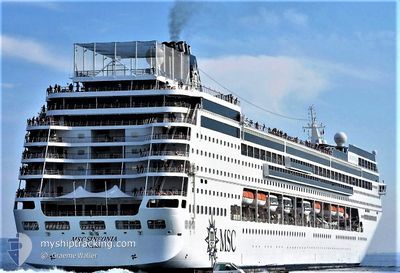
MSC SINFONIA
Passengers Ship
Current Trip
HRSPL
| Time Travelled | 1 day |
|---|---|
| Remaining Time | --- |
| Distance Travelled | 675.45 nm |
| Remaining Distance | --- |
| AVG Speed | 18.3 Noeuds |
| MAX Speed | 20 Noeuds |
| AVG Wind | 13.4 knots |
| MAX Wind | 24 knots |
| MIN Temp | 10.2°C / 50.36°F |
| MAX Temp | 19.3°C / 66.74°F |
| Tirant d eau | 6.6 m |
| Position reçue | 13 h, 15 m depuis |
Current Position
| Longitude | 17.03573° |
|---|---|
| Latitude | 42.27622° |
| Etat | Under way using engine |
| Vitesse | 15.9 Noeuds |
| Parcours | 325.4° |
| Zone | Adriatic Sea |
| Station | T-AIS |
| Position reçue | 13 h, 15 m depuis |
Info
Information
The current position of MSC SINFONIA is in Adriatic Sea with coordinates 42.27622° / 17.03573° as reported on 2024-04-26 22:22 by AIS to our vessel tracker app. The vessel's current speed is 15.9 Noeuds
The vessel MSC SINFONIA (IMO: 9210153, MMSI: 356716000) is a Passengers Ship that was built in 2002 ( 22 Age ). It's sailing under the flag of [PA] Panama.
In this page you can find informations about the vessels current position, last detected port calls, and current voyage information. If the vessels is not in coverage by AIS you will find the latest position.
The current position of MSC SINFONIA is detected by our AIS receivers and we are not responsible for the reliability of the data. The last position was recorded while the vessel was in Coverage by the Ais receivers of our vessel tracking app.
The current draught of MSC SINFONIA as reported by AIS is 6.6 meters
Weather
| Temperature | 16.1°C / 60.98°F |
|---|---|
| Wind Speed | 7 knots |
| Direction | 163° SSE |
| Pressure | 1018.4 hPa |
| Humidity | 58.5 % |
| Cloud Coverage | 12 % |
Featured Company
Last Port Calls
| Port | Arrival | Departure | Time In Port |
|---|---|---|---|
| 2024-04-25 01:33 | 2024-04-25 14:15 | 12 h | |
| 2024-04-24 04:42 | 2024-04-24 16:34 | 11 h | |
| 2024-04-22 13:08 | 2024-04-22 20:01 | 6 h | |
| 2024-04-21 04:05 | 2024-04-21 14:23 | 10 h | |
| 2024-04-18 01:34 | 2024-04-18 14:33 | 12 h | |
| 2024-04-17 05:05 | 2024-04-17 16:40 | 11 h | |
| 2024-04-15 12:48 | 2024-04-15 20:04 | 7 h | |
| 2024-04-14 05:02 | 2024-04-14 14:46 | 9 h | |
| 2024-04-11 01:37 | 2024-04-11 14:17 | 12 h | |
| 2024-04-10 16:10 | 2024-04-10 17:12 | 1 h |
Last Trips
| Origin | Departure | Destination | Arrival | Distance | |
|---|---|---|---|---|---|
| 2024-04-24 19:34 | 2024-04-25 04:33 | 107.49 nm | |||
| 2024-04-22 22:01 | 2024-04-24 07:42 | 521.24 nm | |||
| 2024-04-21 16:23 | 2024-04-22 15:08 | 395.03 nm | |||
| 2024-04-18 17:33 | 2024-04-21 06:05 | 885.29 nm | |||
| 2024-04-17 19:40 | 2024-04-18 04:34 | 106.28 nm | |||
| 2024-04-15 22:04 | 2024-04-17 08:05 | 525.18 nm | |||
| 2024-04-14 16:46 | 2024-04-15 14:48 | 396.58 nm | |||
| 2024-04-11 17:17 | 2024-04-14 07:02 | 919.22 nm | |||
| 2024-04-10 20:12 | 2024-04-11 04:37 | 109.58 nm | |||
| 2024-04-08 22:08 | 2024-04-10 19:10 | 524.40 nm |
Events
| Heure | Evenement | Détails | Position/ Destination | Info |
|---|---|---|---|---|
| 2024-04-27 04:23 | Arret | 0.33 nm, South East of SPLIT |
43.50045 / 16.44055
HRSPL
|
Vitesse: Parcours: 284° |
| 2024-04-26 22:40 | Etat Changé | Default Under way using engine |
42.34172 / 16.97183
HRSPL
|
Vitesse: 15.9 kn Parcours: 325.4° |
| 2024-04-26 22:22 | Detecté en mer | Croatian part of the Adriatic Sea |
42.27622 / 17.03573
Adriatic Sea
HRSPL
|
Vitesse: 15.9 kn Parcours: 325.4° |
| 2024-04-26 22:22 | Etat Changé | Under way using engine Default |
42.27622 / 17.03573
HRSPL
|
Vitesse: 16.4 kn Parcours: 325° |
| 2024-04-26 22:22 | Dans la zone couverte |
42.27622 / 17.03573
Adriatic Sea
HRSPL
|
Vitesse: 15.9 kn Parcours: 325.4° |
|
| 2024-04-26 22:22 | Hors de la zone couverte |
42.27622 / 17.03573
Adriatic Sea
HRSPL
|
Vitesse: 15.9 kn Parcours: 325.4° |
|
| 2024-04-26 16:23 | Etat Changé | Default Under way using engine |
40.80333 / 18.40333
HRSPL
|
Vitesse: 18.9 kn Parcours: 325.2° |
| 2024-04-26 16:04 | Hors de la zone couverte |
40.72592 / 18.47663
Adriatic Sea
HRSPL
|
Vitesse: 18.9 kn Parcours: 325.2° |
|
| 2024-04-26 13:40 | Changement de zone | Italian part of the Adriatic Sea Greek part of the Adriatic Sea |
40.05328 / 18.96110
Adriatic Sea
HRSPL
|
Vitesse: 19.3 kn Parcours: 346.7° |
| 2024-04-26 13:39 | Etat Changé | Under way using engine Default |
40.04382 / 18.96400
HRSPL
|
Vitesse: 19.4 kn Parcours: 346° |