
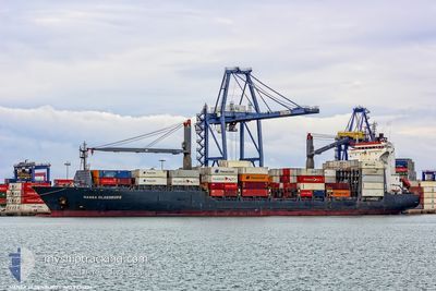
MSC REET II
Container Ship
Current Trip
| Time Travelled | 7 h, 37 mins |
|---|---|
| Remaining Time | --- |
| Distance Travelled | 72.98 nm |
| Remaining Distance | --- |
| AVG Speed | 12.8 Knop |
| MAX Speed | 13.5 Knop |
| AVG Wind | 7.5 knots |
| MAX Wind | 15.8 knots |
| MIN Temp | 14.1°C / 57.38°F |
| MAX Temp | 16.6°C / 61.88°F |
| Djupgående | 10.1 m |
| Position mottagen | 6 h, 36 m sen |
Current Position
| Longitud | --- |
|---|---|
| Latitude | --- |
| Status | Under way using engine |
| Fart | 13.2 Knop |
| Kurs | 266.3° |
| Område | Aegean Sea |
| Station | T-AIS |
| Position mottagen | 6 h, 36 m sen |
Info
Information
The current position of MSC REET II is in Aegean Sea with coordinates 38.78357° / 26.63882° as reported on 2024-11-29 10:09 by AIS to our vessel tracker app. The vessel's current speed is 13.2 Knop
The vessel MSC REET II (IMO: 9236224, MMSI: 636021153) is a Container Ship that was built in 2002 ( 22 År gammal ). It's sailing under the flag of [LR] Liberia.
In this page you can find informations about the vessels current position, last detected port calls, and current voyage information. If the vessels is not in coverage by AIS you will find the latest position.
The current position of MSC REET II is detected by our AIS receivers and we are not responsible for the reliability of the data. The last position was recorded while the vessel was in Coverage by the Ais receivers of our vessel tracking app.
The current draught of MSC REET II as reported by AIS is 10.1 meters
Weather
| Temperature | 16.7°C / 62.06°F |
|---|---|
| Wind Speed | 17 knots |
| Direction | 157° SSE |
| Pressure | 1019.3 hPa |
| Humidity | 82.4 % |
| Cloud Coverage | 2 % |
Featured Company
Last Port Calls
| Port | Arrival | Departure | Time In Port |
|---|---|---|---|
| 2024-11-28 22:51 | 2024-11-29 09:08 | 10 h | |
| 2024-11-27 14:52 | 2024-11-27 22:16 | 7 h | |
| 2024-11-27 02:05 | 2024-11-27 08:23 | 6 h | |
| 2024-11-26 04:01 | 2024-11-26 16:12 | 12 h | |
| 2024-11-23 21:09 | 2024-11-24 16:35 | 19 h | |
| 2024-11-14 13:22 | 2024-11-14 22:48 | 9 h | |
| 2024-11-14 00:18 | 2024-11-14 08:05 | 7 h | |
| 2024-11-11 12:16 | 2024-11-12 04:36 | 16 h | |
| 2024-11-10 09:09 | 2024-11-11 01:29 | 16 h | |
| 2024-11-07 11:58 | 2024-11-08 06:02 | 18 h |
Last Trips
| Origin | Departure | Destination | Arrival | Distance | |
|---|---|---|---|---|---|
| 2024-11-28 01:16 | 2024-11-29 01:51 | 287.67 nm | |||
| 2024-11-27 11:23 | 2024-11-27 17:52 | 74.42 nm | |||
| 2024-11-26 19:12 | 2024-11-27 05:05 | 109.05 nm | |||
| 2024-11-24 18:35 | 2024-11-26 07:01 | 277.83 nm | |||
| 2024-11-15 01:48 | 2024-11-23 23:09 | 750.61 nm | |||
| 2024-11-14 11:05 | 2024-11-14 16:22 | 39.44 nm | |||
| 2024-11-12 07:36 | 2024-11-14 03:18 | 542.30 nm | |||
| 2024-11-11 04:29 | 2024-11-11 15:16 | 108.58 nm | |||
| 2024-11-08 08:02 | 2024-11-10 12:09 | 385.45 nm | |||
| 2024-11-05 07:08 | 2024-11-07 13:58 | 752.41 nm |
Events
| Tid | Event | Detaljer | Position / Dest | Information |
|---|---|---|---|---|
| 2024-11-29 10:15 | Status ändrad | Default Under way using engine |
38.78165 / 26.60663
TRALI
|
Fart: 13.2 kn Kurs: 266.3° |
| 2024-11-29 10:09 | UTANFÖR täckningsområde |
38.78357 / 26.63882
Aegean Sea
|
Fart: 13.2 kn Kurs: 266.3° |
|
| 2024-11-29 09:34 | Status ändrad | Under way using engine Default |
38.79179 / 26.80012
TRALI
|
Fart: 13 kn Kurs: 272° |
| 2024-11-29 09:08 | AVGÅTT HAMN |
|
38.77780 / 26.90492
TRALI
|
Fart: 10.5 kn Kurs: 300° |
| 2024-11-29 09:04 | Status ändrad | Default Under way using engine |
38.77211 / 26.91955
[TR] NEMRUT
|
Fart: 1.5 kn Kurs: 320° |
| 2024-11-29 09:04 | STARTAR förflyttning |
38.77211 / 26.91955
[TR] NEMRUT
|
Fart: 10.5 kn Kurs: 300° |
|
| 2024-11-29 08:29 | Status ändrad | Under way using engine Default |
38.76458 / 26.93524
[TR] NEMRUT
|
Fart: Kurs: 90° |
| 2024-11-29 08:28 | Status ändrad | Default Under way using engine |
38.76455 / 26.93516
[TR] NEMRUT
|
Fart: Kurs: 89° |
| 2024-11-29 08:17 | Status ändrad | Under way using engine Default |
38.76450 / 26.93514
[TR] NEMRUT
|
Fart: Kurs: 89° |
| 2024-11-29 08:12 | Status ändrad | Default Under way using engine |
38.76458 / 26.93516
[TR] NEMRUT
|
Fart: Kurs: 89° |