
MSC REET II
Container Ship
Current Trip
RUNVS
| Time Travelled | 23 h, 16 mins |
|---|---|
| Remaining Time | --- |
| Distance Travelled | --- |
| Remaining Distance | --- |
| AVG Speed | --- |
| MAX Speed | --- |
| AVG Wind | --- |
| MAX Wind | --- |
| MIN Temp | --- |
| MAX Temp | --- |
| Diepgang | 11 M |
| Positie ontvangen | 4 d geleden |
Current Position
| Lengtegraad | --- |
|---|---|
| Breedtegraat | --- |
| Status | Under way using engine |
| Snelheid | 12.5 Knopen |
| Koers | 48.7° |
| Gebied | Black Sea |
| Station | T-AIS |
| Positie ontvangen | 4 d geleden |
Info
Information
The current position of MSC REET II is in Black Sea with coordinates 41.47263° / 29.51151° as reported on 2025-02-22 16:00 by AIS to our vessel tracker app. The vessel's current speed is 12.5 Knopen
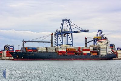
The vessel MSC REET II (IMO: 9236224, MMSI: 636021153) is a Container Ship that was built in 2002 ( 23 Jaar oud ). It's sailing under the flag of [LR] Liberia.
In this page you can find informations about the vessels current position, last detected port calls, and current voyage information. If the vessels is not in coverage by AIS you will find the latest position.
The current position of MSC REET II is detected by our AIS receivers and we are not responsible for the reliability of the data. The last position was recorded while the vessel was in Coverage by the Ais receivers of our vessel tracking app.
The current draught of MSC REET II as reported by AIS is 11 meters
Weather
| Temperature | 6.3°C / 43.34°F |
|---|---|
| Wind Speed | 15 knots |
| Direction | 121° ESE |
| Pressure | 1024.4 hPa |
| Humidity | 72.2 % |
| Cloud Coverage | 25 % |
Featured Company
Last Port Calls
| Port | Arrival | Departure | Time In Port |
|---|---|---|---|
| 2025-02-25 12:01 | 2025-02-26 15:30 | 1 d | |
| 2025-02-20 10:01 | 2025-02-21 01:36 | 15 h | |
| 2025-02-19 08:46 | 2025-02-20 03:33 | 18 h | |
| 2025-02-18 00:47 | 2025-02-18 07:27 | 6 h | |
| 2025-02-15 00:39 | 2025-02-15 16:02 | 15 h | |
| 2025-02-12 04:29 | 2025-02-13 18:40 | 1 d | |
| 2025-02-08 09:17 | 2025-02-09 17:49 | 1 d | |
| 2025-02-03 16:54 | 2025-02-04 09:44 | 16 h | |
| 2025-01-30 19:54 | 2025-01-31 05:16 | 9 h | |
| 2025-01-28 02:15 | 2025-01-28 07:51 | 5 h |
Last Trips
| Origin | Departure | Destination | Arrival | Distance | |
|---|---|---|---|---|---|
| 2025-02-21 04:36 | 2025-02-25 15:01 | 593.55 nm | |||
| 2025-02-20 06:33 | 2025-02-20 13:01 | 68.16 nm | |||
| 2025-02-18 10:27 | 2025-02-19 11:46 | 46.26 nm | |||
| 2025-02-15 19:02 | 2025-02-18 03:47 | 168.36 nm | |||
| 2025-02-13 20:40 | 2025-02-15 03:39 | 368.07 nm | |||
| 2025-02-09 18:49 | 2025-02-12 06:29 | 750.04 nm | |||
| 2025-02-04 10:44 | 2025-02-08 10:17 | 545.33 nm | |||
| 2025-01-31 07:16 | 2025-02-03 17:54 | 1009.16 nm | |||
| 2025-01-28 10:51 | 2025-01-30 21:54 | 266.34 nm | |||
| 2025-01-26 19:45 | 2025-01-28 05:15 | 307.04 nm |
Events
| Tijd | Evenement | Details | Positie / Bestemming | Info |
|---|---|---|---|---|
| 2025-02-26 15:30 | Vertrekhaven |
|
44.61556 / 37.96186
RUNVS
|
Snelheid: 6.8 kn Koers: 58° |
| 2025-02-25 12:33 | Stop beweging |
44.72010 / 37.80930
[RU] NOVOROSSIYSK
|
Snelheid: 0.3 kn Koers: 61° |
|
| 2025-02-25 12:01 | Aankomsthaven |
|
44.69683 / 37.81868
[RU] NOVOROSSIYSK
|
Snelheid: 8 kn Koers: 335° |
| 2025-02-25 11:14 | Start beweging | 7.03 nm, South East of NOVOROSSIYSK |
44.61115 / 37.86547
RUNVS
|
Snelheid: 5.5 kn Koers: 358° |
| 2025-02-25 10:33 | Stop beweging | 7.38 nm, South East of NOVOROSSIYSK |
44.60451 / 37.86481
RUNVS
|
Snelheid: 0.3 kn Koers: 287° |
| 2025-02-25 08:25 | Start beweging | 16.66 nm, South West of GELENDZHIK |
44.37247 / 37.77275
RUNVS
|
Snelheid: 10.6 kn Koers: 71° |
| 2025-02-25 08:04 | Stop beweging | 17.59 nm, South West of GELENDZHIK |
44.36368 / 37.75435
RUNVS
|
Snelheid: 0.3 kn Koers: 299° |
| 2025-02-24 18:50 | Start beweging | 20.44 nm, South West of GELENDZHIK |
44.27891 / 37.79795
RUNVS
|
Snelheid: 3.1 kn Koers: 29° |
| 2025-02-24 10:11 | Stop beweging | 19.15 nm, South West of GELENDZHIK |
44.37476 / 37.69259
RUNVS
|
Snelheid: 0.2 kn Koers: 33° |
| 2025-02-22 16:00 | Buitenbereik |
41.47263 / 29.51151
Black Sea
RUNVS
|
Snelheid: 12.5 kn Koers: 48.7° |