
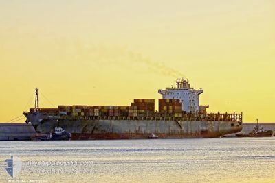
MSC PETRA
Container Ship
Current Trip
CRISTOBAL
| Time Travelled | 3 days |
|---|---|
| Remaining Time | --- |
| Distance Travelled | 1192.38 nm |
| Remaining Distance | --- |
| AVG Speed | 16.6 Knop |
| MAX Speed | 18.9 Knop |
| AVG Wind | 14 knots |
| MAX Wind | 17.9 knots |
| MIN Temp | 24.2°C / 75.56°F |
| MAX Temp | 27.8°C / 82.04°F |
| Djupgående | 12.5 m |
| Position mottagen | 2 d sen |
Current Position
| Longitud | --- |
|---|---|
| Latitude | --- |
| Status | Under way using engine |
| Fart | 16.1 Knop |
| Kurs | 350.3° |
| Område | Caribbean Sea |
| Station | T-AIS |
| Position mottagen | 2 d sen |
Info
Information
The current position of MSC PETRA is in Caribbean Sea with coordinates 13.30296° / -80.52173° as reported on 2025-02-16 08:50 by AIS to our vessel tracker app. The vessel's current speed is 16.1 Knop
The vessel MSC PETRA (IMO: 9222302, MMSI: 636014644) is a Container Ship that was built in 2001 ( 24 År gammal ). It's sailing under the flag of [LR] Liberia.
In this page you can find informations about the vessels current position, last detected port calls, and current voyage information. If the vessels is not in coverage by AIS you will find the latest position.
The current position of MSC PETRA is detected by our AIS receivers and we are not responsible for the reliability of the data. The last position was recorded while the vessel was in Coverage by the Ais receivers of our vessel tracking app.
The current draught of MSC PETRA as reported by AIS is 12.5 meters
Weather
| Temperature | 24.3°C / 75.74°F |
|---|---|
| Wind Speed | 10 knots |
| Direction | 101° E |
| Pressure | 1012.2 hPa |
| Humidity | 88.6 % |
| Cloud Coverage | 63 % |
Featured Company
Last Port Calls
| Port | Arrival | Departure | Time In Port |
|---|---|---|---|
| 2025-02-13 14:58 | 2025-02-15 13:03 | 1 d | |
| 2025-02-09 19:57 | 2025-02-13 14:44 | 3 d | |
| 2025-02-02 00:40 | 2025-02-02 20:21 | 19 h | |
| 2025-01-17 20:18 | 2025-01-17 21:02 | 43 m | |
| 2025-01-16 09:52 | 2025-01-17 01:00 | 15 h | |
| 2025-01-15 03:33 | 2025-01-15 21:51 | 18 h | |
| 2025-01-08 22:20 | 2025-01-09 16:59 | 18 h | |
| 2025-01-03 08:22 | 2025-01-03 20:18 | 11 h | |
| 2024-12-31 02:21 | 2025-01-02 17:36 | 2 d | |
| 2024-12-27 04:31 | 2024-12-27 04:48 | 17 m |
Most Visited Ports (Last year)
| Port | Arrivals | |
|---|---|---|
| 8 | ||
| 6 | ||
| 5 | ||
| 5 | ||
| 4 | ||
| 4 |
Last Trips
| Origin | Departure | Destination | Arrival | Distance | |
|---|---|---|---|---|---|
| 2025-02-13 14:44 | 2025-02-13 14:58 | 0.50 nm | |||
| 2025-02-02 20:21 | 2025-02-09 19:57 | 306.92 nm | |||
| 2025-01-17 21:02 | 2025-02-02 00:40 | 4401.02 nm | |||
| 2025-01-17 01:00 | 2025-01-17 20:18 | 180.15 nm | |||
| 2025-01-15 21:51 | 2025-01-16 09:52 | 82.90 nm | |||
| 2025-01-09 16:59 | 2025-01-15 03:33 | 119.37 nm | |||
| 2025-01-03 20:18 | 2025-01-08 22:20 | 808.64 nm | |||
| 2025-01-02 17:36 | 2025-01-03 08:22 | 149.39 nm | |||
| 2024-12-27 04:48 | 2024-12-31 02:21 | 1012.65 nm | |||
| 2024-12-14 03:15 | 2024-12-27 04:31 | 4548.83 nm |
Events
| Tid | Event | Detaljer | Position / Dest | Information |
|---|---|---|---|---|
| 2025-02-16 09:37 | Status ändrad | Default Under way using engine |
13.51223 / -80.55266
CRISTOBAL
|
Fart: 16.1 kn Kurs: 350.3° |
| 2025-02-16 08:50 | Status ändrad | Under way using engine Default |
13.30296 / -80.52173
CRISTOBAL
|
Fart: 16.1 kn Kurs: 352° |
| 2025-02-16 08:50 | UTANFÖR täckningsområde |
13.30296 / -80.52173
Caribbean Sea
|
Fart: 16.1 kn Kurs: 350.3° |
|
| 2025-02-16 08:39 | Status ändrad | Default Under way using engine |
13.25537 / -80.51453
CRISTOBAL
|
Fart: 16 kn Kurs: 351.6° |
| 2025-02-16 08:33 | Status ändrad | Under way using engine Default |
13.22875 / -80.51041
CRISTOBAL
|
Fart: 16 kn Kurs: 351° |
| 2025-02-16 08:28 | Status ändrad | Default Under way using engine |
13.20707 / -80.50700
CRISTOBAL
|
Fart: 16 kn Kurs: 350.7° |
| 2025-02-16 07:46 | Upptäckt i hav | Colombian part of the Caribbean Sea |
13.02097 / -80.47686
Caribbean Sea
|
Fart: 15.8 kn Kurs: 350.4° |
| 2025-02-16 07:46 | Status ändrad | Under way using engine Default |
13.02097 / -80.47686
CRISTOBAL
|
Fart: 15.7 kn Kurs: 351° |
| 2025-02-16 07:26 | I täckningsområde |
13.02097 / -80.47686
Caribbean Sea
|
Fart: 15.8 kn Kurs: 350.4° |
|
| 2025-02-15 19:33 | UTANFÖR täckningsområde |
9.69102 / -79.96762
Caribbean Sea
|
Fart: 16.2 kn Kurs: 347° |