
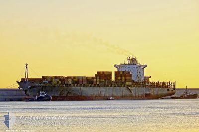
MSC PETRA
Container Ship
Current Trip
| Time Travelled | 4 days |
|---|---|
| Remaining Time | 1 day |
| Distance Travelled | 693.78 nm |
| Remaining Distance | 363.02 nm |
| AVG Speed | 10.4 Noeuds |
| MAX Speed | 14.9 Noeuds |
| AVG Wind | 10.3 knots |
| MAX Wind | 22 knots |
| MIN Temp | 22.8°C / 73.04°F |
| MAX Temp | 29.9°C / 85.82°F |
| Tirant d eau | 13.4 m |
| Position reçue | 22 h, 21 m depuis |
Current Position
| Longitude | -40.75879° |
|---|---|
| Latitude | -22.33073° |
| Etat | Under way using engine |
| Vitesse | 14.4 Noeuds |
| Parcours | 52.2° |
| Zone | South Atlantic Ocean |
| Station | T-AIS |
| Position reçue | 22 h, 21 m depuis |
Info
Information
The current position of MSC PETRA is in South Atlantic Ocean with coordinates -22.33073° / -40.75879° as reported on 2024-04-17 00:48 by AIS to our vessel tracker app. The vessel's current speed is 14.4 Noeuds and is heading at the port of SALVADOR. The estimated time of arrival as calculated by MyShipTracking vessel tracking app is 2024-04-19 03:47 LT
The vessel MSC PETRA (IMO: 9222302, MMSI: 636014644) is a Container Ship that was built in 2001 ( 23 Age ). It's sailing under the flag of [LR] Liberia.
In this page you can find informations about the vessels current position, last detected port calls, and current voyage information. If the vessels is not in coverage by AIS you will find the latest position.
The current position of MSC PETRA is detected by our AIS receivers and we are not responsible for the reliability of the data. The last position was recorded while the vessel was in Coverage by the Ais receivers of our vessel tracking app.
The current draught of MSC PETRA as reported by AIS is 13.4 meters
Weather
| Temperature | 27.2°C / 80.96°F |
|---|---|
| Wind Speed | 12 knots |
| Direction | 94° E |
| Pressure | 1014.2 hPa |
| Humidity | 70.6 % |
| Cloud Coverage | 38 % |
Featured Company
Last Port Calls
| Port | Arrival | Departure | Time In Port |
|---|---|---|---|
| 2024-04-13 02:09 | 2024-04-13 02:33 | 23 m | |
| 2024-04-11 01:51 | 2024-04-11 15:35 | 13 h | |
| 2024-04-07 13:01 | 2024-04-08 01:14 | 12 h | |
| 2024-03-31 09:42 | 2024-03-31 18:22 | 8 h | |
| 2024-03-28 03:01 | 2024-03-30 02:43 | 1 d | |
| 2024-03-26 07:34 | 2024-03-27 06:34 | 23 h | |
| 2024-03-20 10:33 | 2024-03-20 11:30 | 56 m | |
| 2024-03-02 11:45 | 2024-03-04 17:24 | 2 d | |
| 2024-02-28 03:16 | 2024-02-28 03:25 | 9 m | |
| 2024-02-27 04:11 | 2024-02-28 03:05 | 22 h |
Most Visited Ports (Last year)
| Port | Arrivals | |
|---|---|---|
| 9 | ||
| 8 | ||
| 6 | ||
| 5 | ||
| 5 | ||
| 4 |
Last Trips
| Origin | Departure | Destination | Arrival | Distance | |
|---|---|---|---|---|---|
| 2024-04-11 12:35 | 2024-04-12 23:09 | 207.85 nm | |||
| 2024-04-07 22:14 | 2024-04-10 22:51 | 173.40 nm | |||
| 2024-03-31 15:22 | 2024-04-07 10:01 | 901.38 nm | |||
| 2024-03-29 23:43 | 2024-03-31 06:42 | 179.96 nm | |||
| 2024-03-27 03:34 | 2024-03-28 00:01 | 153.38 nm | |||
| 2024-03-20 08:30 | 2024-03-26 04:34 | 931.60 nm | |||
| 2024-03-04 13:24 | 2024-03-20 07:33 | 4134.54 nm | |||
| 2024-02-27 22:25 | 2024-03-02 07:45 | 965.63 nm | |||
| 2024-02-27 22:05 | 2024-02-27 22:16 | 0.43 nm | |||
| 2024-02-26 22:51 | 2024-02-26 23:11 | 0.73 nm |
Events
| Heure | Evenement | Détails | Position/ Destination | Info |
|---|---|---|---|---|
| 2024-04-17 00:56 | Etat Changé | Default Under way using engine |
-22.31247 / -40.73416
SALVADOR
|
Vitesse: 14.4 kn Parcours: 52.2° |
| 2024-04-17 00:48 | Hors de la zone couverte |
-22.33073 / -40.75879
South Atlantic Ocean
SALVADOR
|
Vitesse: 14.4 kn Parcours: 52.2° |
|
| 2024-04-17 00:29 | Etat Changé | Under way using engine Default |
-22.37979 / -40.82577
SALVADOR
|
Vitesse: 14.3 kn Parcours: 52° |
| 2024-04-17 00:29 | Dans la zone couverte |
-22.37677 / -40.82164
South Atlantic Ocean
SALVADOR
|
Vitesse: 14.4 kn Parcours: 51.8° |
|
| 2024-04-16 15:59 | Etat Changé | Default Under way using engine |
-23.09310 / -42.76069
SALVADOR
|
Vitesse: 14.1 kn Parcours: 92.5° |
| 2024-04-16 15:53 | Hors de la zone couverte |
-23.09218 / -42.78592
South Atlantic Ocean
SALVADOR
|
Vitesse: 14.1 kn Parcours: 92.5° |
|
| 2024-04-16 15:46 | Etat Changé | Under way using engine Default |
-23.09057 / -42.81533
SALVADOR
|
Vitesse: 13.9 kn Parcours: 98° |
| 2024-04-16 15:40 | Etat Changé | Default Under way using engine |
-23.08734 / -42.83860
SALVADOR
|
Vitesse: 14.3 kn Parcours: 97.7° |
| 2024-04-16 15:09 | Changement d'ETA | 2024/04/18 22:30 2024/04/18 15:00 |
-23.07738 / -42.97526
SALVADOR
|
Vitesse: 14.4 kn Parcours: 90° |
| 2024-04-16 15:02 | Etat Changé | Under way using engine Moored |
-23.07775 / -43.00365
SALVADOR
|
Vitesse: 14.5 kn Parcours: 87.4° |