

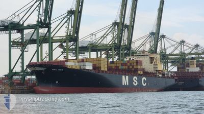
MSC NOA
Container Ship

Current Trip
PAONX
| Time Travelled | 16 h, 26 mins |
|---|---|
| Remaining Time | --- |
| Distance Travelled | 278.55 nm |
| Remaining Distance | --- |
| AVG Speed | 16.4 Knop |
| MAX Speed | 19.6 Knop |
| AVG Wind | 15.6 knots |
| MAX Wind | 19 knots |
| MIN Temp | 26.4°C / 79.52°F |
| MAX Temp | 27.9°C / 82.22°F |
| Djupgående | 14.5 m |
| Position mottagen | 10 h, 33 m sen |
Current Position
| Longitud | --- |
|---|---|
| Latitude | --- |
| Status | Under way using engine |
| Fart | 18.6 Knop |
| Kurs | 31.1° |
| Område | Caribbean Sea |
| Station | T-AIS |
| Position mottagen | 10 h, 33 m sen |
Information
The current position of MSC NOA is in Caribbean Sea with coordinates 10.92339° / -79.06786° as reported on 2025-03-28 03:17 by AIS to our vessel tracker app. The vessel's current speed is 18.6 Knop
The vessel MSC NOA (IMO: 9398228, MMSI: 636018659) is a Container Ship that was built in 2009 ( 16 År gammal ). It's sailing under the flag of [LR] Liberia.
In this page you can find informations about the vessels current position, last detected port calls, and current voyage information. If the vessels is not in coverage by AIS you will find the latest position.
The current position of MSC NOA is detected by our AIS receivers and we are not responsible for the reliability of the data. The last position was recorded while the vessel was in Coverage by the Ais receivers of our vessel tracking app.
The current draught of MSC NOA as reported by AIS is 14.5 meters
Weather
| Temperature | 26.4°C / 79.52°F |
|---|---|
| Wind Speed | 20 knots |
| Direction | 69° ENE |
| Pressure | 1013.3 hPa |
| Humidity | 80.2 % |
| Cloud Coverage | 100 % |


Featured Company
Last Port Calls
| Port | Arrival | Departure | Time In Port |
|---|---|---|---|
| 2025-03-25 11:25 | 2025-03-27 16:24 | 2 d | |
| 2025-03-06 12:52 | 2025-03-06 13:44 | 52 m | |
| 2025-03-04 22:09 | 2025-03-05 15:56 | 17 h | |
| 2025-03-03 14:46 | 2025-03-04 12:53 | 22 h | |
| 2025-02-26 08:27 | 2025-02-27 11:17 | 1 d | |
| 2025-02-19 05:26 | 2025-02-19 05:53 | 27 m | |
| 2025-02-04 16:15 | 2025-02-08 16:04 | 3 d | |
| 2025-01-31 18:32 | 2025-02-03 14:48 | 2 d | |
| 2025-01-27 09:18 | 2025-01-28 05:15 | 19 h | |
| 2025-01-23 15:06 | 2025-01-23 15:11 | 5 m |
Last Trips
| Origin | Departure | Destination | Arrival | Distance | |
|---|---|---|---|---|---|
| 2025-03-06 13:44 | 2025-03-25 11:25 | 4594.25 nm | |||
| 2025-03-05 15:56 | 2025-03-06 12:52 | 174.65 nm | |||
| 2025-03-04 12:53 | 2025-03-04 22:09 | 106.11 nm | |||
| 2025-02-27 11:17 | 2025-03-03 14:46 | 901.62 nm | |||
| 2025-02-19 05:53 | 2025-02-26 08:27 | 1030.93 nm | |||
| 2025-02-08 16:04 | 2025-02-19 05:26 | 4532.89 nm | |||
| 2025-02-03 14:48 | 2025-02-04 16:15 | 99.91 nm | |||
| 2025-01-28 05:15 | 2025-01-31 18:32 | 894.20 nm | |||
| 2025-01-23 15:11 | 2025-01-27 09:18 | 947.07 nm | |||
| 2025-01-23 14:56 | 2025-01-23 15:06 | 0.43 nm |
Events
| Tid | Event | Detaljer | Position / Dest | Information |
|---|---|---|---|---|
| 2025-03-28 03:27 | Status ändrad | Default Under way using engine |
10.97102 / -79.03920
PAONX
|
Fart: 18.6 kn Kurs: 31.1° |
| 2025-03-28 03:17 | Status ändrad | Under way using engine Default |
10.92339 / -79.06786
PAONX
|
Fart: 18.6 kn Kurs: 30° |
| 2025-03-28 03:17 | UTANFÖR täckningsområde |
10.92339 / -79.06786
Caribbean Sea
|
Fart: 18.6 kn Kurs: 31.1° |
|
| 2025-03-28 02:59 | I täckningsområde |
10.92339 / -79.06786
Caribbean Sea
|
Fart: 18.6 kn Kurs: 31.1° |
|
| 2025-03-27 22:43 | Status ändrad | Default Under way using engine |
9.62970 / -79.75455
PAONX
|
Fart: 18.7 kn Kurs: 33.5° |
| 2025-03-27 22:36 | UTANFÖR täckningsområde |
9.59943 / -79.77512
Caribbean Sea
|
Fart: 18.7 kn Kurs: 33.5° |
|
| 2025-03-27 21:24 | AVGÅTT HAMN |
|
9.36927 / -79.89119
PAONX
|
Fart: 3.1 kn Kurs: 293° |
| 2025-03-27 21:24 | STARTAR förflyttning |
9.36921 / -79.89094
[PA] COLON
|
Fart: 3.1 kn Kurs: 293° |
|
| 2025-03-27 21:01 | Status ändrad | Under way using engine Moored |
9.37292 / -79.88920
[PA] COLON
|
Fart: 0.3 kn Kurs: 146° |
| 2025-03-27 19:58 | Status ändrad | Moored Default |
9.37298 / -79.88896
[PA] COLON
|
Fart: Kurs: 146° |