
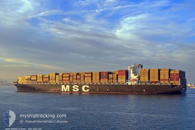
MSC MARIA ELENA
Container Ship
Current Trip
| Time Travelled | 10 days |
|---|---|
| Remaining Time | 1 h, 40 mins |
| Distance Travelled | 3766.74 nm |
| Remaining Distance | 15.42 nm |
| AVG Speed | 11.6 Knop |
| MAX Speed | 19.8 Knop |
| AVG Wind | 23.1 knots |
| MAX Wind | 40.8 knots |
| MIN Temp | -3.7°C / 25.34°F |
| MAX Temp | 19.5°C / 67.1°F |
| Djupgående | 14.5 m |
| Position mottagen | 1 m sen |
Current Position
| Longitud | --- |
|---|---|
| Latitude | --- |
| Status | Under way using engine |
| Fart | 9.2 Knop |
| Kurs | 287° |
| Område | North Atlantic Ocean |
| Station | T-AIS |
| Position mottagen | 1 m sen |
Info
Information
The current position of MSC MARIA ELENA is in North Atlantic Ocean with coordinates 40.45739° / -73.81611° as reported on 2025-02-18 07:13 by AIS to our vessel tracker app. The vessel's current speed is 9.2 Knop and is heading at the port of NEW YORK. The estimated time of arrival as calculated by MyShipTracking vessel tracking app is 2025-02-18 08:54 LT
The vessel MSC MARIA ELENA (IMO: 9304423, MMSI: 355919000) is a Container Ship that was built in 2006 ( 19 År gammal ). It's sailing under the flag of [PA] Panama.
In this page you can find informations about the vessels current position, last detected port calls, and current voyage information. If the vessels is not in coverage by AIS you will find the latest position.
The current position of MSC MARIA ELENA is detected by our AIS receivers and we are not responsible for the reliability of the data. The last position was recorded while the vessel was in Coverage by the Ais receivers of our vessel tracking app.
The current draught of MSC MARIA ELENA as reported by AIS is 14.5 meters
Weather
| Temperature | -3.7°C / 25.34°F |
|---|---|
| Wind Speed | 26 knots |
| Direction | 289° WNW |
| Pressure | 1018.3 hPa |
| Humidity | 57.4 % |
| Cloud Coverage | 5 % |
Featured Company
Last Port Calls
| Port | Arrival | Departure | Time In Port |
|---|---|---|---|
| 2025-02-06 12:08 | 2025-02-07 09:12 | 21 h | |
| 2025-02-02 04:04 | 2025-02-04 09:03 | 2 d | |
| 2025-01-30 09:45 | 2025-02-01 16:21 | 2 d | |
| 2025-01-26 07:28 | 2025-01-29 07:33 | 3 d | |
| 2025-01-23 16:51 | 2025-01-25 09:48 | 1 d | |
| 2025-01-20 16:27 | 2025-01-21 06:43 | 14 h | |
| 2025-01-11 23:39 | 2025-01-11 23:48 | 9 m | |
| 2025-01-10 23:10 | 2025-01-11 23:27 | 1 d | |
| 2025-01-10 22:41 | 2025-01-10 22:55 | 13 m | |
| 2025-01-08 02:36 | 2025-01-09 08:19 | 1 d |
Most Visited Ports (Last year)
| Port | Arrivals | |
|---|---|---|
| 8 | ||
| 8 | ||
| 7 | ||
| 5 | ||
| 5 | ||
| 5 |
Last Trips
| Origin | Departure | Destination | Arrival | Distance | |
|---|---|---|---|---|---|
| 2025-02-04 10:03 | 2025-02-06 13:08 | 863.26 nm | |||
| 2025-02-01 17:21 | 2025-02-02 05:04 | 94.12 nm | |||
| 2025-01-29 08:33 | 2025-01-30 10:45 | 358.69 nm | |||
| 2025-01-25 10:48 | 2025-01-26 08:28 | 173.67 nm | |||
| 2025-01-21 07:43 | 2025-01-23 17:51 | 997.11 nm | |||
| 2025-01-11 18:48 | 2025-01-20 17:27 | 4011.20 nm | |||
| 2025-01-11 18:27 | 2025-01-11 18:39 | 0.49 nm | |||
| 2025-01-10 17:55 | 2025-01-10 18:10 | 0.75 nm | |||
| 2025-01-09 03:19 | 2025-01-10 17:41 | 420.14 nm | |||
| 2025-01-04 17:55 | 2025-01-07 21:36 | 728.64 nm |
Events
| Tid | Event | Detaljer | Position / Dest | Information |
|---|---|---|---|---|
| 2025-02-18 00:53 | Status ändrad | Under way using engine Default |
39.87012 / -73.69552
USNYC
|
Fart: 6.2 kn Kurs: 348° |
| 2025-02-18 00:43 | Status ändrad | Default Under way using engine |
39.85332 / -73.68941
USNYC
|
Fart: 6.2 kn Kurs: 342.3° |
| 2025-02-17 23:32 | Status ändrad | Under way using engine Default |
39.75577 / -73.60978
USNYC
|
Fart: 6.5 kn Kurs: 272° |
| 2025-02-17 23:29 | I täckningsområde |
39.75593 / -73.61484
North Atlantic Ocean
USNYC
|
Fart: 6.3 kn Kurs: 271.7° |
|
| 2025-02-17 22:02 | STARTAR förflyttning |
39.75053 / -73.46203
USNYC
|
Fart: 3.5 kn Kurs: 26° |
|
| 2025-02-17 20:48 | Status ändrad | Default Under way using engine |
39.78041 / -73.49494
USNYC
|
Fart: 2.1 kn Kurs: 16° |
| 2025-02-17 20:42 | UTANFÖR täckningsområde |
39.78324 / -73.49719
North Atlantic Ocean
USNYC
|
Fart: 2.1 kn Kurs: 147.5° |
|
| 2025-02-17 14:33 | STOPPAR förflyttning | 20.26 nm, South East of MANASQUAN |
39.98192 / -73.63880
USNYC
|
Fart: 0.3 kn Kurs: 294° |
| 2025-02-17 11:58 | Status ändrad | Under way using engine Default |
39.98539 / -73.35314
USNYC
|
Fart: 3.4 kn Kurs: 200° |
| 2025-02-17 11:43 | Status ändrad | Default Under way using engine |
39.97475 / -73.36712
USNYC
|
Fart: 3.1 kn Kurs: 196° |