

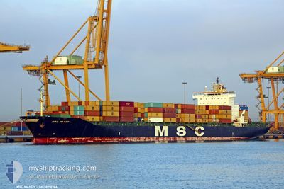
MSC MANDY III
Container Ship

Current Trip
| Trip Time | 3 days |
|---|---|
| Trip Distance | 941.89 nm |
| AVG Speed | 14.3 Knop |
| MAX Speed | 20 Knop |
| Djupgående | 9.9 m |
| AVG Wind | 8.6 knots |
| MAX Wind | 17.7 knots |
| MIN Temp | 17.1°C / 62.78°F |
| MAX Temp | 28°C / 82.4°F |
| Position mottagen | 23 d sen |
Current Position
| Longitud | --- |
|---|---|
| Latitude | --- |
| Status | Under way using engine |
| Fart | 16.1 Knop |
| Kurs | 191.6° |
| Område | North Atlantic Ocean |
| Station | T-AIS |
| Position mottagen | 23 d sen |
Information
The current position of MSC MANDY III is in North Atlantic Ocean with coordinates 27.38966° / -15.39821° as reported on 2025-02-04 13:23 by AIS to our vessel tracker app. The vessel's current speed is 16.1 Knop and is currently inside the port of WALVIS BAY.
The vessel MSC MANDY III (IMO: 8918966, MMSI: 354537000) is a Container Ship that was built in 1993 ( 32 År gammal ). It's sailing under the flag of [PA] Panama.
In this page you can find informations about the vessels current position, last detected port calls, and current voyage information. If the vessels is not in coverage by AIS you will find the latest position.
The current position of MSC MANDY III is detected by our AIS receivers and we are not responsible for the reliability of the data. The last position was recorded while the vessel was in Coverage by the Ais receivers of our vessel tracking app.
The current draught of MSC MANDY III as reported by AIS is 9.9 meters
Weather
| Temperature | 21.1°C / 69.98°F |
|---|---|
| Wind Speed | 5 knots |
| Direction | 231° SW |
| Pressure | 1014.1 hPa |
| Humidity | 69.1 % |
| Cloud Coverage | 21 % |


Featured Company
Last Port Calls
| Port | Arrival | Departure | Time In Port |
|---|---|---|---|
| 2025-02-27 02:08 | |||
| 2025-02-22 00:16 | 2025-02-23 11:27 | 1 d | |
| 2025-02-20 06:28 | 2025-02-21 07:20 | 1 d | |
| 2025-02-15 01:57 | 2025-02-16 11:17 | 1 d | |
| 2025-02-11 06:40 | 2025-02-12 07:21 | 1 d | |
| 2025-02-09 08:35 | 2025-02-09 22:43 | 14 h | |
| 2025-02-03 12:33 | 2025-02-04 10:24 | 21 h | |
| 2025-01-31 20:20 | 2025-02-02 05:22 | 1 d | |
| 2025-01-26 20:17 | 2025-01-28 11:20 | 1 d | |
| 2025-01-21 11:25 | 2025-01-22 15:30 | 1 d |
Most Visited Ports (Last year)
| Port | Arrivals | |
|---|---|---|
| 20 | ||
| 16 | ||
| 3 | ||
| 3 | ||
| 2 | ||
| 2 |
Last Trips
| Origin | Departure | Destination | Arrival | Distance | |
|---|---|---|---|---|---|
| 2025-02-23 12:27 | 2025-02-27 04:08 | 941.89 nm | |||
| 2025-02-21 08:20 | 2025-02-22 01:16 | 301.25 nm | |||
| 2025-02-16 11:17 | 2025-02-20 07:28 | 1003.39 nm | |||
| 2025-02-12 07:21 | 2025-02-15 01:57 | 1155.64 nm | |||
| 2025-02-09 22:43 | 2025-02-11 06:40 | 482.65 nm | |||
| 2025-02-04 10:24 | 2025-02-09 08:35 | 876.06 nm | |||
| 2025-02-02 06:22 | 2025-02-03 12:33 | 538.37 nm | |||
| 2025-01-28 12:20 | 2025-01-31 21:20 | 559.05 nm | |||
| 2025-01-22 16:30 | 2025-01-26 21:17 | 1255.15 nm | |||
| 2025-01-20 11:30 | 2025-01-21 12:25 | 166.33 nm |
Events
| Tid | Event | Detaljer | Position / Dest | Information |
|---|---|---|---|---|
| 2025-02-27 02:56 | STOPPAR förflyttning |
-22.95184 / 14.48526
[NA] WALVIS BAY
|
Fart: Kurs: 23° |
|
| 2025-02-27 02:08 | ANLÄNDER HAMN |
|
-22.93578 / 14.49720
[NA] WALVIS BAY
|
Fart: 7.9 kn Kurs: 182° |
| 2025-02-27 01:32 | STARTAR förflyttning | 4.19 nm, North of WALVIS BAY |
-22.87008 / 14.49055
ES LPA>SN DKR
|
Fart: 3.4 kn Kurs: 135° |
| 2025-02-26 20:08 | STOPPAR förflyttning | 4.17 nm, North of WALVIS BAY |
-22.87024 / 14.49280
ES LPA>SN DKR
|
Fart: 0.3 kn Kurs: 324° |
| 2025-02-26 19:24 | STARTAR förflyttning | 3.75 nm, North West of WALVIS BAY |
-22.88235 / 14.47265
ES LPA>SN DKR
|
Fart: 4.3 kn Kurs: 144° |
| 2025-02-26 00:20 | STOPPAR förflyttning | 3.9 nm, North West of WALVIS BAY |
-22.88019 / 14.47151
ES LPA>SN DKR
|
Fart: 0.2 kn Kurs: 249° |
| 2025-02-23 11:27 | AVGÅTT HAMN |
|
-8.75985 / 13.27543
ES LPA>SN DKR
|
Fart: 9.4 kn Kurs: 28° |
| 2025-02-23 11:07 | STARTAR förflyttning |
-8.79432 / 13.24888
[AO] LUANDA
|
Fart: 4.4 kn Kurs: 27° |
|
| 2025-02-22 00:53 | STOPPAR förflyttning |
-8.79894 / 13.25224
[AO] LUANDA
|
Fart: 0.3 kn Kurs: 263° |
|
| 2025-02-22 00:16 | ANLÄNDER HAMN |
|
-8.76825 / 13.26782
[AO] LUANDA
|
Fart: 3.8 kn Kurs: 220° |