
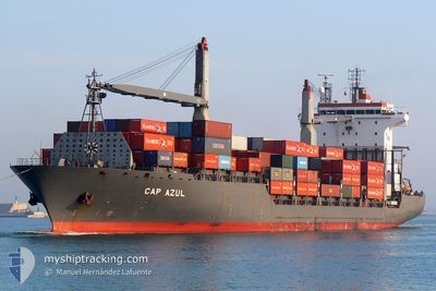
MSC MAKOTO II
Container Ship
Current Trip
BDCGP
| Time Travelled | 22 h, 29 mins |
|---|---|
| Remaining Time | --- |
| Distance Travelled | --- |
| Remaining Distance | --- |
| AVG Speed | --- |
| MAX Speed | --- |
| AVG Wind | --- |
| MAX Wind | --- |
| MIN Temp | --- |
| MAX Temp | --- |
| Djupgående | 9.3 m |
| Position mottagen | 9 d sen |
Current Position
| Longitud | --- |
|---|---|
| Latitude | --- |
| Status | Under way using engine |
| Fart | 8.7 Knop |
| Kurs | 89.7° |
| Område | Indian Ocean |
| Station | T-AIS |
| Position mottagen | 9 d sen |
Info
Information
The current position of MSC MAKOTO II is in Indian Ocean with coordinates 5.70780° / 80.41169° as reported on 2024-10-11 18:27 by AIS to our vessel tracker app. The vessel's current speed is 8.7 Knop
The vessel MSC MAKOTO II (IMO: 9236212, MMSI: 355776000) is a Container Ship that was built in 2002 ( 22 År gammal ). It's sailing under the flag of [PA] Panama.
In this page you can find informations about the vessels current position, last detected port calls, and current voyage information. If the vessels is not in coverage by AIS you will find the latest position.
The current position of MSC MAKOTO II is detected by our AIS receivers and we are not responsible for the reliability of the data. The last position was recorded while the vessel was in Coverage by the Ais receivers of our vessel tracking app.
The current draught of MSC MAKOTO II as reported by AIS is 9.3 meters
Weather
| Temperature | 29.6°C / 85.28°F |
|---|---|
| Wind Speed | 13 knots |
| Direction | 27° NNE |
| Pressure | 1012.1 hPa |
| Humidity | 65.1 % |
| Cloud Coverage | 80 % |
Featured Company
Last Port Calls
| Port | Arrival | Departure | Time In Port |
|---|---|---|---|
| 2024-10-18 05:29 | 2024-10-20 07:21 | 2 d | |
| 2024-10-08 10:21 | 2024-10-09 03:33 | 17 h | |
| 2024-09-26 23:57 | 2024-09-29 04:37 | 2 d | |
| 2024-09-18 10:05 | 2024-09-19 10:17 | 1 d | |
| 2024-09-10 08:37 | 2024-09-12 10:25 | 2 d | |
| 2024-08-29 04:29 | 2024-08-30 04:26 | 23 h | |
| 2024-08-21 06:27 | 2024-08-24 08:57 | 3 d | |
| 2024-08-10 09:38 | |||
| 2024-08-08 06:45 | 2024-08-09 07:58 | 1 d | |
| 2024-08-03 03:52 |
Most Visited Ports (Last year)
| Port | Arrivals | |
|---|---|---|
| 23 | ||
| 22 | ||
| 3 | ||
| 1 | ||
| 1 |
Last Trips
| Origin | Departure | Destination | Arrival | Distance | |
|---|---|---|---|---|---|
| 2024-10-09 09:03 | 2024-10-18 11:29 | 1695.96 nm | |||
| 2024-09-29 10:37 | 2024-10-08 15:51 | 1316.86 nm | |||
| 2024-09-19 15:47 | 2024-09-27 05:57 | 1331.10 nm | |||
| 2024-09-12 16:25 | 2024-09-18 15:35 | 1303.35 nm | |||
| 2024-08-30 09:56 | 2024-09-10 14:37 | 1356.58 nm | |||
| 2024-08-24 14:57 | 2024-08-29 09:59 | 1302.38 nm | |||
| 2024-08-10 15:08 | 2024-08-21 12:27 | 1195.84 nm | |||
| 2024-08-03 09:52 | 2024-08-08 12:15 | 1320.50 nm |
Events
| Tid | Event | Detaljer | Position / Dest | Information |
|---|---|---|---|---|
| 2024-10-20 07:21 | AVGÅTT HAMN |
|
22.22247 / 91.80048
BDCGP
|
Fart: 9.9 kn Kurs: 231° |
| 2024-10-20 06:37 | STARTAR förflyttning |
22.29521 / 91.79658
[BD] CHITTAGONG
|
Fart: 6.8 kn Kurs: 190° |
|
| 2024-10-18 06:32 | STOPPAR förflyttning |
22.30137 / 91.79687
[BD] CHITTAGONG
|
Fart: 0.1 kn Kurs: 204° |
|
| 2024-10-18 05:29 | ANLÄNDER HAMN |
|
22.23068 / 91.81431
[BD] CHITTAGONG
|
Fart: 13.3 kn Kurs: 52° |
| 2024-10-18 02:25 | STARTAR förflyttning | 13.98 nm, South of CHITTAGONG |
22.01391 / 91.73386
BDCGP
|
Fart: 4.8 kn Kurs: 89° |
| 2024-10-16 11:46 | STOPPAR förflyttning | 13.25 nm, South of CHITTAGONG |
22.02210 / 91.74940
BDCGP
|
Fart: 0.1 kn Kurs: 356° |
| 2024-10-11 18:32 | Status ändrad | Default Under way using engine |
5.70775 / 80.42436
BDCGP
|
Fart: 8.7 kn Kurs: 89.7° |
| 2024-10-11 18:27 | UTANFÖR täckningsområde |
5.70780 / 80.41169
Indian Ocean
BDCGP
|
Fart: 8.7 kn Kurs: 89.7° |
|
| 2024-10-11 18:10 | Byter havsområde | Sri Lankan part of the Indian Ocean Sri Lankan part of the Laccadive Sea |
5.70576 / 80.37146
Indian Ocean
BDCGP
|
Fart: 8.3 kn Kurs: 87.3° |
| 2024-10-11 18:10 | Status ändrad | Under way using engine Default |
5.70576 / 80.37146
BDCGP
|
Fart: 8.3 kn Kurs: 91° |