
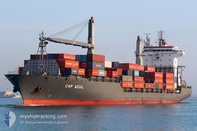
MSC MAKOTO II
Container Ship
Current Trip
| Time Travelled | 13 days |
|---|---|
| Remaining Time | --- |
| Distance Travelled | 2950.16 nm |
| Remaining Distance | 23.34 nm |
| AVG Speed | 10.3 Knopen |
| MAX Speed | 17 Knopen |
| AVG Wind | 8.6 knots |
| MAX Wind | 23.8 knots |
| MIN Temp | 20.4°C / 68.72°F |
| MAX Temp | 28.4°C / 83.12°F |
| Diepgang | 8.3 M |
| Positie ontvangen | 5 d geleden |
Current Position
| Lengtegraad | --- |
|---|---|
| Breedtegraat | --- |
| Status | Under way using engine |
| Snelheid | 8.1 Knopen |
| Koers | 90.9° |
| Gebied | Indian Ocean |
| Station | T-AIS |
| Positie ontvangen | 5 d geleden |
Info
Information
The current position of MSC MAKOTO II is in Indian Ocean with coordinates 5.70393° / 80.41533° as reported on 2025-02-12 18:50 by AIS to our vessel tracker app. The vessel's current speed is 8.1 Knopen and is heading at the port of CHITTAGONG. The estimated time of arrival as calculated by MyShipTracking vessel tracking app is 2025-02-18 02:00 LT
The vessel MSC MAKOTO II (IMO: 9236212, MMSI: 355776000) is a Container Ship that was built in 2002 ( 23 Jaar oud ). It's sailing under the flag of [PA] Panama.
In this page you can find informations about the vessels current position, last detected port calls, and current voyage information. If the vessels is not in coverage by AIS you will find the latest position.
The current position of MSC MAKOTO II is detected by our AIS receivers and we are not responsible for the reliability of the data. The last position was recorded while the vessel was in Coverage by the Ais receivers of our vessel tracking app.
The current draught of MSC MAKOTO II as reported by AIS is 8.3 meters
Weather
| Temperature | 22.3°C / 72.14°F |
|---|---|
| Wind Speed | 6 knots |
| Direction | 37° NE |
| Pressure | 1015.5 hPa |
| Humidity | 56.5 % |
| Cloud Coverage | --- |
Featured Company
Last Port Calls
| Port | Arrival | Departure | Time In Port |
|---|---|---|---|
| 2025-02-02 13:17 | 2025-02-04 14:23 | 2 d | |
| 2025-01-26 23:23 | 2025-01-28 03:27 | 1 d | |
| 2025-01-18 14:41 | 2025-01-20 16:09 | 2 d | |
| 2025-01-09 02:52 | 2025-01-09 18:58 | 16 h | |
| 2025-01-04 18:19 | 2025-01-05 17:19 | 23 h | |
| 2024-12-24 16:56 | 2024-12-27 08:17 | 2 d | |
| 2024-12-15 09:38 | 2024-12-15 20:30 | 10 h | |
| 2024-12-07 15:41 | 2024-12-09 16:17 | 2 d | |
| 2024-12-01 08:35 | 2024-12-01 16:46 | 8 h |
Most Visited Ports (Last year)
| Port | Arrivals | |
|---|---|---|
| 20 | ||
| 19 | ||
| 4 | ||
| 1 | ||
| 1 | ||
| 1 |
Last Trips
| Origin | Departure | Destination | Arrival | Distance | |
|---|---|---|---|---|---|
| 2025-01-28 03:27 | 2025-02-02 13:17 | 1337.33 nm | |||
| 2025-01-20 16:09 | 2025-01-26 23:23 | 1316.48 nm | |||
| 2025-01-09 18:58 | 2025-01-18 14:41 | 1091.67 nm | |||
| 2025-01-05 17:19 | 2025-01-09 02:52 | 676.79 nm | |||
| 2024-12-27 08:17 | 2025-01-04 18:19 | 1324.63 nm | |||
| 2024-12-15 20:30 | 2024-12-24 16:56 | 1708.92 nm | |||
| 2024-12-09 16:17 | 2024-12-15 09:38 | 1310.71 nm | |||
| 2024-12-01 16:46 | 2024-12-07 15:41 | 615.42 nm | |||
| 2024-11-25 11:10 | 2024-12-01 08:35 | 1270.55 nm |
Events
| Tijd | Evenement | Details | Positie / Bestemming | Info |
|---|---|---|---|---|
| 2025-02-17 02:44 | Stop beweging | 8.21 nm, South West of CHITTAGONG |
22.12215 / 91.73216
BDCGP
|
Snelheid: 0.3 kn Koers: 1° |
| 2025-02-12 18:50 | Status Changed | Default Under way using engine |
5.70392 / 80.41682
BDCGP
|
Snelheid: 8.1 kn Koers: 90.9° |
| 2025-02-12 18:50 | Buitenbereik |
5.70393 / 80.41533
Indian Ocean
BDCGP
|
Snelheid: 8.1 kn Koers: 90.9° |
|
| 2025-02-12 18:31 | Gevonden in zee | Sri Lankan part of the Indian Ocean |
5.70586 / 80.37242
Indian Ocean
BDCGP
|
Snelheid: 8.2 kn Koers: 90.9° |
| 2025-02-12 18:31 | Status Changed | Under way using engine Default |
5.70586 / 80.37242
BDCGP
|
Snelheid: 8.2 kn Koers: 93° |
| 2025-02-12 18:12 | Status Changed | Default Under way using engine |
5.70801 / 80.32857
BDCGP
|
Snelheid: 8.2 kn Koers: 92.9° |
| 2025-02-12 17:05 | Destination Changed | BDCGP INTRV |
5.78364 / 80.17138
BDCGP
|
Snelheid: 8.8 kn Koers: 118.9° |
| 2025-02-12 17:05 | ETA Changed | 2025/02/17 20:00 2025/02/15 09:00 |
5.78364 / 80.17138
BDCGP
|
Snelheid: 8.8 kn Koers: 118.9° |
| 2025-02-12 16:56 | Status Changed | Under way using engine Default |
5.78782 / 80.16380
INTRV
|
Snelheid: 8.8 kn Koers: 119° |
| 2025-02-12 16:21 | Status Changed | Default Under way using engine |
5.83047 / 80.08963
INTRV
|
Snelheid: 10.2 kn Koers: 118.4° |