
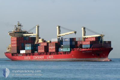
MSC KATALIN II
Cargo
Current Trip
| Time Travelled | 2 days |
|---|---|
| Remaining Time | --- |
| Distance Travelled | 735.84 nm |
| Remaining Distance | --- |
| AVG Speed | 12.5 Knop |
| MAX Speed | 16.4 Knop |
| AVG Wind | 19 knots |
| MAX Wind | 33.8 knots |
| MIN Temp | 14.5°C / 58.1°F |
| MAX Temp | 18.2°C / 64.76°F |
| Djupgående | 9.3 m |
| Position mottagen | 1 m sen |
Current Position
| Longitud | 26.57904° |
|---|---|
| Latitude | 40.29444° |
| Status | Under way using engine |
| Fart | 13.2 Knop |
| Kurs | 46.8° |
| Område | Sea of Marmara |
| Station | T-AIS |
| Position mottagen | 1 m sen |
Info
Information
The current position of MSC KATALIN II is in Sea of Marmara with coordinates 40.29444° / 26.57904° as reported on 2024-05-11 10:03 by AIS to our vessel tracker app. The vessel's current speed is 13.2 Knop and is heading at the port of TEKIRDAG. The estimated time of arrival as calculated by MyShipTracking vessel tracking app is 2024-05-11 12:30 LT
The vessel MSC KATALIN II (IMO: 9232656, MMSI: 636017244) is a Cargo It's sailing under the flag of [LR] Liberia.
In this page you can find informations about the vessels current position, last detected port calls, and current voyage information. If the vessels is not in coverage by AIS you will find the latest position.
The current position of MSC KATALIN II is detected by our AIS receivers and we are not responsible for the reliability of the data. The last position was recorded while the vessel was in Coverage by the Ais receivers of our vessel tracking app.
The current draught of MSC KATALIN II as reported by AIS is 9.3 meters
Weather
| Temperature | 18.5°C / 65.3°F |
|---|---|
| Wind Speed | 16 knots |
| Direction | 35° NE |
| Pressure | 1014.6 hPa |
| Humidity | 45.6 % |
| Cloud Coverage | 72 % |
Featured Company
Last Port Calls
| Port | Arrival | Departure | Time In Port |
|---|---|---|---|
| 2024-05-07 16:14 | 2024-05-08 23:34 | 1 d | |
| 2024-05-06 12:17 | 2024-05-07 04:36 | 16 h | |
| 2024-05-04 13:51 | 2024-05-04 19:40 | 5 h | |
| 2024-05-03 08:25 | 2024-05-03 20:36 | 12 h | |
| 2024-05-02 04:10 | 2024-05-02 20:27 | 16 h | |
| 2024-04-30 13:20 | 2024-05-01 17:20 | 1 d | |
| 2024-04-29 05:17 | 2024-04-30 07:09 | 1 d | |
| 2024-04-27 18:57 | 2024-04-28 06:59 | 12 h | |
| 2024-04-26 09:31 | 2024-04-27 03:39 | 18 h | |
| 2024-04-25 04:59 | 2024-04-26 00:03 | 19 h |
Last Trips
| Origin | Departure | Destination | Arrival | Distance | |
|---|---|---|---|---|---|
| 2024-05-07 06:36 | 2024-05-07 18:14 | 146.93 nm | |||
| 2024-05-04 21:40 | 2024-05-06 14:17 | 315.96 nm | |||
| 2024-05-03 22:36 | 2024-05-04 15:51 | 227.40 nm | |||
| 2024-05-02 22:27 | 2024-05-03 10:25 | 121.72 nm | |||
| 2024-05-01 19:20 | 2024-05-02 06:10 | 148.27 nm | |||
| 2024-04-30 09:09 | 2024-04-30 15:20 | 57.72 nm | |||
| 2024-04-28 08:59 | 2024-04-29 07:17 | 277.08 nm | |||
| 2024-04-27 05:39 | 2024-04-27 20:57 | 227.91 nm | |||
| 2024-04-26 02:03 | 2024-04-26 11:31 | 123.26 nm | |||
| 2024-04-24 17:27 | 2024-04-25 06:59 | 196.99 nm |
Events
| Tid | Event | Detaljer | Position / Dest | Information |
|---|---|---|---|---|
| 2024-05-11 08:08 | Status ändrad | Under way using engine Default |
40.02360 / 26.25452
TR TEK
|
Fart: 11.8 kn Kurs: 84° |
| 2024-05-11 07:57 | Status ändrad | Default Under way using engine |
40.01963 / 26.20785
TR TEK
|
Fart: 8.5 kn Kurs: 76.3° |
| 2024-05-11 07:52 | Upptäckt i hav | Turkish part of the Sea of Marmara |
40.01692 / 26.19183
Sea of Marmara
TR TEK
|
Fart: 7.6 kn Kurs: 74.3° |
| 2024-05-11 07:13 | Status ändrad | Under way using engine Default |
39.99486 / 26.07541
TR TEK
|
Fart: 11 kn Kurs: 48° |
| 2024-05-11 06:26 | Status ändrad | Default Under way using engine |
39.91667 / 25.91833
TR TEK
|
Fart: 12.2 kn Kurs: 54.9° |
| 2024-05-11 06:18 | Byter havsområde | Turkish part of the Aegean Sea Greek part of the Aegean Sea |
39.90111 / 25.89090
Aegean Sea
TR TEK
|
Fart: 11.9 kn Kurs: 54.7° |
| 2024-05-11 06:18 | Status ändrad | Under way using engine Default |
39.89992 / 25.88866
TR TEK
|
Fart: 11 kn Kurs: 56° |
| 2024-05-11 06:05 | Status ändrad | Default Under way using engine |
39.87667 / 25.84333
TR TEK
|
Fart: 11.6 kn Kurs: 55.2° |
| 2024-05-11 01:28 | Status ändrad | Under way using engine Default |
39.02164 / 25.29803
TR TEK
|
Fart: 11 kn Kurs: 26° |
| 2024-05-11 01:17 | Status ändrad | Default Under way using engine |
38.98833 / 25.27667
TR TEK
|
Fart: 11.5 kn Kurs: 27.5° |