
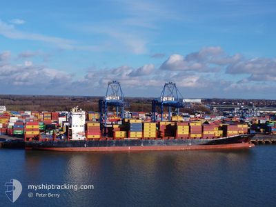
MSC JERSEY
Container Ship
Current Trip
| Time Travelled | 19 h, 29 mins |
|---|---|
| Remaining Time | 1 h, 11 mins |
| Distance Travelled | 249.60 nm |
| Remaining Distance | 20.06 nm |
| AVG Speed | 13.6 Knop |
| MAX Speed | 18.8 Knop |
| AVG Wind | 5.3 knots |
| MAX Wind | 17.2 knots |
| MIN Temp | 6.1°C / 42.98°F |
| MAX Temp | 10.7°C / 51.26°F |
| Djupgående | 11.3 m |
| Position mottagen | 1 m sen |
Current Position
| Longitud | -0.29848° |
|---|---|
| Latitude | 49.60092° |
| Status | Under way using engine |
| Fart | 6.7 Knop |
| Kurs | 173.2° |
| Område | English Channel |
| Station | T-AIS |
| Position mottagen | 1 m sen |
Info
Information
The current position of MSC JERSEY is in English Channel with coordinates 49.60092° / -0.29848° as reported on 2024-04-27 01:16 by AIS to our vessel tracker app. The vessel's current speed is 6.7 Knop and is heading at the port of LE HAVRE. The estimated time of arrival as calculated by MyShipTracking vessel tracking app is 2024-04-27 02:28 LT
The vessel MSC JERSEY (IMO: 9622007, MMSI: 255805956) is a Container Ship that was built in 2014 ( 10 År gammal ). It's sailing under the flag of [PT] Portugal.
In this page you can find informations about the vessels current position, last detected port calls, and current voyage information. If the vessels is not in coverage by AIS you will find the latest position.
The current position of MSC JERSEY is detected by our AIS receivers and we are not responsible for the reliability of the data. The last position was recorded while the vessel was in Coverage by the Ais receivers of our vessel tracking app.
The current draught of MSC JERSEY as reported by AIS is 11.3 meters
Weather
| Temperature | 9.7°C / 49.46°F |
|---|---|
| Wind Speed | 10 knots |
| Direction | 206° SSW |
| Pressure | 1001.3 hPa |
| Humidity | 86.4 % |
| Cloud Coverage | 100 % |
Featured Company
Last Port Calls
| Port | Arrival | Departure | Time In Port |
|---|---|---|---|
| 2024-04-24 23:48 | 2024-04-26 05:48 | 1 d | |
| 2024-04-23 22:13 | 2024-04-24 14:02 | 15 h | |
| 2024-04-17 18:51 | 2024-04-19 05:06 | 1 d | |
| 2024-04-16 01:42 | 2024-04-16 23:17 | 21 h | |
| 2024-04-09 21:43 | 2024-04-11 03:44 | 1 d | |
| 2024-04-08 12:03 | 2024-04-09 11:07 | 23 h | |
| 2024-04-03 18:58 | 2024-04-05 16:02 | 1 d | |
| 2024-03-30 23:59 | 2024-03-31 13:35 | 13 h | |
| 2024-03-21 23:36 | 2024-03-24 19:47 | 2 d | |
| 2024-03-16 20:55 | 2024-03-18 20:46 | 1 d |
Last Trips
| Origin | Departure | Destination | Arrival | Distance | |
|---|---|---|---|---|---|
| 2024-04-24 16:02 | 2024-04-25 01:48 | 128.66 nm | |||
| 2024-04-19 06:06 | 2024-04-24 00:13 | 1607.26 nm | |||
| 2024-04-17 00:17 | 2024-04-17 19:51 | 346.29 nm | |||
| 2024-04-11 03:44 | 2024-04-16 02:42 | 1881.51 nm | |||
| 2024-04-09 11:07 | 2024-04-09 21:43 | 169.05 nm | |||
| 2024-04-05 16:02 | 2024-04-08 12:03 | 826.23 nm | |||
| 2024-03-31 13:35 | 2024-04-03 18:58 | 511.88 nm | |||
| 2024-03-24 19:47 | 2024-03-30 23:59 | 889.88 nm | |||
| 2024-03-18 20:46 | 2024-03-21 23:36 | 588.74 nm | |||
| 2024-03-08 06:28 | 2024-03-16 20:55 | 1531.22 nm |
Events
| Tid | Event | Detaljer | Position / Dest | Information |
|---|---|---|---|---|
| 2024-04-26 21:46 | Byter havsområde | French part of the English Channel United Kingdom part of the English Channel |
50.22402 / -.15813
English Channel
BEANR>>FRLEH
|
Fart: 10.3 kn Kurs: 194.7° |
| 2024-04-26 17:31 | Djupgående ändrat | 11.3 11.4 |
50.71379 / .88020
BEANR>>FRLEH
|
Fart: 15.7 kn Kurs: 234.9° |
| 2024-04-26 15:26 | Byter havsområde | United Kingdom part of the English Channel United Kingdom part of the North Sea |
51.04804 / 1.50587
English Channel
BEANR>>FRLEH
|
Fart: 11.2 kn Kurs: 225.7° |
| 2024-04-26 12:17 | Byter havsområde | United Kingdom part of the North Sea French part of the North Sea |
51.40965 / 2.05903
North Sea
BEANR>>FRLEH
|
Fart: 11.7 kn Kurs: 297.3° |
| 2024-04-26 11:16 | Byter havsområde | French part of the North Sea Belgian part of the North Sea |
51.34430 / 2.33859
North Sea
BEANR>>FRLEH
|
Fart: 12.5 kn Kurs: 250° |
| 2024-04-26 08:37 | Byter havsområde | Belgian part of the North Sea Dutch part of the North Sea |
51.40794 / 3.31343
North Sea
BEANR>>FRLEH
|
Fart: 18.1 kn Kurs: 275.6° |
| 2024-04-26 05:48 | AVGÅTT HAMN |
|
51.36886 / 4.22068
BEANR>>FRLEH
|
Fart: 16.4 kn Kurs: 344° |
| 2024-04-26 05:17 | STARTAR förflyttning |
51.29942 / 4.26740
[BE] ANTWERP
|
Fart: 3.2 kn Kurs: 43° |
|
| 2024-04-26 05:07 | Status ändrad | Under way using engine Moored |
51.29876 / 4.26440
[BE] ANTWERP
|
Fart: Kurs: 32° |
| 2024-04-26 04:55 | Djupgående ändrat | 11.4 10.1 |
51.29863 / 4.26442
[BE] ANTWERP
|
Fart: Kurs: 32° |