
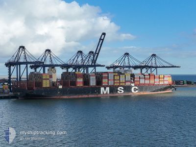
MSC ELOANE
Cargo A
Current Trip
| Time Travelled | 7 days |
|---|---|
| Remaining Time | --- |
| Distance Travelled | 2886.68 nm |
| Remaining Distance | --- |
| AVG Speed | 16 Knop |
| MAX Speed | 19.8 Knop |
| AVG Wind | 8.8 knots |
| MAX Wind | 21 knots |
| MIN Temp | 24.8°C / 76.64°F |
| MAX Temp | 31°C / 87.8°F |
| Djupgående | 15.6 m |
| Position mottagen | 6 d sen |
Current Position
| Longitud | 103.34090° |
|---|---|
| Latitude | 1.28325° |
| Status | Under way using engine |
| Fart | 16.9 Knop |
| Kurs | 309.8° |
| Område | Malacca Strait |
| Station | T-AIS |
| Position mottagen | 6 d sen |
Info
Information
The current position of MSC ELOANE is in Malacca Strait with coordinates 1.28325° / 103.34090° as reported on 2024-04-26 11:45 by AIS to our vessel tracker app. The vessel's current speed is 16.9 Knop and is heading at the port of FELIXSTOWE. The estimated time of arrival as calculated by MyShipTracking vessel tracking app is 2024-05-23 05:00 LT
The vessel MSC ELOANE (IMO: 9755957, MMSI: 636017435) is a Cargo A It's sailing under the flag of [LR] Liberia.
In this page you can find informations about the vessels current position, last detected port calls, and current voyage information. If the vessels is not in coverage by AIS you will find the latest position.
The current position of MSC ELOANE is detected by our AIS receivers and we are not responsible for the reliability of the data. The last position was recorded while the vessel was in Coverage by the Ais receivers of our vessel tracking app.
The current draught of MSC ELOANE as reported by AIS is 15.6 meters
Weather
| Temperature | 27.5°C / 81.5°F |
|---|---|
| Wind Speed | 15 knots |
| Direction | 82° E |
| Pressure | 1011.3 hPa |
| Humidity | 72.6 % |
| Cloud Coverage | 13 % |
Featured Company
Last Port Calls
| Port | Arrival | Departure | Time In Port |
|---|---|---|---|
| 2024-04-24 05:52 | 2024-04-25 10:51 | 1 d | |
| 2024-04-04 22:38 | 2024-04-07 02:23 | 2 d | |
| 2024-03-27 15:01 | 2024-03-29 08:57 | 1 d |
Most Visited Ports (Last year)
| Port | Arrivals | |
|---|---|---|
| 6 | ||
| 5 | ||
| 4 | ||
| 4 | ||
| 3 | ||
| 3 |
Events
| Tid | Event | Detaljer | Position / Dest | Information |
|---|---|---|---|---|
| 2024-04-26 11:52 | Status ändrad | Default Under way using engine |
1.30697 / 103.31242
GBFXT
|
Fart: 16.9 kn Kurs: 309.8° |
| 2024-04-26 11:45 | UTANFÖR täckningsområde |
1.28325 / 103.34090
Malacca Strait
GBFXT
|
Fart: 16.9 kn Kurs: 309.8° |
|
| 2024-04-26 11:43 | Byter havsområde | Malaysian part of the Malacca Strait Indonesian part of the Malacca Strait |
1.27842 / 103.34667
Malacca Strait
GBFXT
|
Fart: 16.9 kn Kurs: 310.3° |
| 2024-04-26 11:43 | Status ändrad | Under way using engine Default |
1.27720 / 103.34808
GBFXT
|
Fart: 16.8 kn Kurs: 310° |
| 2024-04-26 11:40 | Status ändrad | Default Under way using engine |
1.27052 / 103.35587
GBFXT
|
Fart: 16.5 kn Kurs: 315.9° |
| 2024-04-26 11:24 | Byter havsområde | Indonesian part of the Malacca Strait Malaysian part of the Malacca Strait |
1.22833 / 103.41639
Malacca Strait
GBFXT
|
Fart: 17.2 kn Kurs: 285.1° |
| 2024-04-26 11:18 | Byter havsområde | Malaysian part of the Malacca Strait Malaysian part of the Singapore Strait |
1.22112 / 103.44317
Malacca Strait
GBFXT
|
Fart: 17.2 kn Kurs: 284.7° |
| 2024-04-26 10:46 | Byter havsområde | Malaysian part of the Singapore Strait Indonesian part of the Singapore Strait |
1.19247 / 103.58341
Singapore Strait
GBFXT
|
Fart: 13.1 kn Kurs: 277.1° |
| 2024-04-26 10:08 | Byter havsområde | Indonesian part of the Singapore Strait Singaporean part of the Singapore Strait |
1.14280 / 103.71960
Singapore Strait
GBFXT
|
Fart: 12.3 kn Kurs: 294.5° |
| 2024-04-26 08:53 | Byter havsområde | Singaporean part of the Singapore Strait Indonesian part of the Singapore Strait |
1.25643 / 103.99334
Singapore Strait
GBFXT
|
Fart: 15.9 kn Kurs: 268.2° |