
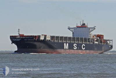
MSC AGRIGENTO
Container Ship
Current Trip
| Time Travelled | 1 day |
|---|---|
| Remaining Time | 2 h, 18 mins |
| Distance Travelled | 445.15 nm |
| Remaining Distance | 26.92 nm |
| AVG Speed | 11.1 Knop |
| MAX Speed | 11.9 Knop |
| AVG Wind | 11.8 knots |
| MAX Wind | 27 knots |
| MIN Temp | 14°C / 57.2°F |
| MAX Temp | 18.7°C / 65.66°F |
| Djupgående | 10 m |
| Position mottagen | Nu |
Current Position
| Longitud | 9.75619° |
|---|---|
| Latitude | 43.69353° |
| Status | Under way using engine |
| Fart | 11 Knop |
| Kurs | 12.8° |
| Område | Tyrrhenian Sea |
| Station | T-AIS |
| Position mottagen | Nu |
Info
Information
The current position of MSC AGRIGENTO is in Tyrrhenian Sea with coordinates 43.69353° / 9.75619° as reported on 2024-05-02 10:02 by AIS to our vessel tracker app. The vessel's current speed is 11 Knop and is heading at the port of LA SPEZIA. The estimated time of arrival as calculated by MyShipTracking vessel tracking app is 2024-05-02 12:21 LT
The vessel MSC AGRIGENTO (IMO: 9618276, MMSI: 357096000) is a Container Ship that was built in 2013 ( 11 År gammal ). It's sailing under the flag of [PA] Panama.
In this page you can find informations about the vessels current position, last detected port calls, and current voyage information. If the vessels is not in coverage by AIS you will find the latest position.
The current position of MSC AGRIGENTO is detected by our AIS receivers and we are not responsible for the reliability of the data. The last position was recorded while the vessel was in Coverage by the Ais receivers of our vessel tracking app.
The current draught of MSC AGRIGENTO as reported by AIS is 10 meters
Weather
| Temperature | 14.4°C / 57.92°F |
|---|---|
| Wind Speed | 18 knots |
| Direction | 256° WSW |
| Pressure | 1007.5 hPa |
| Humidity | 77.7 % |
| Cloud Coverage | 100 % |
Featured Company
Last Port Calls
| Port | Arrival | Departure | Time In Port |
|---|---|---|---|
| 2024-04-29 01:53 | 2024-04-30 17:15 | 1 d | |
| 2024-04-23 22:37 | 2024-04-24 20:21 | 21 h | |
| 2024-04-20 00:18 | 2024-04-20 20:18 | 19 h | |
| 2024-04-06 23:07 | 2024-04-08 18:11 | 1 d | |
| 2024-04-04 11:36 | 2024-04-05 04:33 | 16 h | |
| 2024-03-31 05:14 | 2024-04-01 08:27 | 1 d | |
| 2024-03-25 16:33 | 2024-03-28 20:20 | 3 d | |
| 2024-03-21 18:30 | 2024-03-22 20:00 | 1 d | |
| 2024-03-15 06:40 | 2024-03-16 02:44 | 20 h | |
| 2024-03-13 23:49 | 2024-03-14 15:58 | 16 h |
Most Visited Ports (Last year)
| Port | Arrivals | |
|---|---|---|
| 6 | ||
| 6 | ||
| 6 | ||
| 4 | ||
| 4 | ||
| 3 |
Last Trips
| Origin | Departure | Destination | Arrival | Distance | |
|---|---|---|---|---|---|
| 2024-04-24 22:21 | 2024-04-29 03:53 | 744.50 nm | |||
| 2024-04-20 22:18 | 2024-04-24 00:37 | 560.33 nm | |||
| 2024-04-08 14:11 | 2024-04-20 02:18 | 3926.50 nm | |||
| 2024-04-05 00:33 | 2024-04-06 19:07 | 218.02 nm | |||
| 2024-04-01 03:27 | 2024-04-04 07:36 | 915.15 nm | |||
| 2024-03-28 15:20 | 2024-03-31 00:14 | 448.02 nm | |||
| 2024-03-22 14:00 | 2024-03-25 11:33 | 519.95 nm | |||
| 2024-03-15 22:44 | 2024-03-21 12:30 | 1321.40 nm | |||
| 2024-03-14 11:58 | 2024-03-15 02:40 | 115.61 nm | |||
| 2024-03-03 09:44 | 2024-03-13 19:49 | 3859.91 nm |
Events
| Tid | Event | Detaljer | Position / Dest | Information |
|---|---|---|---|---|
| 2024-05-02 07:25 | Byter havsområde | Italian part of the Tyrrhenian Sea French part of the Tyrrhenian Sea |
43.21879 / 9.58585
Tyrrhenian Sea
ITSPE
|
Fart: 11.6 kn Kurs: 5.4° |
| 2024-05-02 06:35 | Byter havsområde | French part of the Tyrrhenian Sea Italian part of the Tyrrhenian Sea |
43.06881 / 9.63399
Tyrrhenian Sea
ITSPE
|
Fart: 11.1 kn Kurs: 345.5° |
| 2024-05-02 05:47 | Byter havsområde | Italian part of the Tyrrhenian Sea French part of the Tyrrhenian Sea |
42.92109 / 9.68501
Tyrrhenian Sea
ITSPE
|
Fart: 11.6 kn Kurs: 344° |
| 2024-05-02 04:11 | Byter havsområde | French part of the Tyrrhenian Sea Italian part of the Tyrrhenian Sea |
42.62093 / 9.79886
Tyrrhenian Sea
ITSPE
|
Fart: 11.2 kn Kurs: 343.1° |
| 2024-05-01 23:27 | Status ändrad | Under way using engine Default |
41.97434 / 10.47339
ITSPE
|
Fart: 10.5 kn Kurs: 308° |
| 2024-05-01 23:21 | Status ändrad | Default Under way using engine |
41.96464 / 10.48999
ITSPE
|
Fart: 10.5 kn Kurs: 308.7° |
| 2024-05-01 22:14 | Status ändrad | Under way using engine Default |
41.83659 / 10.70537
ITSPE
|
Fart: 10 kn Kurs: 307° |
| 2024-05-01 21:58 | I täckningsområde |
41.83659 / 10.70537
Tyrrhenian Sea
ITSPE
|
Fart: 10.7 kn Kurs: 309.3° |
|
| 2024-05-01 16:34 | Status ändrad | Default Under way using engine |
41.20667 / 11.78333
ITSPE
|
Fart: 10.2 kn Kurs: 307.5° |
| 2024-05-01 16:04 | UTANFÖR täckningsområde |
41.15228 / 11.87401
Tyrrhenian Sea
ITSPE
|
Fart: 10.2 kn Kurs: 307.5° |