
MORNING CHANT
Cargo
Current Trip
| Time Travelled | 26 days |
|---|---|
| Remaining Time | --- |
| Distance Travelled | 9258.84 nm |
| Remaining Distance | --- |
| AVG Speed | 14.5 Knop |
| MAX Speed | 19 Knop |
| AVG Wind | 14.6 knots |
| MAX Wind | 30 knots |
| MIN Temp | 8.7°C / 47.66°F |
| MAX Temp | 29°C / 84.2°F |
| Djupgående | 10 m |
| Position mottagen | 3 d sen |
Current Position
| Longitud | --- |
|---|---|
| Latitude | --- |
| Status | Under way using engine |
| Fart | 15.3 Knop |
| Kurs | 301° |
| Område | South Atlantic Ocean |
| Station | T-AIS |
| Position mottagen | 3 d sen |
Info
Information
The current position of MORNING CHANT is in South Atlantic Ocean with coordinates -34.40219° / 17.74808° as reported on 2025-02-13 08:59 by AIS to our vessel tracker app. The vessel's current speed is 15.3 Knop and is heading at the port of LAS PALMAS.
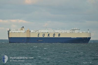
The vessel MORNING CHANT (MMSI: 538005333) is a Cargo It's sailing under the flag of [MH] Marshall Is.
In this page you can find informations about the vessels current position, last detected port calls, and current voyage information. If the vessels is not in coverage by AIS you will find the latest position.
The current position of MORNING CHANT is detected by our AIS receivers and we are not responsible for the reliability of the data. The last position was recorded while the vessel was in Coverage by the Ais receivers of our vessel tracking app.
The current draught of MORNING CHANT as reported by AIS is 10 meters
Weather
| Temperature | 22.1°C / 71.78°F |
|---|---|
| Wind Speed | 15 knots |
| Direction | 134° SE |
| Pressure | 1012.2 hPa |
| Humidity | 79.4 % |
| Cloud Coverage | 100 % |
Featured Company
Last Port Calls
| Port | Arrival | Departure | Time In Port |
|---|---|---|---|
| 2025-01-21 17:57 | 2025-01-22 06:13 | 12 h | |
| 2025-01-19 06:09 | 2025-01-19 20:22 | 14 h | |
| 2025-01-17 23:55 | 2025-01-18 18:39 | 18 h | |
| 2025-01-16 02:06 | 2025-01-16 16:16 | 14 h | |
| 2025-01-13 16:41 | 2025-01-15 12:15 | 1 d | |
| 2025-01-12 02:48 | 2025-01-12 13:37 | 10 h | |
| 2025-01-09 09:03 | 2025-01-09 19:57 | 10 h | |
| 2025-01-06 20:49 | 2025-01-07 06:53 | 10 h | |
| 2024-12-31 07:53 | 2025-01-01 02:14 | 18 h |
Most Visited Ports (Last year)
| Port | Arrivals | |
|---|---|---|
| 4 | ||
| 3 | ||
| 3 | ||
| 3 | ||
| 2 | ||
| 2 |
Last Trips
| Origin | Departure | Destination | Arrival | Distance | |
|---|---|---|---|---|---|
| 2025-01-19 20:22 | 2025-01-21 17:57 | 500.44 nm | |||
| 2025-01-18 18:39 | 2025-01-19 06:09 | 108.92 nm | |||
| 2025-01-16 16:16 | 2025-01-17 23:55 | 421.29 nm | |||
| 2025-01-15 12:15 | 2025-01-16 02:06 | 150.69 nm | |||
| 2025-01-12 13:37 | 2025-01-13 16:41 | 460.88 nm | |||
| 2025-01-09 19:57 | 2025-01-12 02:48 | 747.84 nm | |||
| 2025-01-07 06:53 | 2025-01-09 09:03 | 503.30 nm | |||
| 2025-01-01 02:14 | 2025-01-06 20:49 | 1873.71 nm | |||
| 2024-11-29 00:27 | 2024-12-31 07:53 | 11666.80 nm |
Events
| Tid | Event | Detaljer | Position / Dest | Information |
|---|---|---|---|---|
| 2025-02-13 09:04 | Status ändrad | Default Under way using engine |
-34.39043 / 17.72572
ESLPA
|
Fart: 15.3 kn Kurs: 301° |
| 2025-02-13 08:59 | UTANFÖR täckningsområde |
-34.40219 / 17.74808
South Atlantic Ocean
|
Fart: 15.3 kn Kurs: 301° |
|
| 2025-02-13 08:38 | Status ändrad | Under way using engine Default |
-34.45052 / 17.83996
ESLPA
|
Fart: 15.1 kn Kurs: 302° |
| 2025-02-13 08:35 | Status ändrad | Default Under way using engine |
-34.45766 / 17.85397
ESLPA
|
Fart: 15.2 kn Kurs: 302° |
| 2025-02-13 07:30 | Djupgående ändrat | 10 10.2 |
-34.60296 / 18.13150
ESLPA
|
Fart: 14.9 kn Kurs: 303° |
| 2025-02-13 07:02 | Status ändrad | Under way using engine Default |
-34.66722 / 18.24802
ESLPA
|
Fart: 14.7 kn Kurs: 304° |
| 2025-02-13 06:35 | Status ändrad | Default Under way using engine |
-34.72147 / 18.36705
ESLPA
|
Fart: 14.4 kn Kurs: 287° |
| 2025-02-13 06:31 | Byter havsområde | South African part of the South Atlantic Ocean Indonesian part of the Malacca Strait |
-34.72553 / 18.38343
South Atlantic Ocean
ESLPA
|
Fart: 14.4 kn Kurs: 286° |
| 2025-02-13 06:31 | Status ändrad | Under way using engine Default |
-34.72553 / 18.38343
ESLPA
|
Fart: 14.6 kn Kurs: 286° |
| 2025-02-13 06:24 | I täckningsområde |
-34.72553 / 18.38343
South Atlantic Ocean
ESLPA
|
Fart: 14.4 kn Kurs: 286° |