
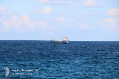
MN GLORY
General Cargo
Current Trip
| Time Travelled | 3 days |
|---|---|
| Remaining Time | 3 days |
| Distance Travelled | 754.58 nm |
| Remaining Distance | 716.30 nm |
| AVG Speed | 9.1 Knop |
| MAX Speed | 10.4 Knop |
| AVG Wind | 6.7 knots |
| MAX Wind | 14.5 knots |
| MIN Temp | 20.3°C / 68.54°F |
| MAX Temp | 23.8°C / 74.84°F |
| Djupgående | 6.7 m |
| Position mottagen | Nu |
Current Position
| Longitud | 19.83822° |
|---|---|
| Latitude | 36.99191° |
| Status | Under way using engine |
| Fart | 9.1 Knop |
| Kurs | 287° |
| Område | Ionian Sea |
| Station | T-AIS |
| Position mottagen | Nu |
Info
Information
The current position of MN GLORY is in Ionian Sea with coordinates 36.99191° / 19.83822° as reported on 2024-06-01 04:50 by AIS to our vessel tracker app. The vessel's current speed is 9.1 Knop and is heading at the port of GENOVA. The estimated time of arrival as calculated by MyShipTracking vessel tracking app is 2024-06-04 12:48 LT
The vessel MN GLORY (IMO: 9003536, MMSI: 577530000) is a General Cargo that was built in 1990 ( 34 År gammal ). It's sailing under the flag of [VU] Vanuatu.
In this page you can find informations about the vessels current position, last detected port calls, and current voyage information. If the vessels is not in coverage by AIS you will find the latest position.
The current position of MN GLORY is detected by our AIS receivers and we are not responsible for the reliability of the data. The last position was recorded while the vessel was in Coverage by the Ais receivers of our vessel tracking app.
The current draught of MN GLORY as reported by AIS is 6.7 meters
Weather
| Temperature | 21.7°C / 71.06°F |
|---|---|
| Wind Speed | 6 knots |
| Direction | 152° SSE |
| Pressure | 1016.1 hPa |
| Humidity | 68.9 % |
| Cloud Coverage | 6 % |
Featured Company
Last Port Calls
| Port | Arrival | Departure | Time In Port |
|---|---|---|---|
| 2024-05-27 15:25 | 2024-05-28 21:57 | 1 d | |
| 2024-05-25 07:39 | 2024-05-26 14:41 | 1 d | |
| 2024-05-22 16:22 | 2024-05-23 07:16 | 14 h | |
| 2024-05-19 06:56 | 2024-05-21 07:55 | 2 d | |
| 2024-05-16 05:43 | 2024-05-16 22:51 | 17 h | |
| 2024-05-06 08:25 | 2024-05-09 12:21 | 3 d | |
| 2024-04-25 10:16 | 2024-04-26 16:04 | 1 d | |
| 2024-04-23 06:48 | 2024-04-24 18:00 | 1 d | |
| 2024-04-18 07:30 | 2024-04-19 10:51 | 1 d | |
| 2024-04-15 16:19 | 2024-04-16 20:15 | 1 d |
Most Visited Ports (Last year)
| Port | Arrivals | |
|---|---|---|
| 6 | ||
| 3 | ||
| 3 | ||
| 2 | ||
| 2 | ||
| 2 |
Last Trips
| Origin | Departure | Destination | Arrival | Distance | |
|---|---|---|---|---|---|
| 2024-05-26 14:41 | 2024-05-27 15:25 | 168.18 nm | |||
| 2024-05-21 07:55 | 2024-05-25 07:39 | 569.12 nm | |||
| 2024-05-21 07:55 | 2024-05-22 16:22 | 278.21 nm | |||
| 2024-05-09 12:21 | 2024-05-19 06:56 | 1832.57 nm | |||
| 2024-05-09 12:21 | 2024-05-16 05:43 | 1554.54 nm | |||
| 2024-04-26 16:04 | 2024-05-06 08:25 | 1540.25 nm | |||
| 2024-04-24 18:00 | 2024-04-25 10:16 | 166.89 nm | |||
| 2024-04-19 10:51 | 2024-04-23 06:48 | 499.60 nm | |||
| 2024-04-16 20:15 | 2024-04-18 07:30 | 273.72 nm | |||
| 2024-03-28 00:18 | 2024-04-15 16:19 | 783.05 nm |
Events
| Tid | Event | Detaljer | Position / Dest | Information |
|---|---|---|---|---|
| 2024-06-01 04:24 | Status ändrad | Under way using engine Default |
36.97337 / 19.91972
IT GOA
|
Fart: 9.2 kn Kurs: 286° |
| 2024-06-01 04:14 | I täckningsområde |
36.97429 / 19.91579
Ionian Sea
IT GOA
|
Fart: 9.1 kn Kurs: 287° |
|
| 2024-06-01 02:54 | Status ändrad | Default Under way using engine |
36.90660 / 20.19659
IT GOA
|
Fart: 9.3 kn Kurs: 287° |
| 2024-06-01 02:48 | UTANFÖR täckningsområde |
36.90217 / 20.21577
Ionian Sea
IT GOA
|
Fart: 9.3 kn Kurs: 287° |
|
| 2024-06-01 02:40 | Status ändrad | Under way using engine Default |
36.89653 / 20.24054
IT GOA
|
Fart: 9.2 kn Kurs: 287° |
| 2024-06-01 02:24 | I täckningsområde |
36.89699 / 20.23858
Ionian Sea
IT GOA
|
Fart: 9.2 kn Kurs: 285° |
|
| 2024-06-01 01:41 | Status ändrad | Default Under way using engine |
36.85500 / 20.42016
IT GOA
|
Fart: 9.2 kn Kurs: 288° |
| 2024-06-01 01:37 | Status ändrad | Under way using engine Default |
36.85154 / 20.43417
IT GOA
|
Fart: 9.4 kn Kurs: 289° |
| 2024-06-01 01:37 | UTANFÖR täckningsområde |
36.85154 / 20.43417
Ionian Sea
IT GOA
|
Fart: 9.2 kn Kurs: 288° |
|
| 2024-06-01 01:18 | I täckningsområde |
36.85154 / 20.43417
Ionian Sea
IT GOA
|
Fart: 9.2 kn Kurs: 288° |