
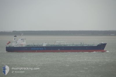
MINERVA LEO
Tanker
Current Trip
| Time Travelled | 10 days |
|---|---|
| Remaining Time | --- |
| Distance Travelled | 2996.58 nm |
| Remaining Distance | --- |
| AVG Speed | 10.7 Knop |
| MAX Speed | 16.9 Knop |
| AVG Wind | 20.7 knots |
| MAX Wind | 37.3 knots |
| MIN Temp | -1.2°C / 29.84°F |
| MAX Temp | 14.2°C / 57.56°F |
| Djupgående | 11.2 m |
| Position mottagen | 11 h, 38 m sen |
Current Position
| Longitud | --- |
|---|---|
| Latitude | --- |
| Status | Under way using engine |
| Fart | 12.2 Knop |
| Kurs | 84.6° |
| Område | Alboran Sea |
| Station | T-AIS |
| Position mottagen | 11 h, 38 m sen |
Info
Information
The current position of MINERVA LEO is in Alboran Sea with coordinates 36.07647° / -4.51367° as reported on 2026-01-07 22:52 by AIS to our vessel tracker app. The vessel's current speed is 12.2 Knop and is heading at the port of MERSIN. The estimated time of arrival as calculated by MyShipTracking vessel tracking app is 2026-01-14 10:00 LT
The vessel MINERVA LEO (IMO: 9723289, MMSI: 241371000) is a Tanker It's sailing under the flag of [GR] Greece.
In this page you can find informations about the vessels current position, last detected port calls, and current voyage information. If the vessels is not in coverage by AIS you will find the latest position.
The current position of MINERVA LEO is detected by our AIS receivers and we are not responsible for the reliability of the data. The last position was recorded while the vessel was in Coverage by the Ais receivers of our vessel tracking app.
The current draught of MINERVA LEO as reported by AIS is 11.2 meters
Weather
| Temperature | 14.1°C / 57.38°F |
|---|---|
| Wind Speed | 16 knots |
| Direction | 257° WSW |
| Pressure | 1030.6 hPa |
| Humidity | 66.1 % |
| Cloud Coverage | --- |
Featured Company
Last Trips
| Origin | Departure | Destination | Arrival | Distance |
|---|
Events
| Tid | Event | Detaljer | Position / Dest | Information |
|---|---|---|---|---|
| 2026-01-07 22:55 | Status ändrad | Default Under way using engine |
36.07667 / -4.49833
TR MER
|
Fart: 12.2 kn Kurs: 84.6° |
| 2026-01-07 22:52 | UTANFÖR täckningsområde |
36.07647 / -4.51367
Alboran Sea
TR MER
|
Fart: 12.2 kn Kurs: 84.6° |
|
| 2026-01-07 21:45 | Status ändrad | Under way using engine Default |
36.03849 / -4.80450
TR MER
|
Fart: 12.8 kn Kurs: 79° |
| 2026-01-07 21:34 | Status ändrad | Default Under way using engine |
36.03122 / -4.84892
TR MER
|
Fart: 13 kn Kurs: 82.3° |
| 2026-01-07 21:30 | Status ändrad | Under way using engine Default |
36.02802 / -4.86830
TR MER
|
Fart: 13 kn Kurs: 76° |
| 2026-01-07 21:02 | Status ändrad | Default Under way using engine |
36.00995 / -4.98876
TR MER
|
Fart: 12.9 kn Kurs: 79.2° |
| 2026-01-07 20:41 | Status ändrad | Under way using engine Default |
36.00420 / -5.08496
TR MER
|
Fart: 13.2 kn Kurs: 91° |
| 2026-01-07 20:37 | Status ändrad | Default Under way using engine |
36.00447 / -5.10309
TR MER
|
Fart: 13.1 kn Kurs: 91° |
| 2026-01-07 19:52 | Byter havsområde | Spanish part of the Alboran Sea Spanish part of the Strait of Gibraltar |
35.99270 / -5.31327
Alboran Sea
TR MER
|
Fart: 14.9 kn Kurs: 71.4° |
| 2026-01-07 19:41 | Byter havsområde | Spanish part of the Strait of Gibraltar Moroccan part of the Strait of Gibraltar |
35.98049 / -5.36789
Strait of Gibraltar
TR MER
|
Fart: 14.9 kn Kurs: 79.4° |