
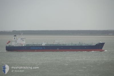
MINERVA LEO
Tanker
Current Trip
OPL MALTA
| Time Travelled | 25 days |
|---|---|
| Remaining Time | --- |
| Distance Travelled | 4081.51 nm |
| Remaining Distance | --- |
| AVG Speed | 12 Noeuds |
| MAX Speed | 15 Noeuds |
| AVG Wind | 11.5 knots |
| MAX Wind | 30.8 knots |
| MIN Temp | -1°C / 30.2°F |
| MAX Temp | 24.4°C / 75.92°F |
| Tirant d eau | 7 m |
| Position reçue | 1 d depuis |
Current Position
| Longitude | 14.82508° |
|---|---|
| Latitude | 35.88691° |
| Etat | At anchor |
| Vitesse | |
| Parcours | 121° |
| Zone | Mediterranean Sea - Eastern Basin |
| Station | T-AIS |
| Position reçue | 1 d depuis |
Info
Information
The current position of MINERVA LEO is in Mediterranean Sea - Eastern Basin with coordinates 35.88691° / 14.82508° as reported on 2024-06-10 09:58 by AIS to our vessel tracker app. The vessel's current speed is 0 Noeuds
The vessel MINERVA LEO (IMO: 9723289, MMSI: 241371000) is a Tanker It's sailing under the flag of [GR] Greece.
In this page you can find informations about the vessels current position, last detected port calls, and current voyage information. If the vessels is not in coverage by AIS you will find the latest position.
The current position of MINERVA LEO is detected by our AIS receivers and we are not responsible for the reliability of the data. The last position was recorded while the vessel was in Coverage by the Ais receivers of our vessel tracking app.
The current draught of MINERVA LEO as reported by AIS is 7 meters
Weather
| Temperature | 23.7°C / 74.66°F |
|---|---|
| Wind Speed | 10 knots |
| Direction | 165° SSE |
| Pressure | 1010.2 hPa |
| Humidity | 80.2 % |
| Cloud Coverage | 13 % |
Featured Company
Events
| Heure | Evenement | Détails | Position/ Destination | Info |
|---|---|---|---|---|
| 2024-06-10 10:31 | Etat Changé | Default At anchor |
35.88701 / 14.82517
OPL MALTA
|
Vitesse: Parcours: 121° |
| 2024-06-10 09:58 | Etat Changé | At anchor Default |
35.88691 / 14.82508
OPL MALTA
|
Vitesse: 0.1 kn Parcours: 121° |
| 2024-06-10 09:58 | Hors de la zone couverte |
35.88691 / 14.82508
Mediterranean Sea - Eastern Basin
|
Vitesse: Parcours: 179° |
|
| 2024-06-10 09:46 | Dans la zone couverte |
35.88691 / 14.82508
Mediterranean Sea - Eastern Basin
|
Vitesse: Parcours: 179° |
|
| 2024-06-10 01:52 | Etat Changé | Default At anchor |
35.88768 / 14.82739
OPL MALTA
|
Vitesse: 0.3 kn Parcours: 164° |
| 2024-06-10 01:46 | Etat Changé | At anchor Default |
35.88764 / 14.82669
OPL MALTA
|
Vitesse: 0.1 kn Parcours: 177° |
| 2024-06-10 01:46 | Hors de la zone couverte |
35.88764 / 14.82669
Mediterranean Sea - Eastern Basin
|
Vitesse: 0.3 kn Parcours: 76.3° |
|
| 2024-06-10 00:55 | Etat Changé | Default At anchor |
35.88742 / 14.82651
OPL MALTA
|
Vitesse: 0.1 kn Parcours: 178° |
| 2024-06-10 00:43 | Etat Changé | At anchor Default |
35.88745 / 14.82659
OPL MALTA
|
Vitesse: 0.1 kn Parcours: 172° |
| 2024-06-10 00:31 | Etat Changé | Default At anchor |
35.88736 / 14.82646
OPL MALTA
|
Vitesse: 0.3 kn Parcours: 178° |