
MICHIGAN HIGHWAY
Vehicles Carrier
Current Trip
| Time Travelled | 10 days |
|---|---|
| Remaining Time | 3 days |
| Distance Travelled | 4046.18 nm |
| Remaining Distance | 1219.66 nm |
| AVG Speed | 15.3 Knop |
| MAX Speed | 18.6 Knop |
| AVG Wind | 16.1 knots |
| MAX Wind | 37.1 knots |
| MIN Temp | 4.6°C / 40.28°F |
| MAX Temp | 20.6°C / 69.08°F |
| Djupgående | 9.3 m |
| Position mottagen | 8 d sen |
Current Position
| Longitud | 141.35575° |
|---|---|
| Latitude | 35.67270° |
| Status | Under way using engine |
| Fart | 18.3 Knop |
| Kurs | 46° |
| Område | North Pacific Ocean |
| Station | T-AIS |
| Position mottagen | 8 d sen |
Info
Information
The current position of MICHIGAN HIGHWAY is in North Pacific Ocean with coordinates 35.67270° / 141.35575° as reported on 2024-05-02 20:46 by AIS to our vessel tracker app. The vessel's current speed is 18.3 Knop and is heading at the port of PORTLAND. The estimated time of arrival as calculated by MyShipTracking vessel tracking app is 2024-05-14 10:38 LT
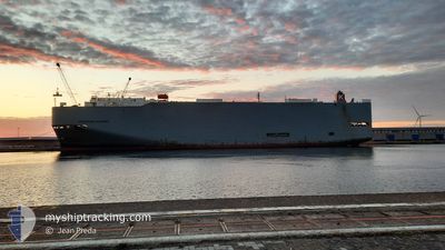
The vessel MICHIGAN HIGHWAY (IMO: 9339832, MMSI: 432633000) is a Vehicles Carrier that was built in 2008 ( 16 År gammal ). It's sailing under the flag of [JP] Japan.
In this page you can find informations about the vessels current position, last detected port calls, and current voyage information. If the vessels is not in coverage by AIS you will find the latest position.
The current position of MICHIGAN HIGHWAY is detected by our AIS receivers and we are not responsible for the reliability of the data. The last position was recorded while the vessel was in Coverage by the Ais receivers of our vessel tracking app.
The current draught of MICHIGAN HIGHWAY as reported by AIS is 9.3 meters
Weather
| Temperature | 7.9°C / 46.22°F |
|---|---|
| Wind Speed | 28 knots |
| Direction | 203° SSW |
| Pressure | 1015.9 hPa |
| Humidity | 89.2 % |
| Cloud Coverage | 100 % |
Featured Company
Last Port Calls
| Port | Arrival | Departure | Time In Port |
|---|---|---|---|
| 2024-04-28 22:13 | 2024-04-30 04:31 | 1 d | |
| 2024-04-25 05:40 | 2024-04-27 10:45 | 2 d | |
| 2024-04-17 15:06 | 2024-04-18 00:30 | 9 h | |
| 2024-04-13 03:19 | 2024-04-13 12:58 | 9 h | |
| 2024-04-08 07:02 | 2024-04-09 13:45 | 1 d | |
| 2024-04-03 22:05 | 2024-04-04 23:46 | 1 d | |
| 2024-04-02 05:03 | 2024-04-03 18:24 | 1 d | |
| 2024-04-01 02:21 | 2024-04-01 08:05 | 5 h | |
| 2024-03-22 16:07 | 2024-03-22 22:05 | 5 h | |
| 2024-03-20 01:23 | 2024-03-20 12:14 | 10 h |
Last Trips
| Origin | Departure | Destination | Arrival | Distance | |
|---|---|---|---|---|---|
| 2024-04-27 19:45 | 2024-04-29 07:13 | 561.97 nm | |||
| 2024-04-18 08:30 | 2024-04-25 14:40 | 2727.43 nm | |||
| 2024-04-13 18:28 | 2024-04-17 23:06 | 1482.78 nm | |||
| 2024-04-09 19:15 | 2024-04-13 08:49 | 1386.89 nm | |||
| 2024-04-05 03:46 | 2024-04-08 12:32 | 992.85 nm | |||
| 2024-04-03 22:24 | 2024-04-04 02:05 | 45.40 nm | |||
| 2024-04-01 12:05 | 2024-04-02 09:03 | 276.47 nm | |||
| 2024-03-23 06:05 | 2024-04-01 06:21 | 3326.62 nm | |||
| 2024-03-20 19:14 | 2024-03-23 00:07 | 787.16 nm | |||
| 2024-03-14 02:53 | 2024-03-20 08:23 | 2280.88 nm |
Events
| Tid | Event | Detaljer | Position / Dest | Information |
|---|---|---|---|---|
| 2024-05-02 20:48 | Status ändrad | Default Under way using engine |
35.67996 / 141.36528
US PDX
|
Fart: 18.3 kn Kurs: 46° |
| 2024-05-02 20:46 | UTANFÖR täckningsområde |
35.67270 / 141.35575
North Pacific Ocean
US PDX
|
Fart: 18.3 kn Kurs: 46° |
|
| 2024-05-02 20:12 | Status ändrad | Under way using engine Default |
35.56238 / 141.19464
US PDX
|
Fart: 17.9 kn Kurs: 50° |
| 2024-05-02 19:57 | Status ändrad | Default Under way using engine |
35.51461 / 141.12210
US PDX
|
Fart: 18 kn Kurs: 50° |
| 2024-05-02 14:32 | ETA ändrat | 2024/05/15 03:00 2024/05/14 11:00 |
34.70906 / 139.66787
US PDX
|
Fart: 15.2 kn Kurs: 63° |
| 2024-05-02 14:28 | Byter havsområde | Japanese part of the North Pacific Ocean Japanese part of the Philippine Sea |
34.70056 / 139.64730
North Pacific Ocean
US PDX
|
Fart: 15.3 kn Kurs: 63° |
| 2024-05-02 14:10 | Byter havsområde | Japanese part of the Philippine Sea South Korean part of the Japan Sea |
34.66249 / 139.56591
Philippine Sea
US PDX
|
Fart: 15.7 kn Kurs: 56° |
| 2024-05-02 14:10 | Status ändrad | Under way using engine Default |
34.66249 / 139.56591
US PDX
|
Fart: 15.7 kn Kurs: 55° |
| 2024-05-02 14:01 | I täckningsområde |
34.66249 / 139.56591
Philippine Sea
US PDX
|
Fart: 15.7 kn Kurs: 56° |