

METIN HUSEYNOV
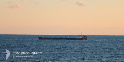
Oil Products Tanker

Current Trip
| Time Travelled | 9 days |
|---|---|
| Remaining Time | --- |
| Distance Travelled | 727.43 nm |
| Remaining Distance | --- |
| AVG Speed | 6.3 Knop |
| MAX Speed | 9.1 Knop |
| AVG Wind | 8.7 knots |
| MAX Wind | 33 knots |
| MIN Temp | 2.5°C / 36.5°F |
| MAX Temp | 23.6°C / 74.48°F |
| Djupgående | 5 m |
| Position mottagen | 4 d sen |
Current Position
| Longitud | --- |
|---|---|
| Latitude | --- |
| Status | Under way using engine |
| Fart | 7 Knop |
| Kurs | 8.5° |
| Område | Black Sea |
| Station | T-AIS |
| Position mottagen | 4 d sen |
Information
The current position of METIN HUSEYNOV is in Black Sea with coordinates 43.32640° / 29.57859° as reported on 2025-03-23 22:02 by AIS to our vessel tracker app. The vessel's current speed is 7 Knop and is heading at the port of SULINA. The estimated time of arrival as calculated by MyShipTracking vessel tracking app is 2025-03-23 12:00 LT
The vessel METIN HUSEYNOV (IMO: 9175171, MMSI: 636021744) is a Oil Products Tanker that was built in 2000 ( 25 År gammal ). It's sailing under the flag of [LR] Liberia.
In this page you can find informations about the vessels current position, last detected port calls, and current voyage information. If the vessels is not in coverage by AIS you will find the latest position.
The current position of METIN HUSEYNOV is detected by our AIS receivers and we are not responsible for the reliability of the data. The last position was recorded while the vessel was in Coverage by the Ais receivers of our vessel tracking app.
The current draught of METIN HUSEYNOV as reported by AIS is 5 meters
Weather
| Temperature | 13.8°C / 56.84°F |
|---|---|
| Wind Speed | 18 knots |
| Direction | 69° ENE |
| Pressure | 1014.4 hPa |
| Humidity | 44.4 % |
| Cloud Coverage | 100 % |


Featured Company
Most Visited Ports (Last year)
| Port | Arrivals | |
|---|---|---|
| 6 | ||
| 4 | ||
| 3 | ||
| 2 | ||
| 2 | ||
| 1 |
Last Trips
| Origin | Departure | Destination | Arrival | Distance | |
|---|---|---|---|---|---|
| 2025-03-03 17:16 | 2025-03-17 11:50 | 1273.84 nm | |||
| 2025-02-23 10:00 | 2025-03-02 15:18 | 343.86 nm | |||
| 2025-02-03 22:37 | 2025-02-23 08:30 | 1217.50 nm | |||
| 2025-01-19 10:46 | 2025-02-02 23:49 | 411.40 nm | |||
| 2024-12-30 11:04 | 2025-01-05 16:16 | 269.13 nm |
Events
| Tid | Event | Detaljer | Position / Dest | Information |
|---|---|---|---|---|
| 2025-03-28 05:22 | STARTAR förflyttning | 8.16 nm, North East of TULCEA |
45.29757 / 28.89562
SULINA ROAD
|
Fart: 7.9 kn Kurs: 140° |
| 2025-03-27 08:29 | STOPPAR förflyttning | 8.36 nm, North East of TULCEA |
45.30387 / 28.88967
SULINA ROAD
|
Fart: 0.2 kn Kurs: 331° |
| 2025-03-27 07:49 | STARTAR förflyttning | 8.4 nm, North of TULCEA |
45.31535 / 28.85233
SULINA ROAD
|
Fart: 4.3 kn Kurs: 125° |
| 2025-03-25 17:14 | STOPPAR förflyttning | 8.54 nm, North of TULCEA |
45.31789 / 28.85180
SULINA ROAD
|
Fart: Kurs: 294° |
| 2025-03-24 17:11 | STOPPAR förflyttning | 7.78 nm, East of SULINA |
45.17092 / 29.83000
SULINA ROAD
|
Fart: 0.3 kn Kurs: 147° |
| 2025-03-23 22:02 | UTANFÖR täckningsområde |
43.32640 / 29.57859
Black Sea
|
Fart: 7 kn Kurs: 8.5° |
|
| 2025-03-23 21:44 | Status ändrad | Under way using engine Default |
43.29205 / 29.57025
SULINA ROAD
|
Fart: 7 kn Kurs: 12° |
| 2025-03-23 21:29 | Status ändrad | Default Under way using engine |
43.26361 / 29.56251
SULINA ROAD
|
Fart: 7 kn Kurs: 12.3° |
| 2025-03-23 20:57 | Byter havsområde | Bulgarian part of the Black Sea Turkish part of the Black Sea |
43.20242 / 29.54710
Black Sea
|
Fart: 7.2 kn Kurs: 8.9° |
| 2025-03-23 20:57 | Status ändrad | Under way using engine Default |
43.20242 / 29.54710
SULINA ROAD
|
Fart: 7.3 kn Kurs: 8° |