

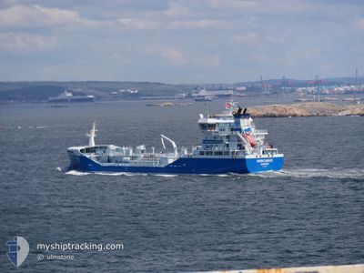
MERCURIUS
Tanker

Current Trip
| Trip Time | 1 day |
|---|---|
| Trip Distance | 154.60 nm |
| AVG Speed | 8.7 Knop |
| MAX Speed | 12.7 Knop |
| Djupgående | 5.8 m |
| AVG Wind | 3.7 knots |
| MAX Wind | 7.7 knots |
| MIN Temp | 3.6°C / 38.48°F |
| MAX Temp | 6.4°C / 43.52°F |
| Position mottagen | Nu |
Current Position
| Longitud | --- |
|---|---|
| Latitude | --- |
| Status | Moored |
| Fart | |
| Kurs | 196° |
| Område | Kattegat |
| Station | T-AIS |
| Position mottagen | Nu |
Information
The current position of MERCURIUS is in Kattegat with coordinates 57.68936° / 11.86991° as reported on 2025-03-11 02:17 by AIS to our vessel tracker app. The vessel's current speed is 0 Knop and is currently inside the port of GOTEBORG.
The vessel MERCURIUS (IMO: 9816531, MMSI: 266465000) is a Tanker It's sailing under the flag of [SE] Sweden.
In this page you can find informations about the vessels current position, last detected port calls, and current voyage information. If the vessels is not in coverage by AIS you will find the latest position.
The current position of MERCURIUS is detected by our AIS receivers and we are not responsible for the reliability of the data. The last position was recorded while the vessel was in Coverage by the Ais receivers of our vessel tracking app.
The current draught of MERCURIUS as reported by AIS is 5.8 meters
Weather
| Temperature | 2.6°C / 36.68°F |
|---|---|
| Wind Speed | 11 knots |
| Direction | 62° ENE |
| Pressure | 1002.5 hPa |
| Humidity | 83.8 % |
| Cloud Coverage | 100 % |


Featured Company
Last Port Calls
| Port | Arrival | Departure | Time In Port |
|---|---|---|---|
| 2025-03-10 04:29 | |||
| 2025-03-08 10:25 | 2025-03-09 03:47 | 17 h | |
| 2025-03-05 11:57 | 2025-03-06 17:18 | 1 d | |
| 2025-03-03 07:39 | 2025-03-03 19:16 | 11 h | |
| 2025-03-02 14:32 | 2025-03-03 02:35 | 12 h | |
| 2025-02-23 01:52 | 2025-02-23 17:56 | 16 h | |
| 2025-02-21 22:29 | 2025-02-22 12:42 | 14 h | |
| 2025-02-20 16:08 | 2025-02-21 11:11 | 19 h | |
| 2025-02-16 17:25 | 2025-02-17 08:13 | 14 h | |
| 2025-02-15 11:05 | 2025-02-16 00:15 | 13 h |
Most Visited Ports (Last year)
| Port | Arrivals | |
|---|---|---|
| 59 | ||
| 46 | ||
| 17 | ||
| 16 | ||
| 7 | ||
| 6 |
Last Trips
| Origin | Departure | Destination | Arrival | Distance | |
|---|---|---|---|---|---|
| 2025-03-09 04:47 | 2025-03-10 05:29 | 154.60 nm | |||
| 2025-03-06 18:18 | 2025-03-08 11:25 | 524.51 nm | |||
| 2025-03-03 20:16 | 2025-03-05 12:57 | 496.88 nm | |||
| 2025-03-03 03:35 | 2025-03-03 08:39 | 45.39 nm | |||
| 2025-02-23 18:56 | 2025-03-02 15:32 | 1162.04 nm | |||
| 2025-02-21 12:11 | 2025-02-21 23:29 | 139.82 nm | |||
| 2025-02-17 09:13 | 2025-02-20 17:08 | 171.46 nm | |||
| 2025-02-16 01:15 | 2025-02-16 18:25 | 208.65 nm | |||
| 2025-02-14 20:13 | 2025-02-15 12:05 | 181.39 nm | |||
| 2025-02-13 15:51 | 2025-02-14 07:20 | 181.69 nm |
Events
| Tid | Event | Detaljer | Position / Dest | Information |
|---|---|---|---|---|
| 2025-03-10 16:02 | Status ändrad | Moored Default |
57.68936 / 11.86992
[SE] GOTEBORG
|
Fart: Kurs: 196° |
| 2025-03-10 15:59 | Status ändrad | Default Moored |
57.68937 / 11.86987
[SE] GOTEBORG
|
Fart: Kurs: 196° |
| 2025-03-10 05:15 | Status ändrad | Moored Under way using engine |
57.68935 / 11.86992
[SE] GOTEBORG
|
Fart: Kurs: 195° |
| 2025-03-10 04:54 | STOPPAR förflyttning |
57.68708 / 11.86719
[SE] GOTEBORG
|
Fart: 0.3 kn Kurs: 160° |
|
| 2025-03-10 04:29 | ANLÄNDER HAMN |
|
57.68035 / 11.82116
[SE] GOTEBORG
|
Fart: 10.9 kn Kurs: 69.7° |
| 2025-03-10 04:21 | STARTAR förflyttning | 1.27 nm, North of ASPERO |
57.67155 / 11.78569
GOTHENBURG
|
Fart: 4.6 kn Kurs: 82° |
| 2025-03-10 04:18 | Status ändrad | Under way using engine At anchor |
57.67218 / 11.78281
GOTHENBURG
|
Fart: Kurs: 121° |
| 2025-03-09 23:34 | Status ändrad | At anchor Under way using engine |
57.67227 / 11.78154
GOTHENBURG
|
Fart: Kurs: 102° |
| 2025-03-09 21:37 | STOPPAR förflyttning | 1.3 nm, South of KROSSHOLMEN |
57.67230 / 11.78255
GOTHENBURG
|
Fart: 0.3 kn Kurs: 82° |
| 2025-03-09 18:47 | Upptäckt i hav | Swedish part of the Kattegat |
57.70650 / 11.16295
Kattegat
GOTHENBURG
|
Fart: 8.9 kn Kurs: 113.2° |