

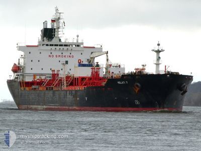
MELATI 7
Chemical Tanker

Current Trip
ID BIT
| Time Travelled | 1 day |
|---|---|
| Remaining Time | --- |
| Distance Travelled | 398.30 nm |
| Remaining Distance | --- |
| AVG Speed | 10.9 Knop |
| MAX Speed | 12.8 Knop |
| AVG Wind | 10.4 knots |
| MAX Wind | 15.7 knots |
| MIN Temp | 26.9°C / 80.42°F |
| MAX Temp | 28.9°C / 84.02°F |
| Djupgående | 8.2 m |
| Position mottagen | 7 d sen |
Current Position
| Longitud | --- |
|---|---|
| Latitude | --- |
| Status | Under way using engine |
| Fart | 10.6 Knop |
| Kurs | 61° |
| Område | Java Sea |
| Station | T-AIS |
| Position mottagen | 7 d sen |
Information
The current position of MELATI 7 is in Java Sea with coordinates -6.76645° / 112.79447° as reported on 2025-03-08 11:56 by AIS to our vessel tracker app. The vessel's current speed is 10.6 Knop
The vessel MELATI 7 (IMO: 9172272, MMSI: 477293800) is a Chemical Tanker that was built in 2000 ( 25 År gammal ). It's sailing under the flag of [HK] Hong Kong.
In this page you can find informations about the vessels current position, last detected port calls, and current voyage information. If the vessels is not in coverage by AIS you will find the latest position.
The current position of MELATI 7 is detected by our AIS receivers and we are not responsible for the reliability of the data. The last position was recorded while the vessel was in Coverage by the Ais receivers of our vessel tracking app.
The current draught of MELATI 7 as reported by AIS is 8.2 meters
Weather
| Temperature | 28.1°C / 82.58°F |
|---|---|
| Wind Speed | 10 knots |
| Direction | 42° NE |
| Pressure | 1009.2 hPa |
| Humidity | 74.2 % |
| Cloud Coverage | 100 % |


Featured Company
Last Port Calls
Most Visited Ports (Last year)
| Port | Arrivals | |
|---|---|---|
| 6 | ||
| 5 | ||
| 3 | ||
| 3 | ||
| 3 | ||
| 3 |
Last Trips
| Origin | Departure | Destination | Arrival | Distance | |
|---|---|---|---|---|---|
| 2025-03-08 16:17 | 2025-03-12 22:33 | 1135.81 nm | |||
| 2025-02-17 14:01 | 2025-03-06 14:16 | 3831.51 nm | |||
| 2025-01-15 14:19 | 2025-02-14 14:28 | 7445.80 nm | |||
| 2025-01-15 14:19 | 2025-02-01 01:41 | 4405.27 nm | |||
| 2024-12-27 13:21 | 2025-01-07 12:59 | 1821.15 nm |
Events
| Tid | Event | Detaljer | Position / Dest | Information |
|---|---|---|---|---|
| 2025-03-14 11:46 | STARTAR förflyttning | 0.42 nm, South West of BITUNG |
1.43232 / 125.16155
ID BIT
|
Fart: 3.5 kn Kurs: 204° |
| 2025-03-14 11:41 | AVGÅTT HAMN |
|
1.43527 / 125.16312
ID BIT
|
Fart: 1.5 kn Kurs: 109° |
| 2025-03-12 14:38 | STOPPAR förflyttning |
1.43790 / 125.16097
[ID] BITUNG
|
Fart: 0.3 kn Kurs: 73° |
|
| 2025-03-12 14:33 | ANLÄNDER HAMN |
|
1.43737 / 125.16080
[ID] BITUNG
|
Fart: 0.8 kn Kurs: 64° |
| 2025-03-12 13:54 | STARTAR förflyttning | 1.52 nm, South West of BITUNG |
1.41707 / 125.15112
ID BIT
|
Fart: 3.8 kn Kurs: 16° |
| 2025-03-12 13:18 | STOPPAR förflyttning | 1.73 nm, South West of BITUNG |
1.41260 / 125.15145
ID BIT
|
Fart: 0.3 kn Kurs: 26° |
| 2025-03-08 12:01 | Status ändrad | Default Under way using engine |
-6.76272 / 112.81085
ID BIT
|
Fart: 10.6 kn Kurs: 61° |
| 2025-03-08 11:56 | UTANFÖR täckningsområde |
-6.76645 / 112.79447
Java Sea
ID BIT
|
Fart: 10.6 kn Kurs: 61° |
|
| 2025-03-08 11:50 | Status ändrad | Under way using engine Default |
-6.77353 / 112.78023
ID BIT
|
Fart: 9.8 kn Kurs: 71° |
| 2025-03-08 11:49 | Status ändrad | Default Under way using engine |
-6.77490 / 112.77628
ID BIT
|
Fart: 9.8 kn Kurs: 72° |