
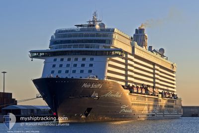
MEIN SCHIFF 6
Passenger
Current Trip
| Time Travelled | 2 days |
|---|---|
| Remaining Time | --- |
| Distance Travelled | 721.38 nm |
| Remaining Distance | --- |
| AVG Speed | 12.3 Knop |
| MAX Speed | 20.5 Knop |
| AVG Wind | 9.9 knots |
| MAX Wind | 19.5 knots |
| MIN Temp | 26.3°C / 79.34°F |
| MAX Temp | 28.7°C / 83.66°F |
| Djupgående | 8.2 m |
| Position mottagen | 2 d sen |
Current Position
| Longitud | --- |
|---|---|
| Latitude | --- |
| Status | Under way using engine |
| Fart | 11.2 Knop |
| Kurs | 147.3° |
| Område | Gulf of Thailand |
| Station | T-AIS |
| Position mottagen | 2 d sen |
Info
Information
The current position of MEIN SCHIFF 6 is in Gulf of Thailand with coordinates 12.54078° / 101.20824° as reported on 2025-03-09 05:03 by AIS to our vessel tracker app. The vessel's current speed is 11.2 Knop
The vessel MEIN SCHIFF 6 (IMO: 9753208, MMSI: 249660000) is a Passenger It's sailing under the flag of [MT] Malta.
In this page you can find informations about the vessels current position, last detected port calls, and current voyage information. If the vessels is not in coverage by AIS you will find the latest position.
The current position of MEIN SCHIFF 6 is detected by our AIS receivers and we are not responsible for the reliability of the data. The last position was recorded while the vessel was in Coverage by the Ais receivers of our vessel tracking app.
The current draught of MEIN SCHIFF 6 as reported by AIS is 8.2 meters
Weather
| Temperature | 27.4°C / 81.32°F |
|---|---|
| Wind Speed | 11 knots |
| Direction | 54° NE |
| Pressure | 1006.9 hPa |
| Humidity | 80.7 % |
| Cloud Coverage | 39 % |
Featured Company
Last Port Calls
| Port | Arrival | Departure | Time In Port |
|---|---|---|---|
| 2025-03-08 00:22 | 2025-03-08 19:30 | 19 h | |
| 2025-03-04 22:32 | 2025-03-05 12:08 | 13 h | |
| 2025-03-01 23:07 | 2025-03-02 14:58 | 15 h | |
| 2025-02-25 18:09 | 2025-02-27 14:11 | 1 d | |
| 2025-02-23 00:13 | 2025-02-23 20:01 | 19 h | |
| 2025-02-19 22:27 | 2025-02-20 12:04 | 13 h | |
| 2025-02-16 22:25 | 2025-02-17 10:33 | 12 h | |
| 2025-02-14 20:21 | 2025-02-15 11:09 | 14 h | |
| 2025-02-10 23:42 | 2025-02-13 14:12 | 2 d | |
| 2025-02-08 22:29 | 2025-02-09 12:11 | 13 h |
Last Trips
| Origin | Departure | Destination | Arrival | Distance | |
|---|---|---|---|---|---|
| 2025-03-05 19:08 | 2025-03-08 07:22 | 772.90 nm | |||
| 2025-03-02 22:58 | 2025-03-05 05:32 | 835.31 nm | |||
| 2025-02-27 22:11 | 2025-03-02 07:07 | 715.37 nm | |||
| 2025-02-24 03:01 | 2025-02-26 02:09 | 801.11 nm | |||
| 2025-02-20 19:04 | 2025-02-23 07:13 | 766.10 nm | |||
| 2025-02-17 18:33 | 2025-02-20 05:27 | 1037.36 nm | |||
| 2025-02-15 19:09 | 2025-02-17 06:25 | 299.13 nm | |||
| 2025-02-13 22:12 | 2025-02-15 04:21 | 206.67 nm | |||
| 2025-02-09 19:11 | 2025-02-11 07:42 | 621.95 nm | |||
| 2025-02-07 02:21 | 2025-02-09 05:29 | 619.79 nm |
Events
| Tid | Event | Detaljer | Position / Dest | Information |
|---|---|---|---|---|
| 2025-03-09 05:10 | Status ändrad | Default Under way using engine |
12.52172 / 101.22181
VNPHU
|
Fart: 11.2 kn Kurs: 147.3° |
| 2025-03-09 05:03 | UTANFÖR täckningsområde |
12.54078 / 101.20824
Gulf of Thailand
|
Fart: 11.2 kn Kurs: 147.3° |
|
| 2025-03-09 04:55 | Status ändrad | Under way using engine Default |
12.56285 / 101.19577
VNPHU
|
Fart: 12.2 kn Kurs: 153° |
| 2025-03-09 04:46 | Status ändrad | Default Under way using engine |
12.58585 / 101.18295
VNPHU
|
Fart: 1.5 kn Kurs: 53° |
| 2025-03-09 04:46 | STARTAR förflyttning | 4.45 nm, South East of MAP TA PHUT |
12.58585 / 101.18295
VNPHU
|
Fart: 7 kn Kurs: 145° |
| 2025-03-09 04:40 | Status ändrad | Under way using engine Default |
12.58905 / 101.17846
VNPHU
|
Fart: 0.2 kn Kurs: 24° |
| 2025-03-09 04:26 | Status ändrad | Default Under way using engine |
12.59014 / 101.17819
VNPHU
|
Fart: 0.8 kn Kurs: 4° |
| 2025-03-09 04:26 | STOPPAR förflyttning | 4.1 nm, South East of MAP TA PHUT |
12.59014 / 101.17819
VNPHU
|
Fart: 0.2 kn Kurs: 24° |
| 2025-03-09 04:18 | Status ändrad | Under way using engine Default |
12.59075 / 101.17780
VNPHU
|
Fart: 1.1 kn Kurs: 357° |
| 2025-03-09 04:14 | Status ändrad | Default Under way using engine |
12.59067 / 101.17664
VNPHU
|
Fart: 0.7 kn Kurs: 306° |