

MDL TOOFAN
Bulk Carrier

Current Trip
| Trip Time | 59 mins |
|---|---|
| Trip Distance | 1.69 nm |
| AVG Speed | 3.6 Knop |
| MAX Speed | 3.9 Knop |
| Djupgående | 13.5 m |
| AVG Wind | 13.9 knots |
| MAX Wind | 14.7 knots |
| MIN Temp | 24°C / 75.2°F |
| MAX Temp | 24.9°C / 76.82°F |
| Position mottagen | 13 d sen |
Current Position
| Longitud | --- |
|---|---|
| Latitude | --- |
| Status | At anchor |
| Fart | |
| Kurs | 136° |
| Område | Persian Gulf |
| Station | T-AIS |
| Position mottagen | 13 d sen |
Information
The current position of MDL TOOFAN is in Persian Gulf with coordinates 29.85167° / 49.21569° as reported on 2025-03-15 08:30 by AIS to our vessel tracker app. The vessel's current speed is 0 Knop and is currently inside the port of BANDAR IMAM KHOMEINI.
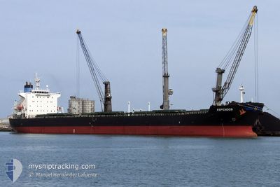
The vessel MDL TOOFAN (IMO: 9275141, MMSI: 352001903) is a Bulk Carrier that was built in 2003 ( 22 År gammal ). It's sailing under the flag of [PA] Panama.
In this page you can find informations about the vessels current position, last detected port calls, and current voyage information. If the vessels is not in coverage by AIS you will find the latest position.
The current position of MDL TOOFAN is detected by our AIS receivers and we are not responsible for the reliability of the data. The last position was recorded while the vessel was in Coverage by the Ais receivers of our vessel tracking app.
The current draught of MDL TOOFAN as reported by AIS is 13.5 meters
Weather
| Temperature | 22.2°C / 71.96°F |
|---|---|
| Wind Speed | 7 knots |
| Direction | 211° SSW |
| Pressure | 1014 hPa |
| Humidity | 31.5 % |
| Cloud Coverage | 76 % |


Featured Company
Last Port Calls
| Port | Arrival | Departure | Time In Port |
|---|---|---|---|
| 2025-03-25 18:38 | |||
| 2025-03-16 18:46 | 2025-03-25 17:39 | 8 d | |
| 2025-01-06 00:07 | 2025-01-10 10:01 | 4 d |
Most Visited Ports (Last year)
| Port | Arrivals | |
|---|---|---|
| 5 | ||
| 2 | ||
| 1 |
Last Trips
| Origin | Departure | Destination | Arrival | Distance | |
|---|---|---|---|---|---|
| 2025-03-25 17:39 | 2025-03-25 18:38 | 1.69 nm | |||
| 2025-01-10 10:01 | 2025-03-16 18:46 | 8768.62 nm | |||
| 2024-12-02 09:06 | 2025-01-06 00:07 | 8836.25 nm |
Events
| Tid | Event | Detaljer | Position / Dest | Information |
|---|---|---|---|---|
| 2025-03-25 14:25 | STOPPAR förflyttning |
30.44031 / 49.04773
[IR] BANDAR IMAM KHOMEINI
|
Fart: Kurs: 115° |
|
| 2025-03-25 14:08 | ANLÄNDER HAMN |
|
30.44000 / 49.04828
[IR] BANDAR IMAM KHOMEINI
|
Fart: 1.3 kn Kurs: 67° |
| 2025-03-25 13:23 | STARTAR förflyttning | 0.35 nm, South of BANDAR IMAM KHOMEINI |
30.41791 / 49.06640
IR BKM
|
Fart: 3.6 kn Kurs: 304° |
| 2025-03-25 13:09 | AVGÅTT HAMN |
|
30.41791 / 49.06640
IR BKM
|
Fart: 0.8 kn Kurs: 69° |