
MDL TOOFAN
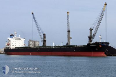
Bulk Carrier
Current Trip
| Time Travelled | 4 days |
|---|---|
| Remaining Time | --- |
| Distance Travelled | 1145.92 nm |
| Remaining Distance | --- |
| AVG Speed | 12.2 Knopen |
| MAX Speed | 17.4 Knopen |
| AVG Wind | 11.7 knots |
| MAX Wind | 26 knots |
| MIN Temp | 26°C / 78.8°F |
| MAX Temp | 32.4°C / 90.32°F |
| Diepgang | 7.2 M |
| Positie ontvangen | 1 d geleden |
Current Position
| Lengtegraad | 57.31008° |
|---|---|
| Breedtegraat | 24.95606° |
| Status | Under way using engine |
| Snelheid | 14 Knopen |
| Koers | 121.6° |
| Gebied | Gulf of Oman |
| Station | T-AIS |
| Positie ontvangen | 1 d geleden |
Info
Information
The current position of MDL TOOFAN is in Gulf of Oman with coordinates 24.95606° / 57.31008° as reported on 2024-05-11 07:43 by AIS to our vessel tracker app. The vessel's current speed is 14 Knopen and is heading at the port of VILA DO CONDE. The estimated time of arrival as calculated by MyShipTracking vessel tracking app is 2024-06-10 09:00 LT
The vessel MDL TOOFAN (IMO: 9275141, MMSI: 352001903) is a Bulk Carrier that was built in 2003 ( 21 Jaar oud ). It's sailing under the flag of [PA] Panama.
In this page you can find informations about the vessels current position, last detected port calls, and current voyage information. If the vessels is not in coverage by AIS you will find the latest position.
The current position of MDL TOOFAN is detected by our AIS receivers and we are not responsible for the reliability of the data. The last position was recorded while the vessel was in Coverage by the Ais receivers of our vessel tracking app.
The current draught of MDL TOOFAN as reported by AIS is 7.2 meters
Weather
| Temperature | 28.2°C / 82.76°F |
|---|---|
| Wind Speed | 5 knots |
| Direction | 219° SW |
| Pressure | 1009.7 hPa |
| Humidity | 74.8 % |
| Cloud Coverage | 23 % |
Featured Company
Last Port Calls
| Port | Arrival | Departure | Time In Port |
|---|---|---|---|
| 2024-04-28 00:28 | 2024-05-08 11:27 | 10 d |
Most Visited Ports (Last year)
| Port | Arrivals | |
|---|---|---|
| 2 | ||
| 1 | ||
| 1 | ||
| 1 |
Last Trips
| Origin | Departure | Destination | Arrival | Distance | |
|---|---|---|---|---|---|
| 2024-02-05 19:26 | 2024-04-28 04:58 | 1482.96 nm |
Events
| Tijd | Evenement | Details | Positie / Bestemming | Info |
|---|---|---|---|---|
| 2024-05-11 07:46 | Status Changed | Default Under way using engine |
24.95129 / 57.31847
BRVDC
|
Snelheid: 14 kn Koers: 121.6° |
| 2024-05-11 07:43 | Buitenbereik |
24.95606 / 57.31008
Gulf of Oman
|
Snelheid: 14 kn Koers: 121.6° |
|
| 2024-05-11 06:35 | Gevonden in zee | Omani part of the Gulf of Oman |
25.09319 / 57.06946
Gulf of Oman
|
Snelheid: 13.2 kn Koers: 121.4° |
| 2024-05-11 03:56 | Start beweging | 10.8 nm, East of KHORFAKKAN |
25.36181 / 56.56051
BRVDC
|
Snelheid: 3.1 kn Koers: 26° |
| 2024-05-11 03:54 | Status Changed | Under way using engine At anchor |
25.36021 / 56.56111
BRVDC
|
Snelheid: 1.1 kn Koers: 327° |
| 2024-05-11 03:27 | Draught Changed | 7.2 7 |
25.36247 / 56.55745
BRVDC
|
Snelheid: 0.1 kn Koers: 282° |
| 2024-05-11 03:27 | Destination Changed | BRVDC AEKLF |
25.36247 / 56.55745
BRVDC
|
Snelheid: 0.1 kn Koers: 282° |
| 2024-05-11 03:27 | ETA Changed | 2024/06/10 09:00 2024/05/10 09:00 |
25.36247 / 56.55745
BRVDC
|
Snelheid: 0.1 kn Koers: 282° |
| 2024-05-10 09:40 | Status Changed | At anchor Under way using engine |
25.36248 / 56.55677
AEKLF
|
Snelheid: 0.2 kn Koers: 277° |
| 2024-05-10 09:20 | Stop beweging | 10.68 nm, East of KHORFAKKAN |
25.36252 / 56.55823
AEKLF
|
Snelheid: 0.3 kn Koers: 267° |