

MAYOURY
Tanker D

Current Trip
| Time Travelled | 15 mins |
|---|---|
| Remaining Time | --- |
| Distance Travelled | --- |
| Remaining Distance | --- |
| AVG Speed | --- |
| MAX Speed | --- |
| AVG Wind | --- |
| MAX Wind | --- |
| MIN Temp | --- |
| MAX Temp | --- |
| Djupgående | 4.5 m |
| Position mottagen | 22 h, 52 m sen |
Current Position
| Longitud | --- |
|---|---|
| Latitude | --- |
| Status | Under way using engine |
| Fart | 10.1 Knop |
| Kurs | 37.3° |
| Område | Mediterranean Sea - Western Basin |
| Station | T-AIS |
| Position mottagen | 22 h, 52 m sen |
Information
The current position of MAYOURY is in Mediterranean Sea - Western Basin with coordinates 37.28962° / -1.24900° as reported on 2025-03-24 16:26 by AIS to our vessel tracker app. The vessel's current speed is 10.1 Knop
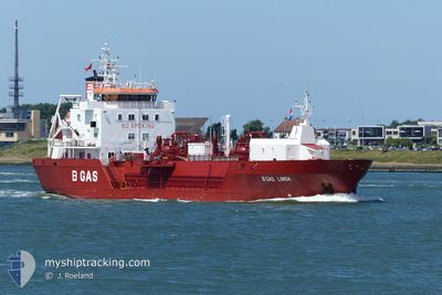
The vessel MAYOURY (IMO: 9777541, MMSI: 256775000) is a Tanker D It's sailing under the flag of [MT] Malta.
In this page you can find informations about the vessels current position, last detected port calls, and current voyage information. If the vessels is not in coverage by AIS you will find the latest position.
The current position of MAYOURY is detected by our AIS receivers and we are not responsible for the reliability of the data. The last position was recorded while the vessel was in Coverage by the Ais receivers of our vessel tracking app.
The current draught of MAYOURY as reported by AIS is 4.5 meters
Weather
| Temperature | 15.7°C / 60.26°F |
|---|---|
| Wind Speed | 7 knots |
| Direction | 149° SSE |
| Pressure | 1019.8 hPa |
| Humidity | 62.1 % |
| Cloud Coverage | 74 % |


Featured Company
Last Port Calls
| Port | Arrival | Departure | Time In Port |
|---|---|---|---|
| 2025-03-24 18:40 | 2025-03-25 15:03 | 20 h | |
| 2025-03-23 14:51 | 2025-03-23 19:44 | 4 h | |
| 2025-03-16 14:15 | 2025-03-17 13:32 | 23 h | |
| 2025-03-08 17:59 | 2025-03-10 07:27 | 1 d | |
| 2025-03-06 20:29 | 2025-03-07 02:52 | 6 h | |
| 2025-03-01 13:52 | 2025-03-02 13:06 | 23 h | |
| 2025-02-23 11:26 | 2025-02-24 06:10 | 18 h | |
| 2025-02-21 23:35 | 2025-02-22 03:55 | 4 h | |
| 2025-02-13 23:43 | 2025-02-15 10:23 | 1 d | |
| 2025-02-11 10:27 | 2025-02-13 07:26 | 1 d |
Most Visited Ports (Last year)
| Port | Arrivals | |
|---|---|---|
| 25 | ||
| 24 | ||
| 11 | ||
| 6 | ||
| 6 | ||
| 4 |
Last Trips
| Origin | Departure | Destination | Arrival | Distance | |
|---|---|---|---|---|---|
| 2025-03-23 20:44 | 2025-03-24 19:40 | 248.06 nm | |||
| 2025-03-17 13:32 | 2025-03-23 15:51 | 989.92 nm | |||
| 2025-03-10 08:27 | 2025-03-16 14:15 | 1222.36 nm | |||
| 2025-03-07 03:52 | 2025-03-08 18:59 | 250.91 nm | |||
| 2025-03-02 13:06 | 2025-03-06 21:29 | 969.13 nm | |||
| 2025-02-24 06:10 | 2025-03-01 13:52 | 574.27 nm | |||
| 2025-02-22 04:55 | 2025-02-23 11:26 | 9.28 nm | |||
| 2025-02-15 11:23 | 2025-02-22 00:35 | 707.15 nm | |||
| 2025-02-13 08:26 | 2025-02-14 00:43 | 168.05 nm | |||
| 2025-02-10 15:27 | 2025-02-11 11:27 | 171.88 nm |
Events
| Tid | Event | Detaljer | Position / Dest | Information |
|---|---|---|---|---|
| 2025-03-25 15:03 | AVGÅTT HAMN |
|
37.56820 / -1.00118
CARTAGENA
|
Fart: 5.5 kn Kurs: 290° |
| 2025-03-25 14:48 | STARTAR förflyttning |
37.56969 / -.96173
[ES] ESCOMBRERAS
|
Fart: 5.5 kn Kurs: 290° |
|
| 2025-03-24 19:06 | STOPPAR förflyttning |
37.56728 / -.95429
[ES] ESCOMBRERAS
|
Fart: Kurs: 237° |
|
| 2025-03-24 18:40 | ANLÄNDER HAMN |
|
37.57113 / -.96729
[ES] ESCOMBRERAS
|
Fart: 6.1 kn Kurs: 33° |
| 2025-03-24 16:32 | Status ändrad | Default Under way using engine |
37.30255 / -1.23644
CARTAGENA
|
Fart: 10.1 kn Kurs: 37.3° |
| 2025-03-24 16:26 | UTANFÖR täckningsområde |
37.28962 / -1.24900
Mediterranean Sea - Western Basin
CARTAGENA
|
Fart: 10.1 kn Kurs: 37.3° |
|
| 2025-03-24 16:22 | Status ändrad | Under way using engine Default |
37.28144 / -1.25682
CARTAGENA
|
Fart: 10.1 kn Kurs: 37° |
| 2025-03-24 16:13 | Status ändrad | Default Under way using engine |
37.26158 / -1.27571
CARTAGENA
|
Fart: 10.2 kn Kurs: 47.8° |
| 2025-03-24 15:37 | Status ändrad | Under way using engine Default |
37.18707 / -1.37155
CARTAGENA
|
Fart: 10.7 kn Kurs: 39° |
| 2025-03-24 15:36 | Status ändrad | Default Under way using engine |
37.18521 / -1.37344
CARTAGENA
|
Fart: 10.7 kn Kurs: 38.7° |