

MAYOURY
Tanker D

Current Trip
| Trip Time | 3 days |
|---|---|
| Trip Distance | 706.35 nm |
| AVG Speed | 8.8 Knopen |
| MAX Speed | 10.9 Knopen |
| Diepgang | 6 M |
| AVG Wind | 10.6 knots |
| MAX Wind | 22 knots |
| MIN Temp | 12.3°C / 54.14°F |
| MAX Temp | 25.2°C / 77.36°F |
| Positie ontvangen | 3 d geleden |
Current Position
| Lengtegraad | --- |
|---|---|
| Breedtegraat | --- |
| Status | Under way using engine |
| Snelheid | 8.7 Knopen |
| Koers | 267.6° |
| Gebied | North Atlantic Ocean |
| Station | T-AIS |
| Positie ontvangen | 3 d geleden |
Information
The current position of MAYOURY is in North Atlantic Ocean with coordinates 35.95072° / -6.13590° as reported on 2025-03-27 02:29 by AIS to our vessel tracker app. The vessel's current speed is 8.7 Knopen and is currently inside the port of AGADIR.
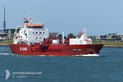
The vessel MAYOURY (IMO: 9777541, MMSI: 256775000) is a Tanker D It's sailing under the flag of [MT] Malta.
In this page you can find informations about the vessels current position, last detected port calls, and current voyage information. If the vessels is not in coverage by AIS you will find the latest position.
The current position of MAYOURY is detected by our AIS receivers and we are not responsible for the reliability of the data. The last position was recorded while the vessel was in Coverage by the Ais receivers of our vessel tracking app.
The current draught of MAYOURY as reported by AIS is 6 meters
Weather
| Temperature | 18.7°C / 65.66°F |
|---|---|
| Wind Speed | 6 knots |
| Direction | 190° S |
| Pressure | 1012.8 hPa |
| Humidity | 58.8 % |
| Cloud Coverage | 26 % |


Featured Company
Last Port Calls
| Port | Arrival | Departure | Time In Port |
|---|---|---|---|
| 2025-03-29 12:32 | |||
| 2025-03-24 19:40 | 2025-03-25 16:03 | 20 h | |
| 2025-03-23 15:51 | 2025-03-23 20:44 | 4 h | |
| 2025-03-16 14:15 | 2025-03-17 13:32 | 23 h | |
| 2025-03-08 18:59 | 2025-03-10 08:27 | 1 d | |
| 2025-03-06 21:29 | 2025-03-07 03:52 | 6 h | |
| 2025-03-01 13:52 | 2025-03-02 13:06 | 23 h | |
| 2025-02-23 11:26 | 2025-02-24 06:10 | 18 h | |
| 2025-02-22 00:35 | 2025-02-22 04:55 | 4 h | |
| 2025-02-14 00:43 | 2025-02-15 11:23 | 1 d |
Most Visited Ports (Last year)
| Port | Arrivals | |
|---|---|---|
| 25 | ||
| 24 | ||
| 12 | ||
| 6 | ||
| 6 | ||
| 4 |
Last Trips
| Origin | Departure | Destination | Arrival | Distance | |
|---|---|---|---|---|---|
| 2025-03-25 16:03 | 2025-03-29 12:32 | 706.35 nm | |||
| 2025-03-23 20:44 | 2025-03-24 19:40 | 248.06 nm | |||
| 2025-03-17 13:32 | 2025-03-23 15:51 | 989.92 nm | |||
| 2025-03-10 08:27 | 2025-03-16 14:15 | 1222.36 nm | |||
| 2025-03-07 03:52 | 2025-03-08 18:59 | 250.91 nm | |||
| 2025-03-02 13:06 | 2025-03-06 21:29 | 969.13 nm | |||
| 2025-02-24 06:10 | 2025-03-01 13:52 | 574.27 nm | |||
| 2025-02-22 04:55 | 2025-02-23 11:26 | 9.28 nm | |||
| 2025-02-15 11:23 | 2025-02-22 00:35 | 707.15 nm | |||
| 2025-02-13 08:26 | 2025-02-14 00:43 | 168.05 nm |
Events
| Tijd | Evenement | Details | Positie / Bestemming | Info |
|---|---|---|---|---|
| 2025-03-29 12:46 | Stop beweging |
30.42358 / -9.63865
[MA] AGADIR
|
Snelheid: 0.1 kn Koers: 217° |
|
| 2025-03-29 12:32 | Aankomsthaven |
|
30.42276 / -9.64165
[MA] AGADIR
|
Snelheid: 2.5 kn Koers: 354° |
| 2025-03-29 11:45 | Start beweging | 1.85 nm, South West of AGADIR |
30.40219 / -9.66497
AGADIR
|
Snelheid: 3.5 kn Koers: 95° |
| 2025-03-29 02:37 | Stop beweging | 2.19 nm, West of AGADIR |
30.42885 / -9.67408
AGADIR
|
Snelheid: 0.1 kn Koers: 99° |
| 2025-03-27 02:33 | Status Changed | Default Under way using engine |
35.95055 / -6.14726
AGADIR
|
Snelheid: 8.7 kn Koers: 267.6° |
| 2025-03-27 02:29 | Buitenbereik |
35.95072 / -6.13590
North Atlantic Ocean
AGADIR
|
Snelheid: 8.7 kn Koers: 267.6° |
|
| 2025-03-27 02:29 | Gevonden in zee | Spanish part of the North Atlantic Ocean |
35.95078 / -6.13436
North Atlantic Ocean
AGADIR
|
Snelheid: 8.7 kn Koers: 266.7° |
| 2025-03-27 02:27 | Status Changed | Under way using engine Default |
35.95100 / -6.12742
AGADIR
|
Snelheid: 8.6 kn Koers: 268° |
| 2025-03-27 02:03 | Status Changed | Default Under way using engine |
35.95301 / -6.05875
AGADIR
|
Snelheid: 8.4 kn Koers: 267.5° |
| 2025-03-27 01:37 | Gevonden in zee | Moroccan part of the North Atlantic Ocean |
35.95302 / -5.98142
North Atlantic Ocean
AGADIR
|
Snelheid: 8.4 kn Koers: 271.9° |