
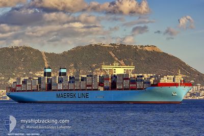
MATZ MAERSK
Container Ship
Current Trip
| Time Travelled | 6 days |
|---|---|
| Remaining Time | 5 h, 9 mins |
| Distance Travelled | 2319.89 nm |
| Remaining Distance | 97.29 nm |
| AVG Speed | 16.1 Knop |
| MAX Speed | 20 Knop |
| AVG Wind | 10 knots |
| MAX Wind | 25.8 knots |
| MIN Temp | 16.7°C / 62.06°F |
| MAX Temp | 30.7°C / 87.26°F |
| Djupgående | 12.6 m |
| Position mottagen | 1 d sen |
Current Position
| Longitud | 123.08225° |
|---|---|
| Latitude | 28.66468° |
| Status | Under way using engine |
| Fart | 16.3 Knop |
| Kurs | 11.1° |
| Område | Eastern China Sea |
| Station | T-AIS |
| Position mottagen | 1 d sen |
Info
Information
The current position of MATZ MAERSK is in Eastern China Sea with coordinates 28.66468° / 123.08225° as reported on 2024-05-15 00:10 by AIS to our vessel tracker app. The vessel's current speed is 16.3 Knop and is heading at the port of SHANGHAI. The estimated time of arrival as calculated by MyShipTracking vessel tracking app is 2024-05-17 08:48 LT
The vessel MATZ MAERSK (IMO: 9619983, MMSI: 219019365) is a Container Ship that was built in 2014 ( 10 År gammal ). It's sailing under the flag of [DK] Denmark.
In this page you can find informations about the vessels current position, last detected port calls, and current voyage information. If the vessels is not in coverage by AIS you will find the latest position.
The current position of MATZ MAERSK is detected by our AIS receivers and we are not responsible for the reliability of the data. The last position was recorded while the vessel was in Coverage by the Ais receivers of our vessel tracking app.
The current draught of MATZ MAERSK as reported by AIS is 12.6 meters
Weather
| Temperature | 17.9°C / 64.22°F |
|---|---|
| Wind Speed | 22 knots |
| Direction | 197° SSW |
| Pressure | 1014.2 hPa |
| Humidity | 72.6 % |
| Cloud Coverage | 7 % |
Featured Company
Last Port Calls
| Port | Arrival | Departure | Time In Port |
|---|---|---|---|
| 2024-05-09 10:07 | 2024-05-10 09:11 | 23 h | |
| 2024-04-07 06:09 | 2024-04-08 03:54 | 21 h | |
| 2024-04-05 01:03 | 2024-04-06 05:27 | 1 d | |
| 2024-04-01 15:37 | 2024-04-03 04:28 | 1 d | |
| 2024-03-27 04:33 | 2024-03-29 01:47 | 1 d | |
| 2024-03-24 05:31 | 2024-03-26 19:10 | 2 d | |
| 2024-03-21 06:18 | 2024-03-22 22:48 | 1 d | |
| 2024-03-18 21:29 | 2024-03-20 13:00 | 1 d |
Most Visited Ports (Last year)
| Port | Arrivals | |
|---|---|---|
| 8 | ||
| 4 | ||
| 4 | ||
| 4 | ||
| 4 | ||
| 4 |
Last Trips
| Origin | Departure | Destination | Arrival | Distance | |
|---|---|---|---|---|---|
| 2024-04-08 03:54 | 2024-05-09 10:07 | 11884.80 nm | |||
| 2024-04-06 05:27 | 2024-04-07 06:09 | 317.71 nm | |||
| 2024-04-03 04:28 | 2024-04-05 01:03 | 361.69 nm | |||
| 2024-03-29 01:47 | 2024-04-01 15:37 | 563.03 nm | |||
| 2024-03-26 19:10 | 2024-03-27 04:33 | 137.45 nm | |||
| 2024-03-22 22:48 | 2024-03-24 05:31 | 391.02 nm | |||
| 2024-03-20 13:00 | 2024-03-21 06:18 | 274.14 nm | |||
| 2024-02-21 07:43 | 2024-03-18 21:29 | 11877.31 nm |
Events
| Tid | Event | Detaljer | Position / Dest | Information |
|---|---|---|---|---|
| 2024-05-16 11:44 | STARTAR förflyttning | 3.33 nm, West of YANGSHAN |
30.60998 / 122.07028
SGSIN -->CNSGH
|
Fart: 5.4 kn Kurs: 126° |
| 2024-05-15 12:32 | STOPPAR förflyttning | 3.38 nm, West of YANGSHAN |
30.61555 / 122.06982
SGSIN -->CNSGH
|
Fart: 0.2 kn Kurs: 309° |
| 2024-05-15 00:17 | Status ändrad | Default Under way using engine |
28.69543 / 123.08894
SGSIN -->CNSGH
|
Fart: 16.3 kn Kurs: 11.1° |
| 2024-05-15 00:10 | UTANFÖR täckningsområde |
28.66468 / 123.08225
Eastern China Sea
SGSIN -->CNSGH
|
Fart: 16.3 kn Kurs: 11.1° |
|
| 2024-05-14 23:43 | Djupgående ändrat | 12.6 11.5 |
28.55010 / 123.03325
SGSIN -->CNSGH
|
Fart: 16.3 kn Kurs: 24.6° |
| 2024-05-14 23:43 | ETA ändrat | 2024/05/15 10:30 2024/05/15 08:00 |
28.55010 / 123.03325
SGSIN -->CNSGH
|
Fart: 16.3 kn Kurs: 24.6° |
| 2024-05-14 23:41 | Status ändrad | Under way using engine Default |
28.54545 / 123.03092
SGSIN -->CNSGH
|
Fart: 16.2 kn Kurs: 21° |
| 2024-05-14 23:28 | Status ändrad | Default Under way using engine |
28.49010 / 123.00558
SGSIN -->CNSGH
|
Fart: 16.3 kn Kurs: 27° |
| 2024-05-14 23:18 | Status ändrad | Under way using engine Default |
28.44732 / 122.98093
SGSIN -->CNSGH
|
Fart: 16.2 kn Kurs: 27° |
| 2024-05-14 23:12 | I täckningsområde |
28.45133 / 122.98327
Eastern China Sea
SGSIN -->CNSGH
|
Fart: 16.3 kn Kurs: 27° |