

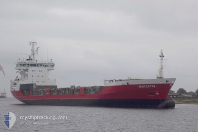
MARJATTA
General Cargo

Current Trip
| Trip Time | 4 days |
|---|---|
| Trip Distance | 1300.56 nm |
| AVG Speed | 13.4 Knop |
| MAX Speed | 17 Knop |
| Djupgående | 6.8 m |
| AVG Wind | 19.9 knots |
| MAX Wind | 29 knots |
| MIN Temp | -11.9°C / 10.58°F |
| MAX Temp | 21.2°C / 70.16°F |
| Position mottagen | 2 d sen |
Current Position
| Longitud | --- |
|---|---|
| Latitude | --- |
| Status | Under way using engine |
| Fart | 15.1 Knop |
| Kurs | 27° |
| Område | Gulf of Bothnia |
| Station | T-AIS |
| Position mottagen | 2 d sen |
Information
The current position of MARJATTA is in Gulf of Bothnia with coordinates 63.49400° / 20.68717° as reported on 2025-03-24 23:27 by AIS to our vessel tracker app. The vessel's current speed is 15.1 Knop and is currently inside the port of ROYTTA.
The vessel MARJATTA (IMO: 9126247, MMSI: 230352000) is a General Cargo that was built in 1996 ( 29 År gammal ). It's sailing under the flag of [FI] Finland.
In this page you can find informations about the vessels current position, last detected port calls, and current voyage information. If the vessels is not in coverage by AIS you will find the latest position.
The current position of MARJATTA is detected by our AIS receivers and we are not responsible for the reliability of the data. The last position was recorded while the vessel was in Coverage by the Ais receivers of our vessel tracking app.
The current draught of MARJATTA as reported by AIS is 6.8 meters
Weather
| Temperature | 1°C / 33.8°F |
|---|---|
| Wind Speed | 14 knots |
| Direction | 219° SW |
| Pressure | 995.9 hPa |
| Humidity | 93.9 % |
| Cloud Coverage | 49 % |


Featured Company
Last Port Calls
| Port | Arrival | Departure | Time In Port |
|---|---|---|---|
| 2025-03-26 02:42 | |||
| 2025-03-20 03:02 | 2025-03-21 13:54 | 1 d | |
| 2025-03-19 19:06 | 2025-03-19 19:57 | 51 m | |
| 2025-03-19 01:27 | 2025-03-19 18:21 | 16 h | |
| 2025-03-19 01:05 | 2025-03-19 01:19 | 14 m | |
| 2025-03-16 18:42 | 2025-03-17 01:09 | 6 h | |
| 2025-03-11 01:05 | 2025-03-13 17:18 | 2 d | |
| 2025-03-05 09:05 | 2025-03-06 20:18 | 1 d | |
| 2025-03-04 02:44 | 2025-03-04 21:45 | 19 h | |
| 2025-03-04 02:20 | 2025-03-04 02:37 | 16 m |
Last Trips
| Origin | Departure | Destination | Arrival | Distance | |
|---|---|---|---|---|---|
| 2025-03-21 13:54 | 2025-03-26 02:42 | 1300.56 nm | |||
| 2025-03-19 19:57 | 2025-03-20 03:02 | 97.42 nm | |||
| 2025-03-19 18:21 | 2025-03-19 19:06 | 2.33 nm | |||
| 2025-03-19 01:19 | 2025-03-19 01:27 | 0.94 nm | |||
| 2025-03-17 01:09 | 2025-03-19 01:05 | 636.81 nm | |||
| 2025-03-13 17:18 | 2025-03-16 18:42 | 861.90 nm | |||
| 2025-03-06 20:18 | 2025-03-11 01:05 | 1470.16 nm | |||
| 2025-03-04 21:45 | 2025-03-05 09:05 | 105.26 nm | |||
| 2025-03-04 02:37 | 2025-03-04 02:44 | 1.01 nm | |||
| 2025-02-26 19:49 | 2025-03-04 02:20 | 1516.58 nm |
Events
| Tid | Event | Detaljer | Position / Dest | Information |
|---|---|---|---|---|
| 2025-03-26 00:54 | STOPPAR förflyttning |
65.75250 / 24.15917
[FI] ROYTTA
|
Fart: 0.3 kn Kurs: 37° |
|
| 2025-03-26 00:42 | ANLÄNDER HAMN |
|
65.75083 / 24.15783
[FI] ROYTTA
|
Fart: 1.8 kn Kurs: 17° |
| 2025-03-25 21:50 | STARTAR förflyttning | 18.61 nm, South West of AJOS |
65.40533 / 24.09033
FI TOR
|
Fart: 10.7 kn Kurs: 75° |
| 2025-03-25 21:30 | STOPPAR förflyttning | 19.14 nm, South West of AJOS |
65.40217 / 24.06417
FI TOR
|
Fart: Kurs: 74° |
| 2025-03-25 21:14 | STARTAR förflyttning | 21.38 nm, South West of AJOS |
65.38633 / 23.96633
FI TOR
|
Fart: 7.8 kn Kurs: 74° |
| 2025-03-25 17:22 | STOPPAR förflyttning |
65.38533 / 23.95583
FI TOR
|
Fart: 0.1 kn Kurs: 78° |
|
| 2025-03-25 17:06 | STARTAR förflyttning |
65.38500 / 23.92717
FI TOR
|
Fart: 8.2 kn Kurs: 91° |
|
| 2025-03-25 16:46 | STOPPAR förflyttning |
65.38567 / 23.90583
FI TOR
|
Fart: Kurs: 95° |
|
| 2025-03-25 13:42 | STARTAR förflyttning |
65.15166 / 23.41200
FI TOR
|
Fart: 7.5 kn Kurs: 306° |
|
| 2025-03-25 08:06 | STOPPAR förflyttning |
65.15166 / 23.41650
FI TOR
|
Fart: 0.1 kn Kurs: 22° |