
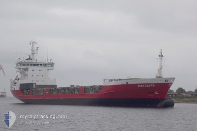
MARJATTA
General Cargo
Current Trip
| Trip Time | 13 h, 20 mins |
|---|---|
| Trip Distance | 180.03 nm |
| AVG Speed | 13.7 Knots |
| MAX Speed | 15.3 Knots |
| Dybgang | 6.5 m |
| AVG Wind | 9.5 knots |
| MAX Wind | 13.8 knots |
| MIN Temp | 3.5°C / 38.3°F |
| MAX Temp | 5°C / 41°F |
| Position Modtaget | 4 m siden |
Current Position
| Longitude | --- |
|---|---|
| Latitude | --- |
| Status | Moored |
| Fart | |
| Kurs | 201° |
| Område | Kattegat |
| Station | T-AIS |
| Position Modtaget | 4 m siden |
Info
Information
The current position of MARJATTA is in Kattegat with coordinates 56.02983° / 12.69467° as reported on 2025-01-25 19:10 by AIS to our vessel tracker app. The vessel's current speed is 0 Knots and is currently inside the port of HELSINGBORG.
The vessel MARJATTA (IMO: 9126247, MMSI: 230352000) is a General Cargo that was built in 1996 ( 29 år gamle ). It's sailing under the flag of [FI] Finland.
In this page you can find informations about the vessels current position, last detected port calls, and current voyage information. If the vessels is not in coverage by AIS you will find the latest position.
The current position of MARJATTA is detected by our AIS receivers and we are not responsible for the reliability of the data. The last position was recorded while the vessel was in Coverage by the Ais receivers of our vessel tracking app.
The current draught of MARJATTA as reported by AIS is 6.5 meters
Weather
| Temperature | 4.8°C / 40.64°F |
|---|---|
| Wind Speed | 11 knots |
| Direction | 256° WSW |
| Pressure | 1004.1 hPa |
| Humidity | 80.2 % |
| Cloud Coverage | 100 % |
Featured Company
Last Port Calls
| Port | Arrival | Departure | Time In Port |
|---|---|---|---|
| 2025-01-25 17:39 | |||
| 2025-01-25 04:15 | 2025-01-25 04:19 | 4 m | |
| 2025-01-23 19:45 | 2025-01-23 20:50 | 1 h | |
| 2025-01-22 11:59 | 2025-01-23 19:16 | 1 d | |
| 2025-01-22 10:01 | 2025-01-22 10:03 | 2 m | |
| 2025-01-19 08:19 | 2025-01-20 07:05 | 22 h | |
| 2025-01-14 13:30 | 2025-01-16 18:13 | 2 d | |
| 2025-01-08 08:29 | 2025-01-09 15:40 | 1 d | |
| 2025-01-07 03:53 | 2025-01-07 23:18 | 19 h | |
| 2025-01-07 03:18 | 2025-01-07 03:34 | 15 m |
Last Trips
| Origin | Departure | Destination | Arrival | Distance | |
|---|---|---|---|---|---|
| 2025-01-25 04:19 | 2025-01-25 17:39 | 180.03 nm | |||
| 2025-01-23 20:50 | 2025-01-25 04:15 | 370.69 nm | |||
| 2025-01-23 19:16 | 2025-01-23 19:45 | 2.19 nm | |||
| 2025-01-22 10:03 | 2025-01-22 11:59 | 5.33 nm | |||
| 2025-01-20 07:05 | 2025-01-22 10:01 | 633.34 nm | |||
| 2025-01-16 18:13 | 2025-01-19 08:19 | 859.11 nm | |||
| 2025-01-09 15:40 | 2025-01-14 13:30 | 1507.49 nm | |||
| 2025-01-07 23:18 | 2025-01-08 08:29 | 102.17 nm | |||
| 2025-01-07 03:34 | 2025-01-07 03:53 | 1.52 nm | |||
| 2025-01-02 19:25 | 2025-01-07 03:18 | 1307.11 nm |
Events
| Tid | Hændelsen | Detaljer | Position / Dest | Info |
|---|---|---|---|---|
| 2025-01-25 17:00 | Status er ændret | Moored Under way using engine |
56.02983 / 12.69467
[SE] HELSINGBORG
|
Fart: Kurs: 201° |
| 2025-01-25 16:56 | STOP Sejllads |
56.02983 / 12.69467
[SE] HELSINGBORG
|
Fart: 0.3 kn Kurs: 202° |
|
| 2025-01-25 16:39 | Skibe i havn |
|
56.02150 / 12.69300
[SE] HELSINGBORG
|
Fart: 3.9 kn Kurs: 359° |
| 2025-01-25 15:37 | Ændre havområde | Swedish part of the Kattegat Danish part of the Kattegat |
55.82317 / 12.71833
Kattegat
SEHEL
|
Fart: 14.7 kn Kurs: 9° |
| 2025-01-25 13:54 | Ændre havområde | Danish part of the Kattegat Swedish part of the Kattegat |
55.48617 / 12.70583
Kattegat
SEHEL
|
Fart: 9.3 kn Kurs: 8° |
| 2025-01-25 13:11 | Ændre havområde | Swedish part of the Kattegat Swedish part of the Baltic Sea |
55.33750 / 12.66033
Kattegat
SEHEL
|
Fart: 14 kn Kurs: 8° |
| 2025-01-25 12:53 | Ændre havområde | Swedish part of the Baltic Sea Danish part of the Baltic Sea |
55.26817 / 12.67400
Baltic Sea
SEHEL
|
Fart: 14.5 kn Kurs: 1° |
| 2025-01-25 09:53 | Ændre havområde | Danish part of the Baltic Sea German part of the Baltic Sea |
54.59017 / 12.31833
Baltic Sea
SEHEL
|
Fart: 14.3 kn Kurs: 15° |
| 2025-01-25 08:56 | Ændre havområde | German part of the Baltic Sea Danish part of the Baltic Sea |
54.41150 / 12.13150
Baltic Sea
SEHEL
|
Fart: 13.8 kn Kurs: 90° |
| 2025-01-25 07:02 | Ændre havområde | Danish part of the Baltic Sea German part of the Baltic Sea |
54.51150 / 11.42067
Baltic Sea
SEHEL
|
Fart: 13.1 kn Kurs: 120° |