
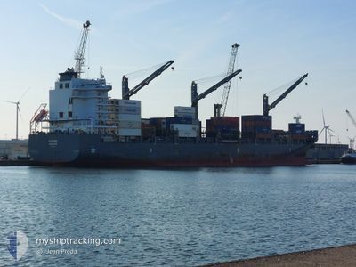
MARINER
Cargo A
Current Trip
| Time Travelled | 1 day |
|---|---|
| Remaining Time | 15 h, 22 mins |
| Distance Travelled | 346.08 nm |
| Remaining Distance | 165.47 nm |
| AVG Speed | 9.5 Knop |
| MAX Speed | 15.3 Knop |
| AVG Wind | 13.3 knots |
| MAX Wind | 21.6 knots |
| MIN Temp | 25.7°C / 78.26°F |
| MAX Temp | 27.7°C / 81.86°F |
| Djupgående | 8.3 m |
| Position mottagen | 3 h, 17 m sen |
Current Position
| Longitud | -94.40864° |
|---|---|
| Latitude | 26.58301° |
| Status | Under way using engine |
| Fart | 10.6 Knop |
| Kurs | 358.9° |
| Område | Gulf of Mexico |
| Station | T-AIS |
| Position mottagen | 3 h, 17 m sen |
Info
Information
The current position of MARINER is in Gulf of Mexico with coordinates 26.58301° / -94.40864° as reported on 2024-05-10 06:15 by AIS to our vessel tracker app. The vessel's current speed is 10.6 Knop and is heading at the port of HOUSTON. The estimated time of arrival as calculated by MyShipTracking vessel tracking app is 2024-05-11 00:55 LT
The vessel MARINER (IMO: 9694414, MMSI: 563417000) is a Cargo A It's sailing under the flag of [SG] Singapore.
In this page you can find informations about the vessels current position, last detected port calls, and current voyage information. If the vessels is not in coverage by AIS you will find the latest position.
The current position of MARINER is detected by our AIS receivers and we are not responsible for the reliability of the data. The last position was recorded while the vessel was in Coverage by the Ais receivers of our vessel tracking app.
The current draught of MARINER as reported by AIS is 8.3 meters
Weather
| Temperature | 25.7°C / 78.26°F |
|---|---|
| Wind Speed | 7 knots |
| Direction | 174° S |
| Pressure | 1006.7 hPa |
| Humidity | 95.2 % |
| Cloud Coverage | 7 % |
Featured Company
Last Port Calls
| Port | Arrival | Departure | Time In Port |
|---|---|---|---|
| 2024-05-08 12:18 | 2024-05-09 00:36 | 12 h | |
| 2024-05-06 23:25 | 2024-05-07 17:57 | 18 h | |
| 2024-05-03 14:26 | 2024-05-04 02:35 | 12 h | |
| 2024-04-20 18:39 | 2024-04-21 22:06 | 1 d | |
| 2024-04-14 05:06 | 2024-04-14 10:52 | 5 h | |
| 2024-04-11 05:30 | 2024-04-12 07:43 | 1 d | |
| 2024-04-09 18:01 | 2024-04-10 05:17 | 11 h | |
| 2024-04-03 08:22 | 2024-04-04 17:54 | 1 d | |
| 2024-03-28 22:29 | 2024-03-29 22:08 | 23 h | |
| 2024-03-28 06:21 | 2024-03-28 15:16 | 8 h |
Most Visited Ports (Last year)
| Port | Arrivals | |
|---|---|---|
| 6 | ||
| 5 | ||
| 4 | ||
| 4 | ||
| 4 | ||
| 4 |
Last Trips
| Origin | Departure | Destination | Arrival | Distance | |
|---|---|---|---|---|---|
| 2024-05-07 12:57 | 2024-05-08 07:18 | 241.42 nm | |||
| 2024-05-03 22:35 | 2024-05-06 18:25 | 1096.32 nm | |||
| 2024-04-22 00:06 | 2024-05-03 10:26 | 4286.86 nm | |||
| 2024-04-14 12:52 | 2024-04-20 20:39 | 177.65 nm | |||
| 2024-04-12 09:43 | 2024-04-14 07:06 | 366.78 nm | |||
| 2024-04-10 07:17 | 2024-04-11 07:30 | 70.23 nm | |||
| 2024-04-04 19:54 | 2024-04-09 20:01 | 1466.06 nm | |||
| 2024-03-29 23:08 | 2024-04-03 10:22 | 838.20 nm | |||
| 2024-03-28 15:16 | 2024-03-28 23:29 | 81.22 nm | |||
| 2024-03-27 04:27 | 2024-03-28 06:21 | 164.34 nm |
Events
| Tid | Event | Detaljer | Position / Dest | Information |
|---|---|---|---|---|
| 2024-05-10 06:23 | Status ändrad | Default Under way using engine |
26.60394 / -94.40895
MXATM=>USHOU
|
Fart: 10.6 kn Kurs: 358.9° |
| 2024-05-10 06:15 | UTANFÖR täckningsområde |
26.58301 / -94.40864
Gulf of Mexico
MXATM=>USHOU
|
Fart: 10.6 kn Kurs: 358.9° |
|
| 2024-05-10 06:11 | Status ändrad | Under way using engine Default |
26.57107 / -94.40842
MXATM=>USHOU
|
Fart: 10.6 kn Kurs: 359° |
| 2024-05-10 06:10 | Status ändrad | Default Under way using engine |
26.56914 / -94.40839
MXATM=>USHOU
|
Fart: 10.6 kn Kurs: 358.4° |
| 2024-05-10 06:10 | Status ändrad | Under way using engine Default |
26.56865 / -94.40838
MXATM=>USHOU
|
Fart: 10.7 kn Kurs: 1° |
| 2024-05-10 06:06 | Status ändrad | Default Under way using engine |
26.55720 / -94.40813
MXATM=>USHOU
|
Fart: 10.7 kn Kurs: 0.7° |
| 2024-05-10 04:42 | Status ändrad | Under way using engine Default |
26.30787 / -94.43974
MXATM=>USHOU
|
Fart: 10.9 kn Kurs: 29° |
| 2024-05-10 04:26 | I täckningsområde |
26.30787 / -94.43974
Gulf of Mexico
MXATM=>USHOU
|
Fart: 10.9 kn Kurs: 29.8° |
|
| 2024-05-10 03:42 | Status ändrad | Default Under way using engine |
26.15730 / -94.55785
MXATM=>USHOU
|
Fart: 10.8 kn Kurs: 37° |
| 2024-05-10 03:36 | UTANFÖR täckningsområde |
26.14420 / -94.56892
Gulf of Mexico
MXATM=>USHOU
|
Fart: 10.8 kn Kurs: 37° |