
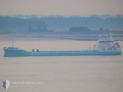
MARIETJE ANDREA
General Cargo
Current Trip
| Time Travelled | 1 day |
|---|---|
| Remaining Time | --- |
| Distance Travelled | 336.41 nm |
| Remaining Distance | --- |
| AVG Speed | 10.8 Knop |
| MAX Speed | 12.7 Knop |
| AVG Wind | 12.9 knots |
| MAX Wind | 22 knots |
| MIN Temp | -4.5°C / 23.9°F |
| MAX Temp | 0.8°C / 33.44°F |
| Djupgående | 6.9 m |
| Position mottagen | 1 m sen |
Current Position
| Longitud | --- |
|---|---|
| Latitude | --- |
| Status | Under way using engine |
| Fart | 11.9 Knop |
| Kurs | 346.5° |
| Område | Kattegat |
| Station | T-AIS |
| Position mottagen | 1 m sen |
Info
Information
The current position of MARIETJE ANDREA is in Kattegat with coordinates 56.71531° / 12.20736° as reported on 2025-02-16 14:10 by AIS to our vessel tracker app. The vessel's current speed is 11.9 Knop and is heading at the port of SEVILLA. The estimated time of arrival as calculated by MyShipTracking vessel tracking app is 2025-02-24 10:00 LT
The vessel MARIETJE ANDREA (IMO: 9361134, MMSI: 246649000) is a General Cargo that was built in 2009 ( 16 År gammal ). It's sailing under the flag of [NL] Netherlands.
In this page you can find informations about the vessels current position, last detected port calls, and current voyage information. If the vessels is not in coverage by AIS you will find the latest position.
The current position of MARIETJE ANDREA is detected by our AIS receivers and we are not responsible for the reliability of the data. The last position was recorded while the vessel was in Coverage by the Ais receivers of our vessel tracking app.
The current draught of MARIETJE ANDREA as reported by AIS is 6.9 meters
Weather
| Temperature | -3.2°C / 26.24°F |
|---|---|
| Wind Speed | 9 knots |
| Direction | 327° NNW |
| Pressure | 1028.4 hPa |
| Humidity | 58.8 % |
| Cloud Coverage | --- |
Featured Company
Last Port Calls
| Port | Arrival | Departure | Time In Port |
|---|---|---|---|
| 2025-02-13 13:46 | 2025-02-15 08:43 | 1 d | |
| 2025-02-10 07:19 | 2025-02-11 13:17 | 1 d | |
| 2025-02-05 22:14 | 2025-02-06 22:56 | 1 d | |
| 2025-02-01 22:43 | 2025-02-03 23:53 | 2 d | |
| 2025-01-28 10:44 | 2025-01-29 12:41 | 1 d | |
| 2025-01-18 10:21 | 2025-01-21 10:05 | 2 d | |
| 2025-01-02 14:43 | 2025-01-11 13:14 | 8 d | |
| 2024-12-16 05:08 | 2024-12-17 21:14 | 1 d | |
| 2024-12-09 14:17 | 2024-12-12 16:40 | 3 d | |
| 2024-12-02 13:27 |
Last Trips
| Origin | Departure | Destination | Arrival | Distance | |
|---|---|---|---|---|---|
| 2025-02-11 14:17 | 2025-02-13 14:46 | 517.22 nm | |||
| 2025-02-06 23:56 | 2025-02-10 08:19 | 531.66 nm | |||
| 2025-02-04 00:53 | 2025-02-05 23:14 | 529.75 nm | |||
| 2025-01-29 13:41 | 2025-02-01 23:43 | 415.45 nm | |||
| 2025-01-21 11:05 | 2025-01-28 11:44 | 1278.55 nm | |||
| 2025-01-11 14:14 | 2025-01-18 11:21 | 1217.87 nm | |||
| 2024-12-18 00:14 | 2025-01-02 15:43 | 3682.20 nm | |||
| 2024-12-12 19:40 | 2024-12-16 08:08 | 491.18 nm | |||
| 2024-12-02 14:27 | 2024-12-09 17:17 | 1563.28 nm |
Events
| Tid | Event | Detaljer | Position / Dest | Information |
|---|---|---|---|---|
| 2025-02-16 09:22 | Byter havsområde | Swedish part of the Kattegat Danish part of the Kattegat |
55.82596 / 12.71183
Kattegat
ESSVQ
|
Fart: 11.9 kn Kurs: 12.1° |
| 2025-02-16 07:37 | Byter havsområde | Danish part of the Kattegat Swedish part of the Kattegat |
55.48880 / 12.71345
Kattegat
ESSVQ
|
Fart: 11.7 kn Kurs: 4.6° |
| 2025-02-16 06:52 | Byter havsområde | Swedish part of the Kattegat Swedish part of the Baltic Sea |
55.34583 / 12.69267
Kattegat
ESSVQ
|
Fart: 11.3 kn Kurs: 5.2° |
| 2025-02-16 04:38 | Status ändrad | Under way using engine Default |
55.23969 / 13.37969
ESSVQ
|
Fart: 11.8 kn Kurs: 273° |
| 2025-02-16 04:29 | Status ändrad | Default Under way using engine |
55.23830 / 13.43042
ESSVQ
|
Fart: 11.9 kn Kurs: 272.5° |
| 2025-02-16 01:53 | Byter havsområde | Swedish part of the Baltic Sea Danish part of the Kattegat |
55.19267 / 14.29928
Baltic Sea
ESSVQ
|
Fart: 8.8 kn Kurs: 353.1° |
| 2025-02-15 21:37 | Upptäckt i hav | Danish part of the Kattegat |
54.90347 / 15.47193
Kattegat
ESSVQ
|
Fart: 11.8 kn Kurs: 267.5° |
| 2025-02-15 18:56 | I täckningsområde |
54.91658 / 16.37075
Baltic Sea
ESSVQ
|
Fart: 11.5 kn Kurs: 268.9° |
|
| 2025-02-15 13:41 | Status ändrad | Default Under way using engine |
54.94596 / 18.08840
ESSVQ
|
Fart: 11.2 kn Kurs: 277.6° |
| 2025-02-15 13:39 | UTANFÖR täckningsområde |
54.94513 / 18.09921
Baltic Sea
ESSVQ
|
Fart: 11.2 kn Kurs: 277.6° |