

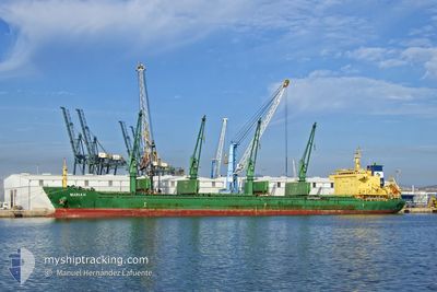
MARIA H
Bulk Carrier

Current Trip
| Time Travelled | 6 days |
|---|---|
| Remaining Time | --- |
| Distance Travelled | 1423.91 nm |
| Remaining Distance | 6.67 nm |
| AVG Speed | 10 Knop |
| MAX Speed | 12.4 Knop |
| AVG Wind | 7.8 knots |
| MAX Wind | 20.9 knots |
| MIN Temp | 7.3°C / 45.14°F |
| MAX Temp | 17.6°C / 63.68°F |
| Djupgående | 9.9 m |
| Position mottagen | 3 d sen |
Current Position
| Longitud | --- |
|---|---|
| Latitude | --- |
| Status | Under way using engine |
| Fart | 11.6 Knop |
| Kurs | 296.3° |
| Område | Mediterranean Sea - Eastern Basin |
| Station | T-AIS |
| Position mottagen | 3 d sen |
Information
The current position of MARIA H is in Mediterranean Sea - Eastern Basin with coordinates 36.24161° / 14.08223° as reported on 2025-02-18 00:52 by AIS to our vessel tracker app. The vessel's current speed is 11.6 Knop and is heading at the port of ALGER. The estimated time of arrival as calculated by MyShipTracking vessel tracking app is 2025-02-20 02:00 LT
The vessel MARIA H (IMO: 9571650, MMSI: 356312000) is a Bulk Carrier that was built in 2013 ( 12 År gammal ). It's sailing under the flag of [PA] Panama.
In this page you can find informations about the vessels current position, last detected port calls, and current voyage information. If the vessels is not in coverage by AIS you will find the latest position.
The current position of MARIA H is detected by our AIS receivers and we are not responsible for the reliability of the data. The last position was recorded while the vessel was in Coverage by the Ais receivers of our vessel tracking app.
The current draught of MARIA H as reported by AIS is 9.9 meters
Weather
| Temperature | 12°C / 53.6°F |
|---|---|
| Wind Speed | 3 knots |
| Direction | 119° ESE |
| Pressure | 1026.9 hPa |
| Humidity | 92.4 % |
| Cloud Coverage | --- |


Featured Company
Most Visited Ports (Last year)
| Port | Arrivals | |
|---|---|---|
| 2 | ||
| 2 | ||
| 1 | ||
| 1 | ||
| 1 | ||
| 1 |
Events
| Tid | Event | Detaljer | Position / Dest | Information |
|---|---|---|---|---|
| 2025-02-20 06:22 | STOPPAR förflyttning | 2.61 nm, North East of ALGER |
36.80973 / 3.09459
ALGIERS
|
Fart: 0.1 kn Kurs: 245° |
| 2025-02-18 01:06 | Status ändrad | Default Under way using engine |
36.26517 / 14.03447
ALGIERS
|
Fart: 11.6 kn Kurs: 296.3° |
| 2025-02-18 00:52 | UTANFÖR täckningsområde |
36.24161 / 14.08223
Mediterranean Sea - Eastern Basin
ALGIERS
|
Fart: 11.6 kn Kurs: 296.3° |
|
| 2025-02-17 23:11 | Destination ändrad | ALGIERS MALTA |
36.13215 / 14.46605
ALGIERS
|
Fart: 11.7 kn Kurs: 301.3° |
| 2025-02-17 23:11 | ETA ändrat | 2025/02/20 02:00 2025/02/17 15:00 |
36.13215 / 14.46605
ALGIERS
|
Fart: 11.7 kn Kurs: 301.3° |
| 2025-02-17 21:57 | Status ändrad | Under way using engine Default |
36.01547 / 14.68985
MALTA
|
Fart: 7.3 kn Kurs: 359° |
| 2025-02-17 21:53 | Status ändrad | Default Under way using engine |
36.00859 / 14.69008
MALTA
|
Fart: 7.2 kn Kurs: 359.2° |
| 2025-02-17 21:02 | Status ändrad | Under way using engine At anchor |
35.92243 / 14.75199
MALTA
|
Fart: 8 kn Kurs: 304° |
| 2025-02-17 20:54 | Status ändrad | At anchor Default |
35.91401 / 14.76511
MALTA
|
Fart: 3.1 kn Kurs: 310° |
| 2025-02-17 20:53 | Status ändrad | Default At anchor |
35.91347 / 14.76589
MALTA
|
Fart: 3 kn Kurs: 310° |