
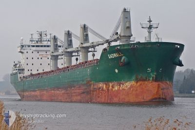
MARIA G
Bulk Carrier
Current Trip
| Time Travelled | 21 days |
|---|---|
| Remaining Time | --- |
| Distance Travelled | 3179.39 nm |
| Remaining Distance | --- |
| AVG Speed | 11.2 Knop |
| MAX Speed | 14.3 Knop |
| AVG Wind | 13.7 knots |
| MAX Wind | 35 knots |
| MIN Temp | -1.4°C / 29.48°F |
| MAX Temp | 19.1°C / 66.38°F |
| Djupgående | 9.8 m |
| Position mottagen | 9 d sen |
Current Position
| Longitud | -9.19726° |
|---|---|
| Latitude | 33.49132° |
| Status | Under way using engine |
| Fart | 11.6 Knop |
| Kurs | 132.7° |
| Område | North Atlantic Ocean |
| Station | T-AIS |
| Position mottagen | 9 d sen |
Info
Information
The current position of MARIA G is in North Atlantic Ocean with coordinates 33.49132° / -9.19726° as reported on 2024-05-12 21:09 by AIS to our vessel tracker app. The vessel's current speed is 11.6 Knop
The vessel MARIA G (IMO: 9358369, MMSI: 248203000) is a Bulk Carrier that was built in 2007 ( 17 År gammal ). It's sailing under the flag of [MT] Malta.
In this page you can find informations about the vessels current position, last detected port calls, and current voyage information. If the vessels is not in coverage by AIS you will find the latest position.
The current position of MARIA G is detected by our AIS receivers and we are not responsible for the reliability of the data. The last position was recorded while the vessel was in Coverage by the Ais receivers of our vessel tracking app.
The current draught of MARIA G as reported by AIS is 9.8 meters
Weather
| Temperature | 17.7°C / 63.86°F |
|---|---|
| Wind Speed | 18 knots |
| Direction | 40° NE |
| Pressure | 1019.1 hPa |
| Humidity | 71.9 % |
| Cloud Coverage | 8 % |
Featured Company
Last Port Calls
| Port | Arrival | Departure | Time In Port |
|---|---|---|---|
| 2024-04-29 10:46 | 2024-04-30 18:45 | 1 d | |
| 2024-04-27 23:58 | 2024-04-28 00:39 | 41 m | |
| 2024-04-21 22:49 | 2024-04-24 01:01 | 2 d | |
| 2024-04-21 00:14 | 2024-04-21 02:48 | 2 h | |
| 2024-04-18 20:01 | 2024-04-18 20:45 | 43 m | |
| 2024-04-05 15:03 | 2024-04-18 15:42 | 13 d | |
| 2024-04-04 03:26 | 2024-04-04 04:51 | 1 h | |
| 2024-04-01 23:59 | 2024-04-03 22:25 | 1 d | |
| 2024-03-15 10:34 | 2024-03-19 04:50 | 3 d |
Most Visited Ports (Last year)
| Port | Arrivals | |
|---|---|---|
| 7 | ||
| 4 | ||
| 2 | ||
| 2 | ||
| 2 | ||
| 1 |
Last Trips
| Origin | Departure | Destination | Arrival | Distance | |
|---|---|---|---|---|---|
| 2024-04-27 20:39 | 2024-04-29 06:46 | 296.07 nm | |||
| 2024-04-23 21:01 | 2024-04-27 19:58 | 737.77 nm | |||
| 2024-04-20 22:48 | 2024-04-21 18:49 | 235.11 nm | |||
| 2024-04-18 16:45 | 2024-04-20 20:14 | 517.95 nm | |||
| 2024-04-18 11:42 | 2024-04-18 16:01 | 35.56 nm | |||
| 2024-04-04 00:51 | 2024-04-05 11:03 | 266.58 nm | |||
| 2024-04-03 18:25 | 2024-04-03 23:26 | 39.54 nm | |||
| 2024-03-19 00:50 | 2024-04-01 19:59 | 2.57 nm | |||
| 2024-02-15 11:22 | 2024-03-15 06:34 | 5502.04 nm |
Events
| Tid | Event | Detaljer | Position / Dest | Information |
|---|---|---|---|---|
| 2024-05-13 00:40 | STOPPAR förflyttning | 3.71 nm, North West of JORF LASFAR |
33.15740 / -8.69824
MA JFL
|
Fart: 0.3 kn Kurs: 18° |
| 2024-05-12 21:22 | Status ändrad | Default Under way using engine |
33.46231 / -9.16016
MA JFL
|
Fart: 11.6 kn Kurs: 132.7° |
| 2024-05-12 21:09 | Status ändrad | Under way using engine Default |
33.49132 / -9.19726
MA JFL
|
Fart: 11.7 kn Kurs: 132° |
| 2024-05-12 21:09 | UTANFÖR täckningsområde |
33.49132 / -9.19726
North Atlantic Ocean
MA JFL
|
Fart: 11.6 kn Kurs: 132.7° |
|
| 2024-05-12 21:00 | I täckningsområde |
33.49132 / -9.19726
North Atlantic Ocean
MA JFL
|
Fart: 11.6 kn Kurs: 132.7° |
|
| 2024-05-12 19:59 | Status ändrad | Default Under way using engine |
33.64410 / -9.40178
MA JFL
|
Fart: 11.8 kn Kurs: 131.7° |
| 2024-05-12 19:59 | UTANFÖR täckningsområde |
33.64482 / -9.40278
North Atlantic Ocean
MA JFL
|
Fart: 11.8 kn Kurs: 131.7° |
|
| 2024-05-12 17:13 | Status ändrad | Under way using engine Default |
33.99381 / -9.89427
MA JFL
|
Fart: 11.6 kn Kurs: 130° |
| 2024-05-12 16:42 | Status ändrad | Default Under way using engine |
34.05652 / -9.98307
MA JFL
|
Fart: 11.3 kn Kurs: 130.7° |
| 2024-05-12 15:38 | Status ändrad | Under way using engine Default |
34.19203 / -10.16580
MA JFL
|
Fart: 11.4 kn Kurs: 132° |