

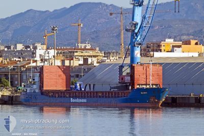
MARGOT
General Cargo

Current Trip
| Time Travelled | 18 h, 23 mins |
|---|---|
| Remaining Time | --- |
| Distance Travelled | 128.98 nm |
| Remaining Distance | --- |
| AVG Speed | 8.1 Knop |
| MAX Speed | 9.9 Knop |
| AVG Wind | 12.2 knots |
| MAX Wind | 16.5 knots |
| MIN Temp | 11.4°C / 52.52°F |
| MAX Temp | 15.8°C / 60.44°F |
| Djupgående | 5.5 m |
| Position mottagen | 2 h, 39 m sen |
Current Position
| Longitud | --- |
|---|---|
| Latitude | --- |
| Status | Under way using engine |
| Fart | 8.6 Knop |
| Kurs | 271.1° |
| Område | North Atlantic Ocean |
| Station | T-AIS |
| Position mottagen | 2 h, 39 m sen |
Information
The current position of MARGOT is in North Atlantic Ocean with coordinates 35.96746° / -5.97245° as reported on 2025-03-25 11:05 by AIS to our vessel tracker app. The vessel's current speed is 8.6 Knop and is heading at the port of GOOLE. The estimated time of arrival as calculated by MyShipTracking vessel tracking app is 2025-03-31 21:00 LT
The vessel MARGOT (IMO: 9192650, MMSI: 205103000) is a General Cargo that was built in 2004 ( 21 År gammal ). It's sailing under the flag of [BE] Belgium.
In this page you can find informations about the vessels current position, last detected port calls, and current voyage information. If the vessels is not in coverage by AIS you will find the latest position.
The current position of MARGOT is detected by our AIS receivers and we are not responsible for the reliability of the data. The last position was recorded while the vessel was in Coverage by the Ais receivers of our vessel tracking app.
The current draught of MARGOT as reported by AIS is 5.5 meters
Weather
| Temperature | 15.5°C / 59.9°F |
|---|---|
| Wind Speed | 6 knots |
| Direction | 331° NNW |
| Pressure | 1021.3 hPa |
| Humidity | 70.2 % |
| Cloud Coverage | 7 % |


Featured Company
Last Port Calls
| Port | Arrival | Departure | Time In Port |
|---|---|---|---|
| 2025-03-24 03:05 | 2025-03-24 20:22 | 17 h | |
| 2025-03-21 04:32 | 2025-03-22 20:19 | 1 d | |
| 2025-03-19 15:35 | 2025-03-19 21:28 | 5 h | |
| 2025-03-11 16:08 | 2025-03-12 22:01 | 1 d | |
| 2025-03-04 16:19 | 2025-03-06 22:41 | 2 d | |
| 2025-03-01 01:43 | 2025-03-03 16:46 | 2 d | |
| 2025-02-12 13:24 | 2025-02-14 00:09 | 1 d | |
| 2025-02-08 14:07 | 2025-02-10 20:21 | 2 d | |
| 2025-02-06 09:06 | 2025-02-07 17:06 | 1 d | |
| 2025-01-16 12:23 | 2025-01-23 21:12 | 7 d |
Most Visited Ports (Last year)
| Port | Arrivals | |
|---|---|---|
| 4 | ||
| 4 | ||
| 4 | ||
| 2 | ||
| 2 | ||
| 2 |
Last Trips
| Origin | Departure | Destination | Arrival | Distance | |
|---|---|---|---|---|---|
| 2025-03-22 20:19 | 2025-03-24 03:05 | 297.60 nm | |||
| 2025-03-19 21:28 | 2025-03-21 04:32 | 6.29 nm | |||
| 2025-03-12 22:01 | 2025-03-19 15:35 | 1238.74 nm | |||
| 2025-03-06 22:41 | 2025-03-11 16:08 | 793.59 nm | |||
| 2025-03-03 16:46 | 2025-03-04 16:19 | 230.41 nm | |||
| 2025-02-14 00:09 | 2025-03-01 01:43 | 1948.27 nm | |||
| 2025-02-10 20:21 | 2025-02-12 13:24 | 405.29 nm | |||
| 2025-02-07 17:06 | 2025-02-08 14:07 | 205.97 nm | |||
| 2025-01-23 21:12 | 2025-02-06 09:06 | 2055.21 nm | |||
| 2025-01-07 07:40 | 2025-01-16 12:23 | 1256.85 nm |
Events
| Tid | Event | Detaljer | Position / Dest | Information |
|---|---|---|---|---|
| 2025-03-25 11:08 | Status ändrad | Default Under way using engine |
35.96752 / -5.98141
GBGOO
|
Fart: 8.6 kn Kurs: 271.1° |
| 2025-03-25 11:05 | UTANFÖR täckningsområde |
35.96746 / -5.97245
North Atlantic Ocean
GBGOO
|
Fart: 8.6 kn Kurs: 271.1° |
|
| 2025-03-25 11:05 | Upptäckt i hav | Spanish part of the North Atlantic Ocean |
35.96746 / -5.97245
North Atlantic Ocean
GBGOO
|
Fart: 8.6 kn Kurs: 271.1° |
| 2025-03-25 11:02 | Status ändrad | Under way using engine Default |
35.96728 / -5.96298
GBGOO
|
Fart: 8.8 kn Kurs: 271° |
| 2025-03-25 11:00 | Status ändrad | Default Under way using engine |
35.96722 / -5.95702
GBGOO
|
Fart: 8.8 kn Kurs: 269.9° |
| 2025-03-25 10:37 | Status ändrad | Under way using engine Default |
35.96740 / -5.88752
GBGOO
|
Fart: 8.6 kn Kurs: 272° |
| 2025-03-25 10:36 | Status ändrad | Default Under way using engine |
35.96735 / -5.88499
GBGOO
|
Fart: 8.7 kn Kurs: 270.2° |
| 2025-03-25 09:50 | Status ändrad | Under way using engine Default |
35.96748 / -5.74163
GBGOO
|
Fart: 10.2 kn Kurs: 269° |
| 2025-03-25 09:47 | Status ändrad | Default Under way using engine |
35.96748 / -5.73268
GBGOO
|
Fart: 9.8 kn Kurs: 267.7° |
| 2025-03-25 07:28 | Byter havsområde | Spanish part of the Strait of Gibraltar Gibraltarian part of the Strait of Gibraltar |
36.02290 / -5.34220
Strait of Gibraltar
GBGOO
|
Fart: 7.1 kn Kurs: 256.7° |