
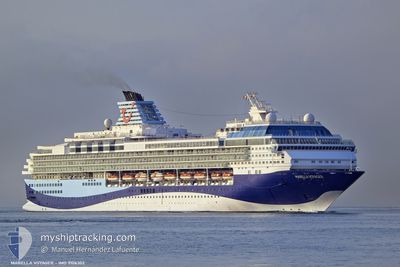
MARELLA VOYAGER
Passengers Ship
Current Trip
VCKTN
| Time Travelled | 14 h, 51 mins |
|---|---|
| Remaining Time | --- |
| Distance Travelled | 85.15 nm |
| Remaining Distance | --- |
| AVG Speed | 7.1 Knop |
| MAX Speed | 8 Knop |
| AVG Wind | 5.9 knots |
| MAX Wind | 8.3 knots |
| MIN Temp | 24.9°C / 76.82°F |
| MAX Temp | 26.8°C / 80.24°F |
| Djupgående | 8.5 m |
| Position mottagen | 5 h, 18 m sen |
Current Position
| Longitud | --- |
|---|---|
| Latitude | --- |
| Status | Under way using engine |
| Fart | 6.8 Knop |
| Kurs | 123.4° |
| Område | Caribbean Sea |
| Station | T-AIS |
| Position mottagen | 5 h, 18 m sen |
Info
Information
The current position of MARELLA VOYAGER is in Caribbean Sea with coordinates 13.26607° / -61.47189° as reported on 2025-03-17 08:51 by AIS to our vessel tracker app. The vessel's current speed is 6.8 Knop
The vessel MARELLA VOYAGER (IMO: 9106302, MMSI: 249053000) is a Passengers Ship that was built in 1997 ( 28 År gammal ). It's sailing under the flag of [MT] Malta.
In this page you can find informations about the vessels current position, last detected port calls, and current voyage information. If the vessels is not in coverage by AIS you will find the latest position.
The current position of MARELLA VOYAGER is detected by our AIS receivers and we are not responsible for the reliability of the data. The last position was recorded while the vessel was in Coverage by the Ais receivers of our vessel tracking app.
The current draught of MARELLA VOYAGER as reported by AIS is 8.5 meters
Weather
| Temperature | 26.5°C / 79.7°F |
|---|---|
| Wind Speed | 4 knots |
| Direction | 87° E |
| Pressure | 1016.4 hPa |
| Humidity | 74.4 % |
| Cloud Coverage | 11 % |
Featured Company
Last Port Calls
| Port | Arrival | Departure | Time In Port |
|---|---|---|---|
| 2025-03-16 07:02 | 2025-03-16 19:18 | 12 h | |
| 2025-03-15 06:48 | 2025-03-15 17:54 | 11 h | |
| 2025-03-13 06:52 | 2025-03-13 20:03 | 13 h | |
| 2025-03-12 07:25 | 2025-03-12 16:55 | 9 h | |
| 2025-03-11 07:43 | 2025-03-11 18:00 | 10 h | |
| 2025-03-10 07:14 | 2025-03-10 20:00 | 12 h | |
| 2025-03-09 07:31 | 2025-03-09 17:45 | 10 h | |
| 2025-03-08 07:28 | 2025-03-08 17:45 | 10 h | |
| 2025-03-06 07:06 | 2025-03-06 20:53 | 13 h | |
| 2025-03-05 07:37 | 2025-03-05 17:49 | 10 h |
Most Visited Ports (Last year)
| Port | Arrivals | |
|---|---|---|
| 28 | ||
| 21 | ||
| 13 | ||
| 12 | ||
| 12 | ||
| 12 |
Last Trips
| Origin | Departure | Destination | Arrival | Distance | |
|---|---|---|---|---|---|
| 2025-03-15 17:54 | 2025-03-16 07:02 | 149.38 nm | |||
| 2025-03-13 20:03 | 2025-03-15 06:48 | 268.17 nm | |||
| 2025-03-12 16:55 | 2025-03-13 06:52 | 186.51 nm | |||
| 2025-03-11 18:00 | 2025-03-12 07:25 | 149.47 nm | |||
| 2025-03-10 20:00 | 2025-03-11 07:43 | 82.47 nm | |||
| 2025-03-09 17:45 | 2025-03-10 07:14 | 95.13 nm | |||
| 2025-03-08 17:45 | 2025-03-09 07:31 | 94.82 nm | |||
| 2025-03-06 20:53 | 2025-03-08 07:28 | 446.84 nm | |||
| 2025-03-05 17:49 | 2025-03-06 07:06 | 158.18 nm | |||
| 2025-03-04 17:49 | 2025-03-05 07:37 | 104.82 nm |
Events
| Tid | Event | Detaljer | Position / Dest | Information |
|---|---|---|---|---|
| 2025-03-17 11:34 | STOPPAR förflyttning | 8.26 nm, North of BEQUIA |
13.14804 / -61.22500
VCKTN
|
Fart: 0.1 kn Kurs: 64° |
| 2025-03-17 08:52 | Status ändrad | Default Under way using engine |
13.26537 / -61.47080
VCKTN
|
Fart: 6.8 kn Kurs: 123.4° |
| 2025-03-17 08:51 | Status ändrad | Under way using engine Default |
13.26607 / -61.47189
VCKTN
|
Fart: 6.7 kn Kurs: 124° |
| 2025-03-17 08:51 | UTANFÖR täckningsområde |
13.26607 / -61.47189
Caribbean Sea
VCKTN
|
Fart: 6.8 kn Kurs: 123.4° |
|
| 2025-03-17 08:19 | Status ändrad | Default Under way using engine |
13.30450 / -61.51883
VCKTN
|
Fart: 6.8 kn Kurs: 156.8° |
| 2025-03-17 08:13 | Status ändrad | Under way using engine Default |
13.31480 / -61.52447
VCKTN
|
Fart: 6.8 kn Kurs: 164° |
| 2025-03-17 08:08 | I täckningsområde |
13.31480 / -61.52447
Caribbean Sea
VCKTN
|
Fart: 6.8 kn Kurs: 156.8° |
|
| 2025-03-17 06:56 | Status ändrad | Default Under way using engine |
13.46212 / -61.49783
VCKTN
|
Fart: 7.3 kn Kurs: 196.5° |
| 2025-03-17 06:48 | UTANFÖR täckningsområde |
13.47830 / -61.49305
Caribbean Sea
VCKTN
|
Fart: 7.3 kn Kurs: 196.5° |
|
| 2025-03-17 06:46 | Status ändrad | Under way using engine Default |
13.48150 / -61.49213
VCKTN
|
Fart: 7.3 kn Kurs: 196° |