

MAGIC CELESTE
Cargo

Current Trip
| Trip Time | 21 days |
|---|---|
| Trip Distance | 5323.65 nm |
| AVG Speed | 10.8 Knop |
| MAX Speed | 13.2 Knop |
| Djupgående | 12.8 m |
| AVG Wind | 10.9 knots |
| MAX Wind | 26 knots |
| MIN Temp | -0.3°C / 31.46°F |
| MAX Temp | 34.4°C / 93.92°F |
| Position mottagen | 7 d sen |
Current Position
| Longitud | --- |
|---|---|
| Latitude | --- |
| Status | Under way using engine |
| Fart | 10.4 Knop |
| Kurs | 307.6° |
| Område | Laccadive Sea |
| Station | T-AIS |
| Position mottagen | 7 d sen |
Information
The current position of MAGIC CELESTE is in Laccadive Sea with coordinates 8.34456° / 76.37366° as reported on 2025-03-21 19:01 by AIS to our vessel tracker app. The vessel's current speed is 10.4 Knop and is currently inside the port of PIPAVAV.
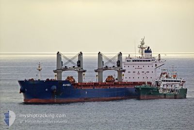
The vessel MAGIC CELESTE (IMO: 9735115, MMSI: 538006084) is a Cargo It's sailing under the flag of [MH] Marshall Is.
In this page you can find informations about the vessels current position, last detected port calls, and current voyage information. If the vessels is not in coverage by AIS you will find the latest position.
The current position of MAGIC CELESTE is detected by our AIS receivers and we are not responsible for the reliability of the data. The last position was recorded while the vessel was in Coverage by the Ais receivers of our vessel tracking app.
The current draught of MAGIC CELESTE as reported by AIS is 12.8 meters
Weather
| Temperature | 26.9°C / 80.42°F |
|---|---|
| Wind Speed | 14 knots |
| Direction | 8° N |
| Pressure | 1010.9 hPa |
| Humidity | 19.2 % |
| Cloud Coverage | 2 % |


Featured Company
Events
| Tid | Event | Detaljer | Position / Dest | Information |
|---|---|---|---|---|
| 2025-03-25 20:12 | STOPPAR förflyttning |
20.90857 / 71.50143
[IN] PIPAVAV
|
Fart: Kurs: 32° |
|
| 2025-03-25 20:03 | ANLÄNDER HAMN |
|
20.90820 / 71.50160
[IN] PIPAVAV
|
Fart: 0.9 kn Kurs: 28° |
| 2025-03-25 18:44 | STARTAR förflyttning | 2.63 nm, South East of PIPAVAV |
20.88082 / 71.53436
IN PAV
|
Fart: 4.4 kn Kurs: 235° |
| 2025-03-24 22:56 | STOPPAR förflyttning | 2.63 nm, South East of PIPAVAV |
20.88321 / 71.53735
IN PAV
|
Fart: 0.2 kn Kurs: 35° |
| 2025-03-21 19:22 | Status ändrad | Default Under way using engine |
8.38055 / 76.32501
IN PAV
|
Fart: 10.4 kn Kurs: 307.6° |
| 2025-03-21 19:01 | UTANFÖR täckningsområde |
8.34456 / 76.37366
Laccadive Sea
IN PAV
|
Fart: 10.4 kn Kurs: 307.6° |
|
| 2025-03-21 18:50 | Status ändrad | Under way using engine Default |
8.32360 / 76.40057
IN PAV
|
Fart: 10.8 kn Kurs: 311° |
| 2025-03-21 18:31 | Status ändrad | Default Under way using engine |
8.28928 / 76.44229
IN PAV
|
Fart: 10.8 kn Kurs: 311.3° |
| 2025-03-21 17:55 | Status ändrad | Under way using engine Default |
8.22779 / 76.53362
IN PAV
|
Fart: 10.6 kn Kurs: 300° |
| 2025-03-21 17:50 | Status ändrad | Default Under way using engine |
8.21973 / 76.54745
IN PAV
|
Fart: 10.4 kn Kurs: 303.4° |