
MAGIC CELESTE
Cargo
Current Trip
| Time Travelled | 25 days |
|---|---|
| Remaining Time | 4 days |
| Distance Travelled | 4905.99 nm |
| Remaining Distance | 1423.45 nm |
| AVG Speed | 11.9 Knots |
| MAX Speed | 16.4 Knots |
| AVG Wind | 9.8 knots |
| MAX Wind | 30.5 knots |
| MIN Temp | 9.7°C / 49.46°F |
| MAX Temp | 30.1°C / 86.18°F |
| Dybgang | 13.3 m |
| Position Modtaget | 4 d siden |
Current Position
| Longitude | --- |
|---|---|
| Latitude | --- |
| Status | Under way using engine |
| Fart | 12.7 Knots |
| Kurs | 308.5° |
| Område | Malacca Strait |
| Station | T-AIS |
| Position Modtaget | 4 d siden |
Info
Information
The current position of MAGIC CELESTE is in Malacca Strait with coordinates 2.20860° / 101.97544° as reported on 2025-12-30 14:39 by AIS to our vessel tracker app. The vessel's current speed is 12.7 Knots and is heading at the port of DAHEJ. The estimated time of arrival as calculated by MyShipTracking vessel tracking app is 2026-01-08 11:27 LT
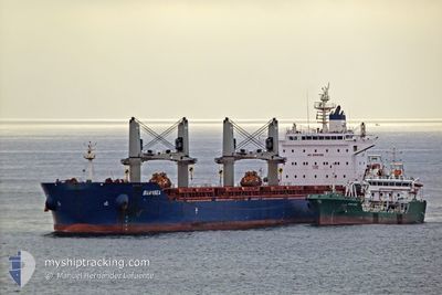
The vessel MAGIC CELESTE (IMO: 9735115, MMSI: 538006084) is a Cargo It's sailing under the flag of [MH] Marshall Is.
In this page you can find informations about the vessels current position, last detected port calls, and current voyage information. If the vessels is not in coverage by AIS you will find the latest position.
The current position of MAGIC CELESTE is detected by our AIS receivers and we are not responsible for the reliability of the data. The last position was recorded while the vessel was in Coverage by the Ais receivers of our vessel tracking app.
The current draught of MAGIC CELESTE as reported by AIS is 13.3 meters
Weather
| Temperature | 26.4°C / 79.52°F |
|---|---|
| Wind Speed | 21 knots |
| Direction | 8° N |
| Pressure | 1011 hPa |
| Humidity | 77.2 % |
| Cloud Coverage | 100 % |
Featured Company
Last Port Calls
| Port | Arrival | Departure | Time In Port |
|---|---|---|---|
| 2025-12-08 07:25 | 2025-12-09 17:29 | 1 d | |
| 2025-11-20 13:36 | 2025-11-23 13:30 | 2 d |
Last Trips
| Origin | Departure | Destination | Arrival | Distance | |
|---|---|---|---|---|---|
| 2025-11-23 13:30 | 2025-12-08 07:25 | 4117.20 nm | |||
| 2025-10-18 22:04 | 2025-11-20 13:36 | 4191.51 nm |
Events
| Tid | Hændelsen | Detaljer | Position / Dest | Info |
|---|---|---|---|---|
| 2025-12-30 14:45 | Status er ændret | Default Under way using engine |
2.22181 / 101.95901
IN DAH
|
Fart: 12.7 kn Kurs: 308.5° |
| 2025-12-30 14:39 | Udenfor Dækning |
2.20860 / 101.97544
Malacca Strait
IN DAH
|
Fart: 12.7 kn Kurs: 308.5° |
|
| 2025-12-30 12:31 | Ændre havområde | Malaysian part of the Malacca Strait Malaysian part of the Singapore Strait |
1.92864 / 102.32054
Malacca Strait
IN DAH
|
Fart: 12.2 kn Kurs: 294.2° |
| 2025-12-30 12:29 | Status er ændret | Under way using engine Default |
1.92511 / 102.32825
IN DAH
|
Fart: 12.1 kn Kurs: 294° |
| 2025-12-30 12:29 | Indenfor Dækning |
1.92864 / 102.32054
Malacca Strait
IN DAH
|
Fart: 12.2 kn Kurs: 294.2° |
|
| 2025-12-30 05:34 | Status er ændret | Default Under way using engine |
1.21500 / 103.52200
IN DAH
|
Fart: 12.7 kn Kurs: 282.2° |
| 2025-12-30 05:30 | Udenfor Dækning |
1.21218 / 103.53568
Singapore Strait
IN DAH
|
Fart: 12.7 kn Kurs: 282.2° |
|
| 2025-12-30 05:13 | Ændre havområde | Malaysian part of the Singapore Strait Indonesian part of the Singapore Strait |
1.20042 / 103.59122
Singapore Strait
IN DAH
|
Fart: 11.6 kn Kurs: 282.2° |
| 2025-12-30 04:28 | Ændre havområde | Indonesian part of the Singapore Strait Singaporean part of the Singapore Strait |
1.14318 / 103.72174
Singapore Strait
IN DAH
|
Fart: 10.8 kn Kurs: 286.1° |
| 2025-12-30 03:59 | ETA er ændret | 2026/01/08 01:00 2026/01/07 01:00 |
1.17231 / 103.79900
IN DAH
|
Fart: 10.6 kn Kurs: 246.2° |