
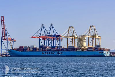
MAERSK LOTA
Container Ship
Current Trip
| Trip Time | 8 days |
|---|---|
| Trip Distance | 3564.85 nm |
| AVG Speed | 18.2 Knop |
| MAX Speed | 20.3 Knop |
| Djupgående | 10.1 m |
| AVG Wind | 11.9 knots |
| MAX Wind | 22.3 knots |
| MIN Temp | 16.3°C / 61.34°F |
| MAX Temp | 28.7°C / 83.66°F |
| Position mottagen | 5 d sen |
Current Position
| Longitud | -18.97595° |
|---|---|
| Latitude | 21.61478° |
| Status | Under way using engine |
| Fart | 18.4 Knop |
| Kurs | 207.8° |
| Område | North Atlantic Ocean |
| Station | T-AIS |
| Position mottagen | 5 d sen |
Info
Information
The current position of MAERSK LOTA is in North Atlantic Ocean with coordinates 21.61478° / -18.97595° as reported on 2024-05-08 10:29 by AIS to our vessel tracker app. The vessel's current speed is 18.4 Knop and is currently inside the port of SALVADOR.
The vessel MAERSK LOTA (IMO: 9526954, MMSI: 219508000) is a Container Ship that was built in 2012 ( 12 År gammal ). It's sailing under the flag of [DK] Denmark.
In this page you can find informations about the vessels current position, last detected port calls, and current voyage information. If the vessels is not in coverage by AIS you will find the latest position.
The current position of MAERSK LOTA is detected by our AIS receivers and we are not responsible for the reliability of the data. The last position was recorded while the vessel was in Coverage by the Ais receivers of our vessel tracking app.
The current draught of MAERSK LOTA as reported by AIS is 10.1 meters
Weather
| Temperature | 27.5°C / 81.5°F |
|---|---|
| Wind Speed | 7 knots |
| Direction | 96° E |
| Pressure | 1013.7 hPa |
| Humidity | 77.5 % |
| Cloud Coverage | --- |
Featured Company
Last Port Calls
| Port | Arrival | Departure | Time In Port |
|---|---|---|---|
| 2024-05-13 23:29 | |||
| 2024-05-05 05:27 | 2024-05-05 22:11 | 16 h | |
| 2024-05-02 16:42 | 2024-05-03 07:31 | 14 h | |
| 2024-04-29 23:55 | 2024-04-30 20:43 | 20 h | |
| 2024-04-28 21:59 | 2024-04-29 15:14 | 17 h | |
| 2024-04-15 21:08 | 2024-04-16 14:30 | 17 h | |
| 2024-04-15 04:56 | 2024-04-15 05:54 | 58 m | |
| 2024-04-13 22:51 | 2024-04-13 23:47 | 56 m | |
| 2024-04-10 08:06 | 2024-04-11 14:03 | 1 d | |
| 2024-04-09 00:02 | 2024-04-09 18:49 | 18 h |
Last Trips
| Origin | Departure | Destination | Arrival | Distance | |
|---|---|---|---|---|---|
| 2024-05-05 23:11 | 2024-05-13 20:29 | 3564.85 nm | |||
| 2024-05-03 09:31 | 2024-05-05 06:27 | 138.10 nm | |||
| 2024-04-30 22:43 | 2024-05-02 18:42 | 11.52 nm | |||
| 2024-04-29 16:14 | 2024-04-30 01:55 | 73.78 nm | |||
| 2024-04-16 11:30 | 2024-04-28 22:59 | 4281.15 nm | |||
| 2024-04-15 02:54 | 2024-04-15 18:08 | 196.11 nm | |||
| 2024-04-13 20:47 | 2024-04-15 01:56 | 3.24 nm | |||
| 2024-04-11 11:03 | 2024-04-13 19:51 | 175.51 nm | |||
| 2024-04-09 15:49 | 2024-04-10 05:06 | 75.83 nm | |||
| 2024-04-07 18:47 | 2024-04-08 21:02 | 225.60 nm |
Events
| Tid | Event | Detaljer | Position / Dest | Information |
|---|---|---|---|---|
| 2024-05-13 23:46 | STOPPAR förflyttning |
-12.95514 / -38.50711
[BR] SALVADOR
|
Fart: Kurs: 19° |
|
| 2024-05-13 23:29 | ANLÄNDER HAMN |
|
-12.95062 / -38.50837
[BR] SALVADOR
|
Fart: 2.3 kn Kurs: 321° |
| 2024-05-08 10:34 | Status ändrad | Default Under way using engine |
21.58932 / -18.99042
MAPTM>BRSSA
|
Fart: 18.4 kn Kurs: 207.8° |
| 2024-05-08 10:29 | UTANFÖR täckningsområde |
21.61478 / -18.97595
North Atlantic Ocean
MAPTM>BRSSA
|
Fart: 18.4 kn Kurs: 207.8° |
|
| 2024-05-08 10:13 | Status ändrad | Under way using engine Default |
21.68701 / -18.93437
MAPTM>BRSSA
|
Fart: 18.7 kn Kurs: 208° |
| 2024-05-08 10:06 | Status ändrad | Default Under way using engine |
21.71775 / -18.91680
MAPTM>BRSSA
|
Fart: 18.8 kn Kurs: 208.3° |
| 2024-05-08 09:56 | Status ändrad | Under way using engine Default |
21.76742 / -18.88838
MAPTM>BRSSA
|
Fart: 18.6 kn Kurs: 208° |
| 2024-05-08 09:46 | Status ändrad | Default Under way using engine |
21.80947 / -18.86425
MAPTM>BRSSA
|
Fart: 18.5 kn Kurs: 208.3° |
| 2024-05-08 09:19 | Status ändrad | Under way using engine Default |
21.93389 / -18.79143
MAPTM>BRSSA
|
Fart: 18.7 kn Kurs: 209° |
| 2024-05-08 09:18 | Status ändrad | Default Under way using engine |
21.93792 / -18.78906
MAPTM>BRSSA
|
Fart: 18.6 kn Kurs: 209.1° |