
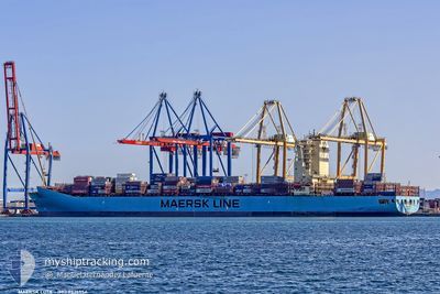
MAERSK LOTA
Container Ship
Current Trip
| Time Travelled | 8 days |
|---|---|
| Remaining Time | --- |
| Distance Travelled | 2905.62 nm |
| Remaining Distance | --- |
| AVG Speed | 14.3 Knots |
| MAX Speed | 16.5 Knots |
| AVG Wind | 10.9 knots |
| MAX Wind | 19 knots |
| MIN Temp | 21.1°C / 69.98°F |
| MAX Temp | 28.2°C / 82.76°F |
| Dybgang | 14.4 m |
| Position Modtaget | 7 d siden |
Current Position
| Longitude | -40.64025° |
|---|---|
| Latitude | -22.25607° |
| Status | Under way using engine |
| Fart | 14.8 Knots |
| Kurs | 50.4° |
| Område | South Atlantic Ocean |
| Station | T-AIS |
| Position Modtaget | 7 d siden |
Info
Information
The current position of MAERSK LOTA is in South Atlantic Ocean with coordinates -22.25607° / -40.64025° as reported on 2024-05-29 07:15 by AIS to our vessel tracker app. The vessel's current speed is 14.8 Knots and is heading at the port of TANGER MED. The estimated time of arrival as calculated by MyShipTracking vessel tracking app is 2024-06-09 04:30 LT
The vessel MAERSK LOTA (IMO: 9526954, MMSI: 219508000) is a Container Ship that was built in 2012 ( 12 år gamle ). It's sailing under the flag of [DK] Denmark.
In this page you can find informations about the vessels current position, last detected port calls, and current voyage information. If the vessels is not in coverage by AIS you will find the latest position.
The current position of MAERSK LOTA is detected by our AIS receivers and we are not responsible for the reliability of the data. The last position was recorded while the vessel was in Coverage by the Ais receivers of our vessel tracking app.
The current draught of MAERSK LOTA as reported by AIS is 14.4 meters
Weather
| Temperature | 21.1°C / 69.98°F |
|---|---|
| Wind Speed | 16 knots |
| Direction | 14° NNE |
| Pressure | 1015 hPa |
| Humidity | 85.7 % |
| Cloud Coverage | 24 % |
Featured Company
Last Port Calls
| Port | Arrival | Departure | Time In Port |
|---|---|---|---|
| 2024-05-27 18:02 | 2024-05-28 12:22 | 18 h | |
| 2024-05-26 07:32 | 2024-05-26 08:26 | 53 m | |
| 2024-05-22 14:09 | 2024-05-23 14:52 | 1 d | |
| 2024-05-19 13:02 | 2024-05-20 17:12 | 1 d | |
| 2024-05-17 03:34 | 2024-05-17 04:25 | 50 m | |
| 2024-05-13 20:29 | 2024-05-14 10:17 | 13 h | |
| 2024-05-05 06:27 | 2024-05-05 23:11 | 16 h | |
| 2024-05-02 18:42 | 2024-05-03 09:31 | 14 h | |
| 2024-04-30 01:55 | 2024-04-30 22:43 | 20 h | |
| 2024-04-28 22:59 | 2024-04-29 16:14 | 17 h |
Last Trips
| Origin | Departure | Destination | Arrival | Distance | |
|---|---|---|---|---|---|
| 2024-05-26 08:26 | 2024-05-27 18:02 | 203.79 nm | |||
| 2024-05-23 14:52 | 2024-05-26 07:32 | 278.28 nm | |||
| 2024-05-20 17:12 | 2024-05-22 14:09 | 73.71 nm | |||
| 2024-05-17 04:25 | 2024-05-19 13:02 | 289.06 nm | |||
| 2024-05-14 10:17 | 2024-05-17 03:34 | 1050.77 nm | |||
| 2024-05-05 23:11 | 2024-05-13 20:29 | 3564.85 nm | |||
| 2024-05-03 09:31 | 2024-05-05 06:27 | 138.10 nm | |||
| 2024-04-30 22:43 | 2024-05-02 18:42 | 11.52 nm | |||
| 2024-04-29 16:14 | 2024-04-30 01:55 | 73.78 nm | |||
| 2024-04-16 11:30 | 2024-04-28 22:59 | 4281.15 nm |
Events
| Tid | Hændelsen | Detaljer | Position / Dest | Info |
|---|---|---|---|---|
| 2024-05-29 07:21 | Status er ændret | Default Under way using engine |
-22.23963 / -40.61865
BRSPB>MAPTM
|
Fart: 14.8 kn Kurs: 50.4° |
| 2024-05-29 07:15 | Udenfor Dækning |
-22.25607 / -40.64025
South Atlantic Ocean
BRSPB>MAPTM
|
Fart: 14.8 kn Kurs: 50.4° |
|
| 2024-05-29 07:03 | Status er ændret | Under way using engine Default |
-22.28811 / -40.68231
BRSPB>MAPTM
|
Fart: 14.8 kn Kurs: 50° |
| 2024-05-29 06:57 | Status er ændret | Default Under way using engine |
-22.30283 / -40.70164
BRSPB>MAPTM
|
Fart: 14.8 kn Kurs: 50.2° |
| 2024-05-29 06:06 | Status er ændret | Under way using engine Default |
-22.43735 / -40.88004
BRSPB>MAPTM
|
Fart: 15 kn Kurs: 51° |
| 2024-05-29 05:47 | Indenfor Dækning |
-22.43735 / -40.88004
South Atlantic Ocean
BRSPB>MAPTM
|
Fart: 15 kn Kurs: 51.4° |
|
| 2024-05-28 22:53 | Status er ændret | Default Under way using engine |
-23.23176 / -42.54778
BRSPB>MAPTM
|
Fart: 15.6 kn Kurs: 77.3° |
| 2024-05-28 22:38 | Udenfor Dækning |
-23.24585 / -42.61492
South Atlantic Ocean
BRSPB>MAPTM
|
Fart: 15.6 kn Kurs: 77.3° |
|
| 2024-05-28 17:39 | ETA er ændret | 2024/06/09 03:30 2024/06/09 08:00 |
-23.18633 / -43.96888
BRSPB>MAPTM
|
Fart: 14.8 kn Kurs: 124.4° |
| 2024-05-28 16:39 | Dybgangen er ændret | 14.4 13.9 |
-23.04461 / -44.09553
BRSPB>MAPTM
|
Fart: 11.4 kn Kurs: 197.2° |